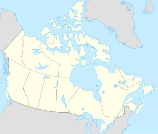
Young Island is an uninhabited member of the Canadian Arctic Archipelago in the territory of Nunavut. It lies in the Parry Channel, southwest of Lowther Island, and northeast of Hamilton Island.

Curry Island is an irregularly shaped, uninhabited island located in the Qikiqtaaluk Region of Nunavut, Canada. It is located at the mouth of White Bay, off Baffin Island. Eclipse Sound lies to its north.

The Spicer Islands are an uninhabited island group located in Foxe Basin, within Qikiqtaaluk Region, in the Canadian territory of Nunavut. The Melville Peninsula is to the west, Prince Charles Island to the east, Rowley Island to the north. The two main islands are North Spicer Island and South Spicer Island. They are very low-lying and swampy.

One of the Baffin Island offshore island groups in Cumberland Sound, the Drum Islands are located on the southern side of the mouth of Kangilo Fiord, south of Iglunga, west of Pangnirtung, and north of the Saunik and Imigen islands. They are part of the Qikiqtaaluk Region, in the Canadian territory of Nunavut.
Opingivik Island is an uninhabited Baffin Island offshore island located in the Canadian Arctic Archipelago in Nunavut's Qikiqtaaluk Region. It lies in Cumberland Sound between Ikpit Bay to the north and Robert Peel Inlet approximately 18.6 km (11.6 mi) to the south.
Kangigutsak Island is an uninhabited Baffin Island offshore island located in the Canadian Arctic Archipelago in Nunavut's Qikiqtaaluk Region. It lies in Cumberland Sound, across the mouth of Robert Peel Inlet. Shakshukuk Island lies north.
Utsusivik Island is an uninhabited Baffin Island offshore island located in the Canadian Arctic Archipelago in Nunavut's Qikiqtaaluk Region. It lies in Cumberland Sound, across the mouth of Chidliak Bay, approximately 14.4 km (8.9 mi) southeast of Robert Peel Inlet Nimigen Island lies to its west.

Dexterity Island is an uninhabited island in the Qikiqtaaluk Region of Nunavut, Canada. It is located in Baffin Bay off the northeastern coast of Baffin Island. Adams Island is 19.3 km (12.0 mi) to the south, while Bergesen Island is 17.2 km (10.7 mi) to the west, across Isbjorn Strait.
Round Island is an uninhabited island in the Qikiqtaaluk Region of Nunavut, Canada. It is located across the mouth of Coutts Inlet in Baffin Bay off the northeastern coast of Baffin Island. Nova Zembla Island is 7.4 km (4.6 mi) to the northwest.

Scott Island is an uninhabited island in the Qikiqtaaluk Region of Nunavut, Canada. It is located in Baffin Bay, off the eastern coast of Baffin Island, in the middle of Scott Inlet, north of the confluence of Clark Fiord and Gibbs Fiord which embrace Sillem Island.

Akulagok Island is an uninhabited island in the Qikiqtaaluk Region of Nunavut, Canada. It belongs to the Kikastan Islands, located in the Cumberland Sound, off Baffin Island's Cumberland Peninsula. On its south side, Kekerten Harbour lies between Akulagok and Kekerten Island, while to the north lies Tuapait Island. Aupaluktok Island, Beacon Island, Kekertukdjuak Island, Miliakdjuin Island, Tesseralik Island, and Ugpitimik Island are in the vicinity.

Kekerten Island is an uninhabited island in the Qikiqtaaluk Region of Nunavut, Canada. Southernmost of the Kikastan Islands, it is located in the Cumberland Sound, off Baffin Island's Cumberland Peninsula. Akulagok Island forms Kekerten Harbour with the island. Tuapait Island lies to the north. Beacon Island, Kekertukdjuak Island, Miliakdjuin Island, Tesseralik Island, and Ugpitimik Island are in the vicinity.
Kekertukdjuak Island is an uninhabited island in the Qikiqtaaluk Region of Nunavut, Canada. It is located where the Kingnait Fiord joins the Cumberland Sound, off Baffin Island's Cumberland Peninsula. The Kikastan Islands lie to its southwest. Beacon Island, Miliakdjuin Island, Tesseralik Island, and Ugpitimik Island are in the vicinity.
Tesseralik Island is an uninhabited island in the Qikiqtaaluk Region of Nunavut, Canada. It is located in the Cumberland Sound, off Baffin Island's Cumberland Peninsula, and is one of the islands forming Brown Harbour. Akulagok Island, Aupaluktok Island, Beacon Island, Kekerten Island, Kekertukdjuak Island, Miliakdjuin Island, Tuapait Island, and Ugpitimik Island are in the vicinity.
Tuapait Island is an uninhabited island in the Qikiqtaaluk Region of Nunavut, Canada. It is one of the Kikastan Islands, located in the Cumberland Sound, off Baffin Island's Cumberland Peninsula. To its south lie Akulagok Island and Kekerten Island. Aupaluktok Island, Beacon Island, Kekertukdjuak Island, Miliakdjuin Island, Tesseralik Island, and Ugpitimik Island are in the vicinity.

Aupaluktok Island is an uninhabited island in the Qikiqtaaluk Region of Nunavut, Canada. It is one of the two main Sanigut Islands, stretching between Avataktoo Bay to the north and the Cumberland Sound to the south, off Baffin Island's Cumberland Peninsula. Akulagok Island, Anarnittuq Island, Beacon Island, Imigen Island, Ivisa Island, Kekertelung Island, Saunik Island, Tesseralik Island, Tuapait Island, and Ugpitimik Island are in the vicinity.
Ugpitimik Island is an uninhabited island in the Qikiqtaaluk Region of Nunavut, Canada. It is located at the mouth of Pangnirtung Fiord, in the Cumberland Sound, off Baffin Island's Cumberland Peninsula. Akulagok Island, Aupaluktok Island, Beacon Island, Kekerten Island, Kekertukdjuak Island, Tesseralik Island, and Tuapait Island are in the vicinity.
The Sanigut Islands are an uninhabited island group in the Qikiqtaaluk Region of Nunavut, Canada. They are located in Baffin Island's Cumberland Sound, just south of Avataktoo Bay. Aupaluktok Island is the southern one. Anarnittuq Island, Beacon Island, Imigen Island, Ivisa Island, Kekertelung Island, Saunik Island, Tesseralik Island, and Ugpitimik Island are in the vicinity.

Anarnittuq Island is an uninhabited island in the Qikiqtaaluk Region of Nunavut, Canada. It is located in Baffin Island's Cumberland Sound. It lies at the combined mouths of Clearwater and Shark Fiord, between Clear Passage Island and Kekertelung Island. The Sanigut Islands, Iglunga Island, and Nunatak Island are in the vicinity.

Beacon Island is an uninhabited island located in the Qikiqtaaluk Region, Nunavut, Canada. It lies in the Nascopie Reefs, just east of Dorset Island, itself a Baffin Island offshore island in Hudson Strait. The closest community is Kimmirut, 20.9 km (13.0 mi) away.


