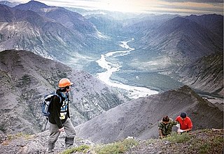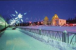
Aldan is a gold-mining town and the administrative center of Aldansky District of the Sakha Republic, Russia, located in the Aldan Highlands, in the Aldan River basin, on the stream Orto-Sala near its mouth in the Seligdar River, about 470 kilometers (290 mi) south of the republic's capital of Yakutsk. As of the 2010 Census, its population was 21,275.

Pokrovsk is a town and the administrative center of Khangalassky District of the Sakha Republic, Russia, located on the left bank of the Lena River, 78 kilometers (48 mi) southwest of Yakutsk, the capital of the republic. As of the 2010 Census, its population was 9,495.

Khandyga is an urban locality and the administrative center of Tomponsky District in the Sakha Republic, Russia, 380 kilometers (240 mi) northeast of Yakutsk, the capital of the republic. As of the 2010 Census, its population was 6,638.

Ust-Maya is an urban locality and the administrative center of Ust-Maysky District of the Sakha Republic, Russia, southeast of Yakutsk, the capital of the republic. As of the 2010 Census, its population was 2,293.

Chulman is an urban locality in Neryungrinsky District of the Sakha Republic, Russia, located 41 kilometers (25 mi) from Neryungri, the administrative center of the district, on the Chulman River. As of the 2010 Census, its population was 9,766.

Churapchinsky District is an administrative and municipal district, one of the thirty-four in the Sakha Republic, Russia. It is located in the center of the republic and borders Tattinsky District in the north, Ust-Maysky District in the east and southeast, Amginsky District in the south, Megino-Kangalassky District in the west, and Ust-Aldansky District in the northwest. The area of the district is 12,600 square kilometers (4,900 sq mi). Its administrative center is the rural locality of Churapcha. As of the 2010 Census, the total population of the district was 20,387, with the population of Churapcha accounting for 43.0% of that number.

Aldansky District is an administrative and municipal district, one of the thirty-four in the Sakha Republic, Russia.

Ytyk-Kyuyol is a rural locality and the administrative center of Tattinsky District of the Sakha Republic, Russia, located on the left bank of the Tatta River, 255 kilometers (158 mi) from Yakutsk, the capital of the republic. As of the 2010 Census, its population was 6,828.

Amginsky District is an administrative and municipal district, one of the thirty-four in the Sakha Republic, Russia. It is located in the southeast of the republic and borders with Churapchinsky District in the north, Ust-Maysky District in the east and southeast, Aldansky District in the south and southwest, and with Khangalassky and Megino-Kangalassky Districts in the northwest. The area of the district is 29,400 square kilometers (11,400 sq mi). Its administrative center is the rural locality of Amga. As of the 2010 Census, the total population of the district was 17,183, with the population of Amga accounting for 38.0% of that number.

Tomponsky District is an administrative and municipal district, one of the thirty-four in the Sakha Republic, Russia. It is located in the east of the republic and borders with Momsky District in the northeast, Oymyakonsky District in the east, Ust-Maysky District in the southeast, Tattinsky District in the southwest, Ust-Aldansky and Kobyaysky Districts in the west, and with Verkhoyansky District in the north and northwest. The area of the district is 135,800 square kilometers (52,400 sq mi). Its administrative center is the urban locality of Khandyga. Population: 14,099 (2010 Census); 15,275 ; 22,844 (1989 Census). The population of Khandyga accounts for 47.1% of the district's total population.

Ust-Aldansky District is an administrative and municipal district, one of the thirty-four in the Sakha Republic, Russia. It is located in the center of the republic and borders with Kobyaysky District in the north, Tomponsky District in the northeast, Tattinsky District in the east, Churapchinsky District in the southeast, Megino-Kangalassky District in the south, and with Namsky District in the west. The area of the district is 18,300 square kilometers (7,100 sq mi). Its administrative center is the rural locality of Borogontsy. Population: 22,155 (2010 Census); 22,372 ; 21,389 (1989 Census). The population of Borogontsy accounts for 23.6% of the district's total population.

Berkakit is an urban locality in Neryungrinsky District of the Sakha Republic, Russia, located 7 kilometers (4.3 mi) from Neryungri, the administrative center of the district. As of the 2010 Census, its population was 4,291.
Serebryany Bor is an urban locality in Neryungrinsky District of the Sakha Republic, Russia, located 6 kilometers (3.7 mi) from Neryungri, the administrative center of the district, on the Amur–Yakutsk Mainline, in the Aldan Highlands. As of the 2010 Census, its population was 4,163.

Nizhny Kuranakh is an urban locality in Aldansky District of the Sakha Republic, Russia, located 30 kilometers (19 mi) from Aldan, the administrative center of the district. As of the 2010 Census, its population was 5,901.
Lebediny is an urban locality in Aldansky District of the Sakha Republic, Russia, located 26 kilometers (16 mi) from Aldan, the administrative center of the district. As of the 2010 Census, its population was 1,058.

Verkhnyaya Amga is a rural locality, one of five settlements, in addition to Tommot, the administrative centre of the settlement, the Urban-type settlement of Bezymyanny, and the villages of Ulu and Yllymakh in the Town of Tommot of Aldansky District in the Sakha Republic, Russia. It is located 186 kilometers (116 mi) from Aldan, the district centre and 111 kilometers (69 mi) from Tommot. Its population as of the 2010 Census was 27; up from 19 recorded in the 2002 Census.
Nagorny is an urban locality in Neryungrinsky District of the Sakha Republic, Russia, located 100 kilometers (62 mi) from Neryungri, the administrative center of the district, on the right bank of the Timpton River on the northern flank of the Stanovoy Highlands, only 10 kilometers (6.2 mi) from the border with Amur Oblast. As of the 2010 Census, its population was 68.
Leninsky is an urban locality in Aldansky District of the Sakha Republic, Russia, located 6 kilometers (3.7 mi) from Aldan, the administrative center of the district. As of the 2010 Census, its population was 1,866.
Bezymyanny is an urban locality in Aldansky District of the Sakha Republic, Russia, located 112 kilometers (70 mi) from Aldan, the administrative center of the district. As of the 2010 Census, it had no recorded population.
Chagda is a rural locality, the only inhabited locality, and the administrative center of Chagdinsky Rural Okrug of Aldansky District in the Sakha Republic, Russia, located 380 kilometers (240 mi) from Aldan, the administrative center of the district. Its population as of the 2010 Census was 218, down from 368 recorded during the 2002 Census and 682 recorded during the 1989 Census.


