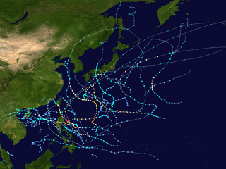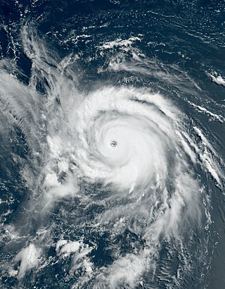
This timeline documents all the storm formations, strengthening, weakening, landfalls, extratropical transitions, as well as dissipation during the 2008 Pacific typhoon season. The 2008 Pacific typhoon season officially started on January 1, 2008 and ended on January 1, 2009.

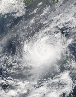
Severe Tropical Storm Halong, known in the Philippines as Typhoon Cosme, was the fourth severe tropical storm named by the Japan Meteorological Agency (JMA), which is the Regional Specialized Meteorological Centre for the Northwestern Pacific Ocean. The Joint Typhoon Warning Center also recognized Halong as the fifth tropical depression, the fourth tropical storm, as well as the third typhoon of the 2008 Pacific typhoon season.

The 2011 Pacific typhoon season was a below average season that produced a total of 21 named storms, 8 typhoons, and four super typhoons. This season was much more active than the previous season, although both seasons were below the Pacific typhoon average of 26. The season ran throughout 2011, though most tropical cyclone tend to develop between May and October. The season's first named storm, Aere, developed on May 7 while the season's last named storm, Washi dissipated on December 19.

The 2014 Pacific typhoon season was a slightly below average season in terms of named storms, but featured the highest amount of Category 5 typhoons since 1997. This was mainly due to a developing El Niño that favors multiple powerful storms to form in the basin. The season formed twenty-three tropical storms, eleven typhoons, eight super typhoons, and seven Category 5 typhoons. The season's peak months August and September saw minimal activity caused by an unusually strong and a persistent suppressing phase of the Madden–Julian oscillation (MJO). The season ran throughout 2014, though most tropical cyclones typically develop between May and October. The season began with the development of Tropical Storm Lingling on January 18, and ended after Tropical Storm Jangmi which dissipated on January 1 of the next year.

The 2015 Pacific typhoon season was a slightly above average season that produced twenty-seven tropical storms, eighteen typhoons, and nine super typhoons. The season ran throughout 2015, though most tropical cyclones typically develop between May and November. The season's first named storm, Mekkhala, developed on January 15, while the season's last named storm, Melor, dissipated on December 17. The season saw at least one named tropical system forming in each of every month, the first time since 1965. Similar to the previous season, this season saw a high number of super typhoons. Accumulated cyclone energy (ACE) during 2015 was extremely high, the third highest since 1970, and the 2015 ACE has been attributed in part to anthropogenic warming, and also the 2014-16 El Niño event, that led to similarly high ACE values in the East Pacific.

The 2018 Pacific typhoon season was at the time, the costliest Pacific typhoon season on record, until the record was beaten by the following year. The season was well above-average, producing twenty-nine storms, thirteen typhoons, seven super typhoons and six Category 5 tropical cyclones. The season ran throughout 2018, though most tropical cyclones typically develop between May and October. The season's first named storm, Bolaven, developed on January 3, while the season's last named storm, Man-yi, dissipated on November 28. The season's first typhoon, Jelawat, reached typhoon status on March 29, and became the first super typhoon of the year on the next day.

The 2019 Pacific typhoon season was a devastating season that became the costliest on record, just ahead of the previous year and 2023, mainly due to the catastrophic damage wrought by typhoons Lekima, Faxai, and Hagibis. The season featured fairly above-average tropical cyclone activity for the second consecutive year, producing 29 named storms, 17 typhoons, and five super typhoons. The season's first named storm, Pabuk, reached tropical storm status on January 1, becoming the earliest-forming tropical storm of the western Pacific Ocean on record, breaking the previous record that was held by Typhoon Alice in 1979. The season's first typhoon, Wutip, reached typhoon status on February 20. Wutip further intensified into a super typhoon on February 23, becoming the strongest February typhoon on record, and the strongest tropical cyclone recorded in February in the Northern Hemisphere. The season's last named storm, Phanfone, dissipated on December 29 after it made landfall in the Philippines.

This timeline documents all of the events of the 2011 Pacific typhoon season, the period that tropical cyclones formed in the Western Pacific Ocean in 2011. Most of the tropical cyclones formed between May and November 2011. The scope of this article is limited to the Pacific Ocean, north of the equator between 100°E and the International Date Line. Tropical storms that form in the entire Western Pacific basin are assigned a name by the Japan Meteorological Agency (JMA). Tropical depressions that form in this basin are given a number with a "W" suffix by the United States' Joint Typhoon Warning Center (JTWC). In addition, the Philippine Atmospheric, Geophysical and Astronomical Services Administration (PAGASA) assigns names to tropical cyclones that enter or form in the Philippine area of responsibility. These names, however, are not in common use outside of the Philippines.

This timeline documents all of the events of the 2014 Pacific typhoon season. Most of the tropical cyclones forming between May and November. The scope of this article is limited to the Pacific Ocean, north of the equator between 100°E and the International Date Line. Tropical storms that form in the entire Western Pacific basin are assigned a name by the Japan Meteorological Agency. Tropical depressions that form in this basin are given a number with a "W" suffix by the United States' Joint Typhoon Warning Center. In addition, the Philippine Atmospheric, Geophysical and Astronomical Services Administration (PAGASA) assigns names to tropical cyclones that enter or form in the Philippine area of responsibility. These names, however, are not in common use outside of the Philippines.

This timeline documents all of the events of the 2012 Pacific typhoon season. The scope of this article is limited to the Pacific Ocean, north of the equator between 100°E and the International Date Line. During the season, 34 systems were designated as tropical depressions by either the Japan Meteorological Agency (JMA), the Philippine Atmospheric, Geophysical and Astronomical Services Administration (PAGASA), the Joint Typhoon Warning Center (JTWC), or other National Meteorological and Hydrological Services such as the China Meteorological Administration and the Hong Kong Observatory. Since the JMA runs the Regional Specialized Meteorological Centre (RSMC) for the Western Pacific, they assigned names to tropical depressions which developed into tropical storms in the basin. PAGASA also assigned local names to systems which are active in their area of responsibility; however, these names are not in common use outside of the Philippines.

Typhoon Kalmaegi, known in the Philippines as Typhoon Luis, was the 22nd depression and the 15th named storm of the 2014 typhoon season. Kalmaegi was the first storm to make landfall over the Philippines since Typhoon Rammasun, two months prior. The storm caused flooding in Southeast Asia during mid-September. Kalmaegi started as a disturbance near Palau that could become a tropical cyclone in the next few days. JTWC would designate it to Tropical Depression 15W. PAGASA also named the system Luis as the 11th named storm inside PAR. Environmental conditions became more conducive for intensification, which allowed 15W to intensify into a tropical storm and attained the name Kalmaegi. On September 13, the storm intensified into a Category-1 typhoon as it moved through open warm waters. Around 17:00 PHT on September 14, the eye of Kalmaegi made landfall in the coastal town of Divilacan, Isabela, bringing gusty winds and heavy rains in the area.

This timeline documents all of the events of the 2015 Pacific typhoon season. Most of the tropical cyclones formed between May and November. The scope of this article is limited to the Pacific Ocean, north of the equator between 100°E and the International Date Line. This area, called the Western Pacific basin, is the responsibility of the Japanese Meteorological Agency (JMA). They host and operate the Regional Specialized Meteorological Center (RSMC), located in Tokyo. The Japanese Meteorological Agency (JMA) is also responsible for assigning names to all tropical storms that are formed within the basin. However, any storm that enters or forms in the Philippine Area of Responsibility (PAR) will be named by the Philippine Atmospheric, Geophysical and Astronomical Services Administration (PAGASA) using a local name. Also of note - the Western Pacific basin is monitored by the United States' Joint Typhoon Warning Center (JTWC), which gives all Tropical depressions a number with a "W" suffix.

Typhoon Nangka was a large and powerful tropical cyclone that impacted central Japan in mid-July 2015. Nangka started its long-living journey as a tropical disturbance over the Marshall Islands and west of the International Dateline, becoming the eleventh named storm of the annual typhoon season on July 3. It quickly intensified while moving to the west-northwest, attaining typhoon status on July 6. Nangka moved through the Northern Marianas Islands, passing directly over the uninhabited island of Alamagan. Shortly thereafter, the typhoon attained peak winds; the Japan Meteorological Agency (JMA) estimated 10‑minute sustained winds of 185 km/h (115 mph), while the unofficial Joint Typhoon Warning Center (JTWC) estimated 1‑minute winds of 250 km/h (155 mph), making it a super typhoon. Nangka later weakened as it curved to the north, moving across central Japan on July 16 as a minimal typhoon. The storm weakened soon after, dissipating in the Sea of Japan on July 18.

Typhoon Nesat, known in the Philippines as Typhoon Gorio, was a strong tropical cyclone that impacted Taiwan and Fujian, China. It was the ninth named storm and the second typhoon of the annual typhoon season. After consolidating slowly for several days, Tropical Storm Nesat developed east of the Philippines on July 25. While experiencing favorable environmental conditions such as very warm sea surface temperatures and low wind shear, Nesat strengthened into a typhoon and reached its peak intensity on July 28. On July 29, the typhoon made landfall near the Taiwanese city of Yilan, before weakening to a severe tropical storm and making landfall again near Fuqing on China's east coast late the same day. Moving into July 30, Nesat continued to weaken under the effects of land interaction.

The 2021 Pacific typhoon season was the second consecutive season to have below average tropical cyclone activity, with twenty-two named storms, and was the least active since 2011. Nine became typhoons, and five of those intensified into super typhoons. This low activity was caused by a strong La Niña that had persisted from the previous year. The season's first named storm, Dujuan, developed on February 16, while the last named storm, Rai, dissipated on December 21. The season's first typhoon, Surigae, reached typhoon status on April 16. It became the first super typhoon of the year on the next day, also becoming the strongest tropical cyclone in 2021. Surigae was also the most powerful tropical cyclone on record in the Northern Hemisphere for the month of April. Typhoons In-fa and Rai are responsible for more than half of the total damage this season, adding up to a combined total of $2.02 billion.

The 2022 Pacific typhoon season was the third consecutive season to have below average tropical cyclone activity, with twenty-five named storms forming. Of the tropical storms, ten became typhoons, and three would intensify into super typhoons. The season saw near-average activity by named storm count, although many of the storms were weak and short-lived, particularly towards the end of the season. This low activity was caused by an unusually strong La Niña that had persisted from 2020. The season's first named storm, Malakas, developed on April 6, while the last named storm, Pakhar, dissipated on December 12. The season's first typhoon, Malakas, reached typhoon status on April 12. The season ran throughout 2022, though most tropical cyclones typically develop between May and October. Tropical storms Megi and Nalgae were responsible for more than half of the casualties, while typhoons Hinnamnor and Nanmadol both caused $1 billion in damages.

The 2023 Pacific typhoon season was the fourth and final consecutive below-average season and became the third-most inactive typhoon season on record in terms of named storms, with just 17 named storms developing, only ahead of 2010 and 1998. Despite the season occurring during an El Niño event, which typically favors activity in the basin, activity was abnormally low. This was primarily due to a consistent period of negative PDO, which typically discourages tropical storm formation in this basin. The season was less active than the 2023 Atlantic hurricane season in terms of named storms, the fourth such season on record, after 2005, 2010 and 2020. The season's number of storms also did not exceed that of the 2023 Pacific hurricane season. Only ten became typhoons, with four strengthening further into super typhoons. However, it was very destructive, primarily due to Typhoon Doksuri which devastated the northern Philippines, Taiwan, and China in July, becoming the costliest typhoon on record as well as the costliest typhoon to hit mainland China, and Typhoon Haikui in September, which devastated China, Taiwan, and Hong Kong. The season was less active in Southeast Asia, with no tropical storm making landfall in mainland Vietnam.

Tropical Storm Sarika, known in the Philippines as Tropical Storm Dodong, was a weak but costly tropical storm that affected Philippines and the East China in early-June 2011. The sixth tropical depression and the third named storm of the 2011 Pacific typhoon season, Sarika formed from an area of low pressure near Cebu City. As it traversed the Verde Island Passage on June 8, both the JTWC and the JMA started issuing advisories on the system, with the former issuing a TCFA on the system later that day. The next day, the PAGASA upgraded the low-pressure area to a tropical depression, naming it Dodong. Moving to the north, the system struggled to intensify due to strong wind shear and was downgraded by the JTWC to a tropical depression; however, the JMA kept the system as a minimal tropical storm until it made landfall near Shantou on June 11. It dissipated soon thereafter.

Severe Tropical Storm Kompasu, known in the Philippines as Severe Tropical Storm Maring was a very large and deadly tropical cyclone that affected the Philippines, Taiwan, and southeast China. Part of the 2021 Pacific typhoon season, Kompasu originated from an area of low pressure east of the Philippines on 6 October 2021. The Japan Meteorological Agency (JMA) classified it as a tropical depression that day. A day later, the Philippine Atmospheric, Geophysical and Astronomical Services Administration (PAGASA) classified it as a tropical depression, naming it Maring. The cyclone was initially heavily disorganised, competing with another vortex, Tropical Depression Nando. Eventually, Maring became dominant, and the JMA reclassified it as a tropical storm, naming it Kompasu. Kompasu made landfall in Cagayan, Philippines, on 11 October 2021, and two days later, the storm made landfall in Hainan, China. The cyclone dissipated on 14 October 2021 while located over Vietnam.

Typhoon Saola, known in the Philippines as Super Typhoon Goring, was a powerful and erratic tropical cyclone that affected the Philippines, southern Taiwan, Hong Kong, Macau and South China. The name Saola, is in reference to a rare animal found in Vietnam. The ninth named storm, seventh typhoon, and third super typhoon of the 2023 typhoon season, Saola originated from an area of convection east of Taiwan and headed southwestwards.


