Roads that cross Upper Paradise Road
These streets are listed from north to south.
- Scenic Drive - Fennell Avenue, West
- Sanatorium Road
- Mohawk Road, West
- Limeridge Road West
- Lincoln M. Alexander Parkway
- Stone Church Road, West
-
 ; Rymal Road, West
It is proposed that this article be deleted because of the following concern:
If you can address this concern by improving, copyediting, sourcing, renaming, or merging the page, please edit this page and do so. You may remove this message if you improve the article or otherwise object to deletion for any reason. Although not required, you are encouraged to explain why you object to the deletion, either in your edit summary or on the talk page. If this template is removed, do not replace it . The article may be deleted if this message remains in place for seven days, i.e., after 17:30, 29 March 2022 (UTC). Find sources: "Upper Paradise Road" Hamilton, Ontario – news · newspapers · books · scholar · JSTOR Nominator: Please consider notifying the author/project: {{ subst:proposed deletion notify |Upper Paradise Road (Hamilton, Ontario)|concern=Generic street, notability not established with substantive sources about the road itself}} ~~~~ |
Upper Paradise Road is an Upper City (mountain) collector road in Hamilton, Ontario, Canada. It starts off just north of Scenic Drive by Cliffview Park and extends southward where it ends just south of Rymal Road beside Carpenter Park. It is a two-way street throughout.
It is named Upper Paradise Road because it is in alignment with Paradise Road in Lower City Hamilton. Paradise Road got its name because it led into Cootes Paradise. Paradise Road spent many years known as West Street, because it was the western boundary of the city from 1846 until approximately 1920. [1]
These landmarks are listed from north to south.
These neighbourhoods are listed from north to south. [2]
These roads are listed from west to east.
These streets are listed from north to south.
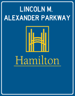
The Lincoln Alexander Parkway, nicknamed The Linc, is a municipal expressway in the Canadian city of Hamilton, Ontario, which connects Highway 403 with the Red Hill Valley Parkway, which continues north to the Queen Elizabeth Way (QEW). Collectively, the two expressways form a southern and eastern bypass of Hamilton. Located on the Hamilton mountain, atop the Niagara Escarpment, the freeway was named after the former Progressive Conservative MP and first black Lieutenant Governor of Ontario, Lincoln Alexander in July 1997, despite him never holding a driver's license.

Below is the transportation infrastructure found in Hamilton, Ontario:
Clementina Trenholm Fessenden was a Canadian author and social organiser. She was also the mother of Reginald Fessenden, the radio pioneer.
Queen Street is a Lower City arterial road in Hamilton, Ontario, Canada. It starts off at Beckett Drive, a mountain-access road in the city and is a two-way street up to Herkimer Street and a one-way street (Southbound) the rest of the way north up to the Canadian National Railway Yard where the road turns right, merging with Stuart Street which travels in a west–east direction.
Dundurn Street is a Lower City arterial road in Hamilton, Ontario, Canada. It is a two-way street that starts off at Mountain Face Park, Niagara Escarpment in front of the Bruce Trail as a collector road, right behind Hillcrest Avenue and then turns into a four lane thoroughfare from Aberdeen Avenue northward to York Boulevard where it ends in front of Dundurn Park.
Kenilworth Avenue is a Lower City arterial road in Hamilton, Ontario, Canada. It starts off at the Kenilworth Traffic Circle and Kenilworth Access, a mountain-access road at the base of the Niagara Escarpment (mountain) and is a two-way street throughout stretching northward through the city's North End industrial neighbourhood where it then flows underneath the Burlington Street bridge and right into Dofasco's Industrial Park.

Centennial Parkway, is a Lower City arterial road in Hamilton, Ontario, Canada. It is best known as the western terminus of former King's Highway 20, now maintained by the City of Hamilton. It starts off as Upper Centennial Parkway, a mountain-access road in the City right before the Canadian Pacific Railway line at the backend of Battlefield Park and is a two-way street throughout that extends north over the Queen Elizabeth Way and ends at Beach Boulevard/ Van Wagners Beach Road in front of Confederation Park.

Cannon Street, is a Lower City collector road in Hamilton, Ontario, Canada. It starts off at Queen Street North as a one-way street (Westbound) up to Sherman Avenue North where it then switches over to a two-way street the rest of the way Eastward and ends just past Kenilworth Avenue North on Barons Avenue and merges with Britannia Avenue, a street that runs parallel with Cannon Street from Ottawa Street North to Barons Avenue.

Hunter Street is a Lower City collector road in Hamilton, Ontario, Canada. It is a one-way street (Westbound) that starts West of Locke Street at Hill Street Park and ends two blocks East of Victoria Avenue at Emerald Street.

Mohawk Road is an Upper City (mountain) arterial road in Hamilton, Ontario, Canada. It is a two-way street throughout that starts just west of Highway 403 & Meadowlands and travels eastward linking up with the Lincoln M. Alexander Parkway. Mohawk Road east of Highway 403 resumes again in front of Iroquoia Heights Conservation Area, and runs parallel with the Lincoln M. Alexander Parkway, cuts across the Hamilton mountain and ends at Mountain Brow Boulevard, the site of Mohawk Sports Park.
Stone Church Road, is a two-way Upper City (mountain) east-west arterial road in Hamilton, Ontario, Canada. It starts at Golf Links Road, just east of Meadowlands, and goes across the Escarpment and ends at Upper Mount Albion Road. Note: This road continues East of Upper Mount Albion Road as Paramount Drive.
King's Highway 53, commonly referred to as Highway 53, was a provincially maintained highway in the southern portion of the Canadian province of Ontario that connected Woodstock to Hamilton via Brantford. The 76.5-kilometre (47.5 mi) route served as a southerly bypass to Highway 2, avoiding Paris, Ancaster and Hamilton. In addition to the previously mentioned cities, Highway 53 served the communities of Cathcart and Burford.
Lower Westcliffe Falls is a 7.9-metre-high (26 ft) complex classic cascade waterfall found near the Chedoke Civic Golf Course in Hamilton, Ontario, Canada.
Upper Wellington Street is an Upper City (mountain) arterial road in Hamilton, Ontario, Canada. It starts at the Jolley Cut, a mountain-access road to the north, beside Sam Lawrence Park and extends southward past Rymal Road where it ends at the Mount Hamilton Cemetery. It is a two-way street throughout. As with most of the "Upper" streets, their addresses start at roughly the point where their lower counterpart finishes just below the Escarpment and were originally labelled without the "Upper" prefix.
Upper Gage Avenue is a Hamilton Mountain arterial road in Hamilton, Ontario, Canada. It starts off at Concession Street in front of Mountain Drive Park and works its way southward and ends just past Rymal Road beside Broughton West Park 2. It is a two-way street throughout. Upper Gage starts at roughly the point where its lower counterpart Gage Avenue finishes just below the Escarpment and was originally labelled without the "upper" prefix.
West 5th Street is an Upper City (mountain) arterial road in Hamilton, Ontario, Canada. It starts off in the north at James Mountain Road, a mountain-access road, and extends southward past Rymal Road where it ends just south of Christopher Drive. It is a two-way street throughout.
Garth Street is an Upper City (mountain) arterial road in Hamilton, Ontario, Canada. It starts off at Beckett Drive, a mountain-access road in the north, and extends southward where it ends at Twenty Road just east of the Glancaster Golf and Country Club. It is a two-way street throughout.
Upper Centennial Parkway is a mountain-access road in Hamilton, Ontario, Canada. Also known as Hamilton Highway 20, the road starts off at Centennial Parkway in the Lower City beside Battlefield Park and extends south up the Niagara Escarpment and southward across the mountain where it ends at Rymal Road. It is a two-way street throughout.