Velika Grabovnica Велика Грабовница | |
---|---|
Village | |
Coordinates: 42°55′33″N22°00′42″E / 42.92583°N 22.01167°E | |
Country | |
District | Jablanica District |
Municipality | Leskovac |
Elevation | 794 ft (242 m) |
Population (2002) | |
• Total | 1,452 |
Time zone | CET (UTC+1) |
• Summer (DST) | CEST (UTC+2) |
Velika Grabovnica is a village in the municipality of Leskovac, Serbia. According to the 2002 census, the village has a population of 1452 people. [1]
A village is a clustered human settlement or community, larger than a hamlet but smaller than a town, with a population ranging from a few hundred to a few thousand. Though villages are often located in rural areas, the term urban village is also applied to certain urban neighborhoods. Villages are normally permanent, with fixed dwellings; however, transient villages can occur. Further, the dwellings of a village are fairly close to one another, not scattered broadly over the landscape, as a dispersed settlement.
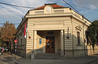
Leskovac is a city and the administrative center of the Jablanica District in southern Serbia. According to the 2011 census, the city urban area has 60,288 inhabitants, while the city administrative area has 144,206.
Serbia, officially the Republic of Serbia, is a country situated at the crossroads of Central and Southeast Europe in the southern Pannonian Plain and the central Balkans. The sovereign state borders Hungary to the north, Romania to the northeast, Bulgaria to the southeast, North Macedonia to the south, Croatia and Bosnia and Herzegovina to the west, and Montenegro to the southwest. The country claims a border with Albania through the disputed territory of Kosovo. Serbia's population is about seven million. Its capital, Belgrade, ranks among the oldest and largest citiеs in southeastern Europe.
Jerusalem Avenue is one of the principal streets of the city of Warsaw in Poland. It runs through the City Centre along the East-West axis, linking the western borough of Wola with the bridge on the Vistula River and the borough of Praga on the other side of the river.
Veselí is a village in the Pardubice Region of the Czech Republic. It has around 300 inhabitants.
Hai Bà Trưng District is an urban district (quận) of Hanoi, the capital city of Vietnam.
Vânători is a commune in Mureș County, Romania. It is composed of five villages: Archita, Feleag, Mureni, Șoard and Vânători. It has a population of 3,760: 47% Romanians, 26% Hungarians, 26% Roma and 1% others.
Żuniewo is a village in the administrative district of Gmina Dziadkowice, within Siemiatycze County, Podlaskie Voivodeship, in north-eastern Poland.
Kyzylly is a village in the Davachi Rayon of Azerbaijan.
Tağaser is a village in the Khojavend Rayon of Azerbaijan.
Wrony is a village in the administrative district of Gmina Kobiele Wielkie, within Radomsko County, Łódź Voivodeship, in central Poland. It lies approximately 9 kilometres (6 mi) west of Kobiele Wielkie, 8 km (5 mi) south-east of Radomsko, and 86 km (53 mi) south of the regional capital Łódź.
Wola Mędrzechowska is a village in the administrative district of Gmina Mędrzechów, within Dąbrowa County, Lesser Poland Voivodeship, in southern Poland.
Kaleń-Towarzystwo is a village in the administrative district of Gmina Żabia Wola, within Grodzisk Mazowiecki County, Masovian Voivodeship, in east-central Poland.
Ping Shan is an at-grade MTR Light Rail stop located at Castle Peak Road in Yuen Long District, near Ping Shan. It began service on 18 September 1988 and belongs to Zone 4.
Przęsin is a village in Gmina Miastko, Bytów County, Pomeranian Voivodeship, in northern Poland, on the border with West Pomeranian Voivodeship. It lies approximately 21 kilometres (13 mi) south-west of Bytów and 69 km (43 mi) south-west of Gdańsk.
Mała Lipna is a village in the administrative district of Gmina Przewóz, within Żary County, Lubusz Voivodeship, in western Poland, close to the German border.
Bačevo is a village in the municipality of Dimitrovgrad, Serbia. According to the 2002 census, the village has a population of 19 people.
Senokos is a village in the municipality of Dimitrovgrad, Serbia. According to the 2002 census, the village has a population of 44 people.
Pae is a village in Lääne-Harju Parish, Harju County in northern Estonia.
Lužani Bosanski is a village in the municipality of Derventa, Bosnia and Herzegovina.
Munaderahu is an island belonging to the country of Estonia.
Glavinci is a village in the municipality of Jagodina, Serbia. According to the 2002 census, the village has a population of 636 people.
Kızılağaç is a village in the Saimbeyli, Adana Province, Turkey.
Coordinates: 42°55′33″N22°00′42″E / 42.92583°N 22.01167°E
A geographic coordinate system is a coordinate system that enables every location on Earth to be specified by a set of numbers, letters or symbols. The coordinates are often chosen such that one of the numbers represents a vertical position and two or three of the numbers represent a horizontal position; alternatively, a geographic position may be expressed in a combined three-dimensional Cartesian vector. A common choice of coordinates is latitude, longitude and elevation. To specify a location on a plane requires a map projection.
This Jablanica District, Serbia location article is a stub. You can help Wikipedia by expanding it. |