History
| | This section is empty. You can help by adding to it. (July 2010) |
It is proposed that this article be deleted because of the following concern:
If you can address this concern by improving, copyediting, sourcing, renaming, or merging the page, please edit this page and do so. You may remove this message if you improve the article or otherwise object to deletion for any reason. Although not required, you are encouraged to explain why you object to the deletion, either in your edit summary or on the talk page. If this template is removed, do not replace it . The article may be deleted if this message remains in place for seven days, i.e., after 17:29, 29 March 2022 (UTC). Find sources: "West 5th Street" Hamilton, Ontario – news · newspapers · books · scholar · JSTOR |
West 5th Street is an Upper City (mountain) arterial road in Hamilton, Ontario, Canada. It starts off in the north at James Mountain Road, a mountain-access road, and extends southward past Rymal Road where it ends just south of Christopher Drive. It is a two-way street throughout.
| | This section is empty. You can help by adding to it. (July 2010) |
Note: Listing of Landmarks from North to South.
Note: Listing of neighbourhoods from North to South. [1]
Note: Listing of Roads from West to East.
Note: Listing of streets from North to South.

Hamilton Mountain is a federal electoral district in Ontario, Canada, that has been represented in the House of Commons of Canada since 1968. The riding is located in the Hamilton region.
Queen Street is a Lower City arterial road in Hamilton, Ontario, Canada. It starts off at Beckett Drive, a mountain-access road in the city and is a two-way street up to Herkimer Street and a one-way street (Southbound) the rest of the way north up to the Canadian National Railway Yard where the road turns right, merging with Stuart Street which travels in a west–east direction.
Dundurn Street is a Lower City arterial road in Hamilton, Ontario, Canada. It is a two-way street that starts off at Mountain Face Park, Niagara Escarpment in front of the Bruce Trail as a collector road, right behind Hillcrest Avenue and then turns into a four lane thoroughfare from Aberdeen Avenue northward to York Boulevard where it ends in front of Dundurn Park.
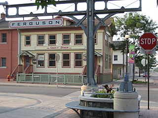
Ferguson Avenue is a Lower City collector road in Hamilton, Ontario, Canada. It is a two-way street throughout that starts off at the base of the Mountain on Foster Street. It's interrupted 3 blocks north at Corktown Park where Canadian Pacific Railway lines passes through it. Ferguson Avenue resumes again north of the Park right before Hunter Street East, extending northward past Barton Street East through the city's North End industrial neighbourhood where it ends on Dock Service Road, the site of a Royal Canadian Navy base and Pier 10.

Wentworth Street is a Lower City arterial road in Hamilton, Ontario, Canada. It starts off at the base of the Niagara Escarpment (mountain) on Charlton Avenue East just south of the CP lines and runs right through the city's North End industrial neighbourhood and ends north of Burlington Street East at Pier 14, which one time was used by International Harvester (1902–1992).

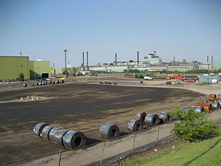
Sherman Avenue is a collector road in the lower portion of Hamilton, Ontario, Canada. It begins at the Niagara Escarpment just south of Cumberland Avenue and is a one-way street bisecting the industrialized northern neighbourhoods of the city. It ends at Ship Street — the site of Steel Company of Canada (Stelco).

Gage Avenue is a Lower City arterial road in Hamilton, Ontario, Canada. It starts off at Lawrence Road at the base of the Niagara Escarpment (mountain) at the south end of Gage Park. It is a two-way arterial road that extends north through the city's North End industrial neighbourhood and ends at Industrial Drive.
Kenilworth Avenue is a Lower City arterial road in Hamilton, Ontario, Canada. It starts off at the Kenilworth Traffic Circle and Kenilworth Access, a mountain-access road at the base of the Niagara Escarpment (mountain) and is a two-way street throughout stretching northward through the city's North End industrial neighbourhood where it then flows underneath the Burlington Street bridge and right into Dofasco's Industrial Park.

Centennial Parkway, is a Lower City arterial road in Hamilton, Ontario, Canada. It is best known as the western terminus of former King's Highway 20, now maintained by the City of Hamilton. It starts off as Upper Centennial Parkway, a mountain-access road in the City right before the Canadian Pacific Railway line at the backend of Battlefield Park and is a two-way street throughout that extends north over the Queen Elizabeth Way and ends at Beach Boulevard/ Van Wagners Beach Road in front of Confederation Park.

Hunter Street is a Lower City collector road in Hamilton, Ontario, Canada. It is a one-way street (Westbound) that starts West of Locke Street at Hill Street Park and ends two blocks East of Victoria Avenue at Emerald Street.

Aberdeen Avenue is a Lower City minor arterial road in Hamilton, Ontario, Canada. It starts off just west of Longwood Road South and east of Highway 403 as a two-way thoroughfare up to Queen Street South, where it then switches over to a one-way collector road (eastbound) to Bay Street South and then to another two-way section from Bay Street to James Mountain Road, a mountain-access road in the city near the base of the Niagara Escarpment (mountain).

Fennell Avenue, is an Upper City (mountain) arterial road in Hamilton, Ontario, Canada. It starts off just east of Garth Street on the West mountain and is a two-way street throughout that extends eastward and ends at Mountain Brow Boulevard, a road that wraps around the edge of the Niagara Escarpment on Hamilton mountain.

Mohawk Road is an Upper City (mountain) arterial road in Hamilton, Ontario, Canada. It is a two-way street throughout that starts just west of Highway 403 & Meadowlands and travels eastward linking up with the Lincoln M. Alexander Parkway. Mohawk Road east of Highway 403 resumes again in front of Iroquoia Heights Conservation Area, and runs parallel with the Lincoln M. Alexander Parkway, cuts across the Hamilton mountain and ends at Mountain Brow Boulevard, the site of Mohawk Sports Park.
Stone Church Road, is a two-way Upper City (mountain) east-west arterial road in Hamilton, Ontario, Canada. It starts at Golf Links Road, just east of Meadowlands, and goes across the Escarpment and ends at Upper Mount Albion Road. Note: This road continues East of Upper Mount Albion Road as Paramount Drive.
Upper James Street, is an Upper City (mountain) arterial road in Hamilton, Ontario, Canada. It starts at the Claremont Access, a mountain-access road in the north, and extends southward towards the John C. Munro Hamilton International Airport where it then changes its name to the Hamilton Port Dover Plank Road,. It is a two-way street throughout. As with most of the "Upper" streets, their addresses start at roughly the point where their lower counterpart finishes just below the Escarpment and were originally labelled without the "Upper" prefix.
Upper Wellington Street is an Upper City (mountain) arterial road in Hamilton, Ontario, Canada. It starts at the Jolley Cut, a mountain-access road to the north, beside Sam Lawrence Park and extends southward past Rymal Road where it ends at the Mount Hamilton Cemetery. It is a two-way street throughout. As with most of the "Upper" streets, their addresses start at roughly the point where their lower counterpart finishes just below the Escarpment and were originally labelled without the "Upper" prefix.
Upper Gage Avenue is a Hamilton Mountain arterial road in Hamilton, Ontario, Canada. It starts off at Concession Street in front of Mountain Drive Park and works its way southward and ends just past Rymal Road beside Broughton West Park 2. It is a two-way street throughout. Upper Gage starts at roughly the point where its lower counterpart Gage Avenue finishes just below the Escarpment and was originally labelled without the "upper" prefix.
Garth Street is an Upper City (mountain) arterial road in Hamilton, Ontario, Canada. It starts off at Beckett Drive, a mountain-access road in the north, and extends southward where it ends at Twenty Road just east of the Glancaster Golf and Country Club. It is a two-way street throughout.
Upper Paradise Road is an Upper City (mountain) collector road in Hamilton, Ontario, Canada. It starts off just north of Scenic Drive by Cliffview Park and extends southward where it ends just south of Rymal Road beside Carpenter Park. It is a two-way street throughout.
Upper Centennial Parkway is a mountain-access road in Hamilton, Ontario, Canada. Also known as Hamilton Highway 20, the road starts off at Centennial Parkway in the Lower City beside Battlefield Park and extends south up the Niagara Escarpment and southward across the mountain where it ends at Rymal Road. It is a two-way street throughout.
| | This Ontario road-related article is a stub. You can help Wikipedia by expanding it. |