West Division | |
---|---|
County | |
Country | Northern Ireland |
Sovereign state | United Kingdom |
Police | Northern Ireland |
Fire | Northern Ireland |
Ambulance | Northern Ireland |
EU Parliament | Northern Ireland |
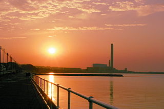
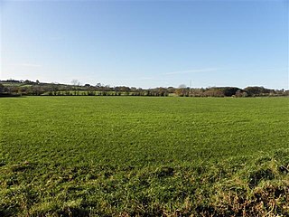
West Division is a townland of 6,739 acres in County Antrim, Northern Ireland. It is situated in the civil parish of Carrickfergus and the historic barony of Carrickfergus. [1]
A townland is a small geographical division of land used in Ireland. The townland system is of Gaelic origin, pre-dating the Norman invasion, and most have names of Irish Gaelic origin. However, some townland names and boundaries come from Norman manors, plantation divisions, or later creations of the Ordnance Survey. The total number of inhabited townlands was 60,679 in 1911. The total number recognised by the Irish Place Names database as of 2014 was 61,098, including uninhabited townlands, mainly small islands.
County Antrim is one of six counties that form Northern Ireland. Adjoined to the north-east shore of Lough Neagh, the county covers an area of 3,046 square kilometres (1,176 sq mi) and has a population of about 618,000. County Antrim has a population density of 203 people per square kilometre or 526 people per square mile. It is also one of the thirty-two traditional counties of Ireland, as well as part of the historic province of Ulster.
Northern Ireland is a part of the United Kingdom in the north-east of the island of Ireland, variously described as a country, province or region. Northern Ireland shares a border to the south and west with the Republic of Ireland. In 2011, its population was 1,810,863, constituting about 30% of the island's total population and about 3% of the UK's population. Established by the Northern Ireland Act 1998 as part of the Good Friday Agreement, the Northern Ireland Assembly holds responsibility for a range of devolved policy matters, while other areas are reserved for the British government. Northern Ireland co-operates with the Republic of Ireland in some areas, and the Agreement granted the Republic the ability to "put forward views and proposals" with "determined efforts to resolve disagreements between the two governments".
Carrickfergus is a large town in County Antrim, Northern Ireland. It sits on the north shore of Belfast Lough, 11 miles (18 km) from Belfast. The town had a population of 27,903 at the 2011 Census. It is County Antrim's oldest town and one of the oldest towns in Ireland as a whole. Carrickfergus was the administrative centre for Carrickfergus Borough Council, before this was amalgamated into the Mid and East Antrim District Council in 2015, and forms part of the Belfast Metropolitan Area. It is also a townland of 65 acres, a civil parish and a barony.
Kilroot is a townland, population centre and civil parish in County Antrim, Northern Ireland. It lies to the east of Eden, on the outskirts of Carrickfergus on the northern shore of Belfast Lough. It is within the Mid and East Antrim Bourgh council area.
Aldergrove is a townland sub-division in County Antrim, Northern Ireland. It is within the townland of Seacash and parish of Killead – 6 miles (9.7 km) south of Antrim and 18 miles (29 km) west of Belfast. It is part of the Borough of Antrim and Newtownabbey.
Newtownabbey is a large settlement north of Belfast in County Antrim, Northern Ireland. Sometimes considered to be a suburb of Belfast, it is separated from the rest of the city by Cavehill and Fortwilliam golf course. At the 2001 Census, Newtownabbey Urban Area had a population of 62,056, making it the fourth largest settlement in Northern Ireland. It is part of Antrim and Newtownabbey Borough Council.
Donegore is the name of a hill, a townland, a small cluster of residences, and a civil parish in the historic barony of Antrim Upper, County Antrim, Northern Ireland. Donegore lies approximately 5 miles (8 km) east of Antrim town. 154 acres of the townland lies in the civil parish of Grange of Nilteen.
Dunamuggy is a townland of 172 acres in County Antrim, Northern Ireland. It is situated in the civil parish of Donegore and the historic barony of Antrim Upper.
Barmeen is a townland in County Antrim, Northern Ireland. It is located at the foot of Glendun, one of the nine Glens of Antrim, west of Cushendun and north of Knocknacarry. It is situated in the historic barony of Cary and the civil parish of Culfeightrin and covers 59 acres.
Carrick was a single-member county constituency of the Parliament of Northern Ireland.
The counties of Northern Ireland were the principal local government divisions of Northern Ireland from its creation in 1921 until 1972, when their governmental features were abolished and replaced with twenty-six unitary authorities.
Newtowncrommelin is a small village and civil parish in County Antrim, Northern Ireland. It lies 8 miles north-northeast of Ballymena and is part of the Borough of Ballymena. The village of Newtowncrommelin was founded in the townland of Skerry.
The Battle of Connor was fought on 10 September 1315, in the townland of Tannybrake just over a mile north of what is now the modern village of Connor, County Antrim. It was part of the Bruce campaign in Ireland.
Solar is a townland of 42 acres in County Antrim, Northern Ireland. It is situated in the civil parish of Carncastle and the historic barony of Glenarm Upper.
Antrim Lower is a barony in County Antrim, Northern Ireland. It is bordered by six other baronies: Antrim Upper to the south; Toome Upper to the south-west; Toome Lower to the west; Kilconway to the north-west; Glenarm Lower to the north-east; and Glenarm Upper to the east. The River Braid flows through this barony.
Carrickfergus is a barony in County Antrim, Northern Ireland. It is bounded on the south-east by Belfast Lough, and otherwise surrounded by the barony of Belfast Lower. It is coextensive with the civil parish of Carrickfergus or St Nicholas and corresponds to the former county of the town of Carrickfergus, a county corporate encompassing Carrickfergus town.
Artiforty or Shanaghy is a townland in County Antrim, Northern Ireland.