
Kunětice is a village in the Pardubice Region of the Czech Republic. It has cca 270 inhabitants.

Kondratowice is a village in Strzelin County, Lower Silesian Voivodeship, in south-western Poland. It is the seat of the administrative district (gmina) called Gmina Kondratowice.
Zwierzyniec is a village in the administrative district of Gmina Śliwice, within Tuchola County, Kuyavian-Pomeranian Voivodeship, in north-central Poland. It lies approximately 7 kilometres (4 mi) west of Śliwice, 20 km (12 mi) north-east of Tuchola, and 67 km (42 mi) north of Bydgoszcz.

Mioarele is a commune in Argeș County, in southern central Romania. It is composed of five villages: Aluniș, Chilii, Cocenești, Mățău and Suslănești.

Golfe-Juan is a seaside resort on France's Côte d'Azur. The distinct local character of Golfe-Juan is indicated by the existence of a demonym, "Golfe-Juanais," which is applied to its inhabitants.
Grądy-Łazy is a village in the administrative district of Gmina Działoszyn, within Pajęczno County, Łódź Voivodeship, in central Poland. It lies approximately 6 kilometres (4 mi) south-east of Działoszyn, 8 km (5 mi) south-west of Pajęczno, and 85 km (53 mi) south-west of the regional capital Łódź.
Adolfów is a village in the administrative district of Gmina Zgierz, within Zgierz County, Łódź Voivodeship, in central Poland. It lies approximately 11 kilometres (7 mi) north-west of Zgierz and 19 km (12 mi) north-west of the regional capital Łódź.
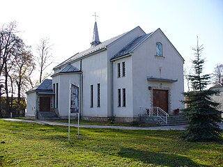
Bęczyn is a village in the administrative district of Gmina Brzeźnica, within Wadowice County, Lesser Poland Voivodeship, in southern Poland.
Babica is a village in the administrative district of Gmina Czudec, within Strzyżów County, Subcarpathian Voivodeship, in south-eastern Poland. It lies approximately 5 kilometres (3 mi) east of Czudec, 11 km (7 mi) north-east of Strzyżów, and 14 km (9 mi) south-west of the regional capital Rzeszów.
Poręby is a village in the administrative district of Gmina Besko, within Sanok County, Podkarpackie Voivodeship, in south-eastern Poland.
Niedzbórz is a village in the administrative district of Gmina Strzegowo, within Mława County, Masovian Voivodeship, in east-central Poland. It lies approximately 21 kilometres (13 mi) south of Mława and 91 km (57 mi) north-west of Warsaw.
Wojciechowo is a village in the administrative district of Gmina Rogoźno, within Oborniki County, Greater Poland Voivodeship, in west-central Poland. It lies approximately 6 kilometres (4 mi) south-east of Rogoźno, 20 km (12 mi) north-east of Oborniki, and 38 km (24 mi) north of the regional capital Poznań.
Zastawie is a village in the administrative district of Gmina Słupca, within Słupca County, Greater Poland Voivodeship, in west-central Poland. It lies approximately 6 kilometres (4 mi) north-east of Słupca and 70 km (43 mi) east of the regional capital Poznań.
Domanice is a village in Gmina Miastko, Bytów County, Pomeranian Voivodeship, in northern Poland, on the border with West Pomeranian Voivodeship. It lies approximately 44 kilometres (27 mi) south-west of Bytów and 120 km (75 mi) south-west of Gdańsk.
Lasowice Wielkie is a village in the administrative district of Gmina Malbork, within Malbork County, Pomeranian Voivodeship, in northern Poland. It lies approximately 7 kilometres (4 mi) north-east of Malbork and 43 km (27 mi) south-east of the regional capital Gdańsk.
Laurentowo is a village in the administrative district of Gmina Dźwierzuty, within Szczytno County, Warmian-Masurian Voivodeship, in northern Poland.
Alliku is a village in Alutaguse Parish, Ida-Viru County in northeastern Estonia.
Kabeli is a village in Lääne-Nigula Parish, Lääne County, in western Estonia.
Neeme is a village in Saaremaa Parish, Saare County in western Estonia.

Dragon Creek, also called Kocaçay or Anamur Creek, is a creek in Anamur district of Mersin Province, southern Turkey.


