Belmont Village, Philadelphia

Last updated
Belmont Village
TudorStyleSherwoodRd.jpg
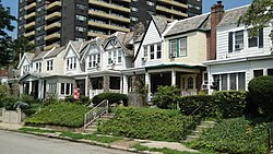
Tudor-inspired homes on Sherwood Rd, Belmont Village
Street map of Philadelphia and surrounding area.png
Red pog.svg
Belmont Village
Coordinates: 40°00′04″N75°13′21″W / 40.0010°N 75.2224°W / 40.0010; -75.2224
CountryFlag of the United States (23px).png  United States
State Pennsylvania
County Philadelphia
City Philadelphia
Area codes 215, 267 and 445
Map of Belmont Village Belmont Village Map.png
Map of Belmont Village

Belmont Village is a middle class neighborhood located in the West Philadelphia section of Philadelphia, Pennsylvania, United States. The zip code is 19131.

Contents

Known as Blockley in the early 1900s, when developers first built homes in the area, the region now comprises Overbrook, Wynnefield, Belmont Village, and Wynnefield Heights. In Belmont Village, the homes have stone facing on Lenape Road, while on nearby Conshohocken Avenue, the homes have an opulent Spanish Revival-style. [1]

In the early 20th-century, John McClatchy shaped the look of many Philadelphia neighbors, including Belmont Village. McClatchy advertised the development at the time as located in Bala, and it is close to Bala station on the Cynwyd Regional Rail line, but is actually in the city’s Belmont Village section. [2]

Boundaries

Belmont Village encompasses the area from City Avenue to the north, Fairmount Park to the south, the Bala Golf Club to the west, and Belmont Avenue to the east. [3]

Belmont Village is separated from its closest neighbor to the west, Wynnefield, by the grounds of the Bala Golf Club and SEPTA’s Cynwyd Line (formerly the R6). Belmont Village is separated from its closest neighbor to the east, Wynnefield Heights, by the Belmont Water Treatment Facility. Belmont Village borders Fairmount Park to its south. Its northern border is City Avenue.

Along with East Falls and Manayunk, Belmont Village is part of Pennsylvania House of Representatives, District 194 and Pennsylvania Senate, District 7. The civic association for the neighborhood is the Belmont Village Community Association. [4]

Demographics

According the U.S. Census from the 2019 American Community Survey 5-Year Estimates, the total population of 19131, which include Overbrook, Wynnfield, Belmont Village, and Wynnefield Heights, was 44,723 [5] where 44.5% is male and 55.5% is female. [6] Per the 2019 U.S. Census data, the community is 82.2% African-American, 13.4% Caucasian, 4.1% Asian/Pacific Islander, and 3.6% Hispanic/Latino. [7]

The mean household income in the past 12 months (in 2019 inflation-adjusted dollars) was $49,724. [8]

Of the 21,361 total housing units located in the 19131 zip code per 2019 Census data, 8,544 or 48.8% are owner-occupied units. [9]

Transportation

Belmont Village is accessible to Center City via West River Drive and SEPTA’s Cynwyd Line. The Bala Station sits directly across the street from the northern end of Belmont Village. The neighborhood is also accessible to several major roadways such as Route 1, I-76, and I-95.

Education

Belmont Village is served by the Philadelphia School District. Students in the neighborhood attend William B. Mann Elementary School. In May 2010, after years of failing to meet state standards, the School District turned operation of Mann over to Mastery Charter Schools. [10] Mann will continue to be run as a neighborhood school and is one of Mastery's first elementary schools. [10] [11]

The area high school is Overbrook High School. [12]

Belmont Village is close to a number of private elementary and secondary schools, including Friends' Central School on City Avenue. Two colleges also flank Belmont Village, the Philadelphia College of Osteopathic Medicine (PCOM) to the east and Saint Joseph's University to the west.

Local points of interest

Along Belmont Village's northern border is the City Avenue Business District, home to several stores and restaurants. [13] The Bala-Cynwyd Shopping Center is located across City Avenue from Belmont Village and contains a department store, a large grocery store, shops, and restaurants.

Along Belmont Village's southern border is Fairmount Park, which contains points of interest such as the Carousel House and the Mann Center for the Performing Arts. Nearby East Parkside is home of the Philadelphia Zoo and Memorial Hall/Please Touch Museum.

Every July, the Greek Picnic draws over 100,000 people to an adjacent area of Fairmount Park, celebrating African-American college fraternities and sororities. [14]

Related Research Articles

<span class="mw-page-title-main">Lower Merion Township, Pennsylvania</span> Township in Pennsylvania, United States

Lower Merion Township is a township in Montgomery County, Pennsylvania, United States. It is part of the Philadelphia Main Line. The township's name originates with the county of Merioneth in north Wales. Merioneth is an English-language transcription of the Welsh Meirionnydd.

<span class="mw-page-title-main">Narberth, Pennsylvania</span> Borough in Montgomery County, Pennsylvania

Narberth is a borough in Montgomery County, Pennsylvania. It is one of many neighborhoods on the historic Philadelphia Main Line. The population was 4,282 at the 2010 census.
<span class="mw-page-title-main">Merion Station, Pennsylvania</span> Census-designated place in Pennsylvania, United States

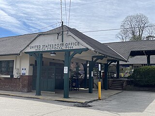
Merion Station, also known as Merion, is an unincorporated community in Montgomery County, Pennsylvania. It borders Philadelphia to its west and is one of the communities that make up the Philadelphia Main Line. Merion Station is part of Lower Merion Township, Montgomery County. The community is known for its grand mansions and for the wealth of its residents.
<span class="mw-page-title-main">Philadelphia Main Line</span> Collection of suburban communities in Pennsylvania, United States

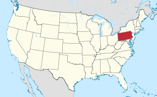
The Philadelphia Main Line, known simply as the Main Line, is an informally delineated historical and social region of suburban Philadelphia, Pennsylvania. Lying along the former Pennsylvania Railroad's once prestigious Main Line, it runs northwest from Center City Philadelphia parallel to Philadelphia and Lancaster Turnpike, also known as U.S. Route 30.

<span class="mw-page-title-main">Bala Cynwyd, Pennsylvania</span> Census-designated place in Pennsylvania, United States

Bala Cynwyd is a community and census-designated place in Lower Merion Township, Pennsylvania, United States. It is located on the Philadelphia Main Line in Southeastern Pennsylvania and borders the western edge of Philadelphia at U.S. Route 1. The present-day community was originally two separate towns, Bala and Cynwyd, but was united as a singular community largely because the U.S. Post Office, the Bala Cynwyd branch, served both towns using ZIP Code 19004. The combining of the communities gives a total population of 9,285 as of the 2020 census. The community was long known as hyphenated Bala-Cynwyd. Bala and Cynwyd are currently served by separate stations on SEPTA's Cynwyd Line of Regional Rail.

<span class="mw-page-title-main">Wynnefield, Philadelphia</span> Neighborhood of Philadelphia in Philadelphia County, Pennsylvania, United States

Wynnefield is a diverse middle-class neighborhood in West Philadelphia. Its borders are 53rd Street at Jefferson to the south, Philadelphia's Fairmount Park to the east, City Avenue to the north and the Amtrak Philadelphia Main Line tracks to the west.

<span class="mw-page-title-main">Manayunk, Philadelphia</span> Neighborhood of Philadelphia in Pennsylvania, United States

Manayunk is a neighborhood in the section of Lower Northwest Philadelphia in the state of Pennsylvania. Located adjacent to the neighborhoods of Roxborough and Wissahickon and also on the banks of the Schuylkill River, Manayunk contains the first canal begun in the United States.

<span class="mw-page-title-main">Overbrook, Philadelphia</span> Neighborhood of Philadelphia in Philadelphia County, Pennsylvania, United States

Overbrook is a historic neighborhood of Philadelphia, Pennsylvania. It is situated in the northwest of West Philadelphia.
<span class="mw-page-title-main">West Philadelphia</span> Neighborhood of Philadelphia, Pennsylvania

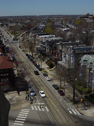
West Philadelphia, nicknamed West Philly, is a section of the city of Philadelphia. Although there are no officially defined boundaries, it is generally considered to reach from the western shore of the Schuylkill River, to City Avenue to the northwest, Cobbs Creek to the southwest, and the SEPTA Media/Wawa Line to the south. An alternate definition includes all city land west of the Schuylkill; this would also include Southwest Philadelphia and its neighborhoods. The eastern side of West Philadelphia is also known as University City.
<span class="mw-page-title-main">Wynnewood, Pennsylvania</span> Place in Pennsylvania, United States

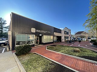
Wynnewood is a suburban unincorporated community, located west of Philadelphia, straddling Lower Merion Township in Montgomery County, Pennsylvania and Haverford Township in Delaware County, Pennsylvania, United States.

<span class="mw-page-title-main">Schuylkill Expressway</span> Highway in Pennsylvania

The Schuylkill Expressway, locally known as "the Schuylkill", is a freeway through southern Montgomery County and Philadelphia. It is the easternmost segment of Interstate 76 (I-76) in the U.S. state of Pennsylvania. It extends from the Valley Forge interchange of the Pennsylvania Turnpike in King of Prussia, paralleling its namesake Schuylkill River for most of the route, southeast to the Walt Whitman Bridge over the Delaware River in South Philadelphia. It serves as the primary corridor into Philadelphia from points west. Maintenance and planning for most of the highway are administered through Pennsylvania Department of Transportation (PennDOT) District 6, with the Delaware River Port Authority (DRPA) maintaining the approach to the Walt Whitman Bridge.

<span class="mw-page-title-main">Cobbs Creek</span> River in Pennsylvania, United States

Cobbs Creek is an 11.8-mile-long (19.0 km) tributary of Darby Creek in Delaware County, Pennsylvania, in the United States. It forms an approximate border between Montgomery County and Delaware County. After Cobbs Creek passes underneath Township Line Road, it forms the border between Philadelphia County and Delaware County. It runs directly through the two sides of Mount Moriah Cemetery which spans the border of Southwest Philadelphia and Yeadon, Pennsylvania. It later joins Darby Creek before flowing into the Delaware River.

<span class="mw-page-title-main">Strawberry Mansion, Philadelphia</span> Neighborhood of Philadelphia in Pennsylvania, United States

Strawberry Mansion is a neighborhood in the U.S. city of Philadelphia, Pennsylvania, located east of Fairmount Park in North Philadelphia. The neighborhood is bounded by 33rd Street to the west, 29th Street to the east, Lehigh Avenue to the north, and Oxford Street to the south. As of the 2000 census, the neighborhood had a population of 22,562. It is often associated with the historic house of the same name, Historic Strawberry Mansion, located adjacent to the neighborhood and generally thought to be the source of the community's name.

<span class="mw-page-title-main">Penn Valley, Pennsylvania</span> Unincorporated community in Pennsylvania, United States

Penn Valley is an unincorporated community located within Lower Merion Township, Pennsylvania, United States. Penn Valley residents share a zip code with Merion, Narberth, or Wynnewood because the community does not have its own post office. However, Penn Valley is a distinct community whose civic association demarcates its boundaries with iconic signs featuring William Penn and a farmhouse in blue or red on white, dating from 1930.

<span class="mw-page-title-main">Overbrook Farms, Philadelphia</span> United States historic place

Overbrook Farms is a neighborhood that is situated on the western edge of the West Philadelphia section of Philadelphia, Pennsylvania, United States. It is roughly bounded by City Avenue, 58th Street, Woodbine Avenue, and 66th Street at Morris Park.

<span class="mw-page-title-main">Wynnefield Heights, Philadelphia</span> Neighborhood of Philadelphia in Pennsylvania, United States

Wynnefield Heights is a middle class neighborhood that is located in the greater West Philadelphia area of Philadelphia, Pennsylvania, United States. The neighborhood is bounded by City Avenue to the north, Belmont Avenue to the west, Fairmount Park to the south and east, and the Schuylkill Expressway to the east.

<span class="mw-page-title-main">Belmont Hills, Pennsylvania</span> Town near Philadelphia

Located in Lower Merion Township, Montgomery County, Pennsylvania, United States, Belmont Hills is a suburb of Philadelphia. Belmont Hills is a neighborhood within the village of Bala Cynwyd. It is a distinct community with its own public elementary school, public pool, fire department and public library. Belmont Hills is known for its hilly terrain. Belmont means "Beautiful Mountain" so its literal name is "Beautiful Mountain Hills".

Route 38 is a bus and former subway–surface streetcar route operated by the Southeastern Pennsylvania Transportation Authority (SEPTA) in Philadelphia, Pennsylvania, United States.

<span class="mw-page-title-main">Cynwyd Line</span> SEPTA Regional Rail service

The Cynwyd Line is a SEPTA Regional Rail line from Center City Philadelphia to Cynwyd in Montgomery County, Pennsylvania. Originally known as the Ivy Ridge Line, service was truncated on May 17, 1986, at its current terminus at Cynwyd.
References

  1. "4 West Philly neighborhoods attracting homebuyers in 2021". PhillyVoice. 2021-03-22. Retrieved 2021-07-29.
  2. Smith, Sandy (2017-11-15). "A Pioneer's Spanish Fantasy in Belmont Village for $175K". Philadelphia Magazine . Archived from the original on 2017-11-15.
  3. [usurped] Page 5, Retrieved 10-31-2010.
  4. Archived 2010-12-17 at the Wayback Machine Retrieved 10-31-2010.
  5. "Explore Census Data". data.census.gov. Retrieved 2021-07-29.
  6. "Explore Census Data". data.census.gov. Retrieved 2021-07-29.
  7. "Explore Census Data". data.census.gov. Retrieved 2021-07-29.
  8. "Explore Census Data". data.census.gov. Retrieved 2021-07-29.
  9. "Explore Census Data". data.census.gov. Retrieved 2021-07-29.
  10. 1 2 [ dead link ] Retrieved on 08-29-2010.
  11. "Turnaround charter getting high marks for college prep | Philadelphia Inquirer | 05/23/2010". Archived from the original on 2010-09-27. Retrieved 2010-10-16.
  12. "School Profile: Overbrook High School - the School District of Philadelphia". Archived from the original on 2011-07-27. Retrieved 2010-11-08.
  13. "City Ave Special Services District | Work Here | Live Here | Grow Here | Explore Here". www.cityave.org. Retrieved November 6, 2010.
  14. Belmont Village Community Association Archived 2010-12-17 at the Wayback Machine , "About Us".