Bohemia River State Park

Last updated

Bohemia River State Park
USA Maryland relief location map.svg
Red pog.svg
Bohemia River State Park
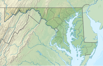
Location in Maryland
Location Cecil County, Maryland, United States
Nearest town Chesapeake City, Maryland
Coordinates 39°28′41″N75°51′13″W / 39.477974°N 75.853600°W / 39.477974; -75.853600
Area466 acres (189 ha) [1]
Established2017; opened 2022
Administered by Maryland Department of Natural Resources
Designation Maryland state park
Website ​​Bohemia River State Park

​​Bohemia River State Park is a public recreation area along the north bank of Great Bohemia Creek, a tributary of the Bohemia River, in Cecil County, Maryland, United States. [2] The state park's environmental mix includes agricultural fields, hardwood forests, marshes, beaches, tidal inlets, and open water. [3] The park has five miles (8.0 km) of natural-surface, multi-use trails and is used for low-impact recreational activities including hiking, biking, wildlife viewing, fishing and hunting. [2]
Contents

History

Bohemia River State Park opened on Earth Day in 2022. The state of Maryland purchased the site in 2017 and began making improvements in 2021. Further improvements including the establishment of five more miles of trails and access to a boat launch area are planned for 2025. [3]

Related Research Articles

<span class="mw-page-title-main">Deep Creek Lake State Park</span> State park in Garrett County, Maryland

Deep Creek Lake State Park is a public recreation area occupying more than 1,100 acres (450 ha) on the northeast side of Deep Creek Lake in Garrett County, Maryland, in the United States. The park features water activities, camping facilities, and recreational trails and is located about 18 miles (29 km) south of Interstate 68 on U.S. Route 219.

<span class="mw-page-title-main">Charlestown State Park</span> State park in Clark County, Indiana

Charlestown State Park is an Indiana state park on 5,100 acres (20.64 km2) in Clark County, Indiana, in the United States. The park is on the banks of the Ohio River, 1 mile (2 km) east of Charlestown. It was once part of the Indiana Army Ammunition Plant (INAAP), and was donated in separate parcels to the Indiana state government. In 1993, the state of Indiana was given 859 acres (3.48 km2), and in 1994 was given an additional 1,125 acres (4.55 km2). When the park opened in 1996, it encompassed 2,400 acres (9.7 km2). With an additional 2,600 acres (10.5 km2) given by the INAAP in 2004, the park has 5,100 acres (20.6 km2), making it the third largest state park in Indiana. The park attracts nearly 200,000 visitors annually.

<span class="mw-page-title-main">Seneca Creek State Park</span> State park in Montgomery County, Maryland, United States

Seneca Creek State Park is a public recreation area encompassing more than 6,300 acres (2,500 ha) along 14 miles of Seneca Creek in its run to the Potomac River in Montgomery County, Maryland. The park features facilities for boating and fishing as well as trails for hiking, cycling, and horseback riding. It is managed by the Maryland Department of Natural Resources.

<span class="mw-page-title-main">Ohiopyle State Park</span> State park in Fayette County, Pennsylvania, United States

Ohiopyle State Park is a Pennsylvania state park on 20,500 acres (8,300 ha) in Dunbar, Henry Clay and Stewart Townships, Fayette County, Pennsylvania in the United States. The focal point of the park is the more than 14 miles (23 km) of the Youghiogheny River gorge that passes through the park. The river provides whitewater boating, recreational fishing, and kayaking. Ohiopyle State Park is bisected by Pennsylvania Route 381 south of the Pennsylvania Turnpike. The park opened to the public in 1965 but was not officially dedicated until 1971.

<span class="mw-page-title-main">Susquehanna State Park (Maryland)</span> State park in Maryland, United States

Susquehanna State Park is a public recreation area located on the banks of the lower Susquehanna River north of the city of Havre de Grace, Maryland. The state park's main area is on the west bank of the river; the park also manages land on the river islands and east bank. The park offers fishing, boating, camping, and trails for hiking and equestrian use. It is managed as a complex with Rocks State Park and Palmer State Park by the Maryland Department of Natural Resources.

<span class="mw-page-title-main">Susquehannock State Park</span> State park in Pennsylvania, United States

Susquehannock State Park is a Pennsylvania state park on 224 acres (91 ha) in Drumore Township, Lancaster County, Pennsylvania in the United States. The park is on a scenic plateau overlooking the Susquehanna River and Conowingo Reservoir. The park is named for the Susquehannock people, who lived in the area. Susquehannock State Park is located on small roads a few miles south of Pennsylvania Route 372 and west of Pennsylvania Route 272. The nearest city is Quarryville, Pennsylvania, about 12 miles (19 km) East.

<span class="mw-page-title-main">Swatara State Park</span> State park in the U.S. state of Pennsylvania

Swatara State Park is a 3,515-acre (1,422 ha) Pennsylvania state park in Bethel, Swatara and Union Townships, Lebanon County and Pine Grove Township, Schuylkill County in Pennsylvania in the United States. 8 miles (13 km) of Swatara Creek lie within the park's boundaries, which are roughly formed by Pennsylvania Route 443 to the north and Interstate 81 to the south. The park is in a valley in the ridge and valley region of Pennsylvania between Second Mountain (north) and Blue Mountain (south).

<span class="mw-page-title-main">Denton Hill State Park</span> State park in Potter County, Pennsylvania


Denton Hill State Park is a 700-acre (283 ha) Pennsylvania state park in Ulysses Township, Potter County, Pennsylvania, in the United States. The park is a downhill skiing resort. Denton Hill State Park is on U.S. Route 6 between Coudersport and Galeton. In 2000 the park became part of the Hills Creek State Park complex, an administrative grouping of eight state parks in Potter and Tioga counties.

Dans Mountain State Park is a public recreation area located nine miles (14 km) south of Frostburg and to the east of the town of Lonaconing in Allegany County, Maryland. The state park occupies 482 acres (195 ha) on 16-mile-long (26 km) Dans Mountain and is managed by the Maryland Department of Natural Resources.

<span class="mw-page-title-main">Laurel Hill State Park</span> State park in Pennsylvania, United States

Laurel Hill State Park is a 3,935-acre (1,592 ha) Pennsylvania state park in Jefferson and Middlecreek Townships, Somerset County, Pennsylvania in the United States. Laurel Hill Lake is a 63-acre (25 ha) man-made lake with a dam that was constructed during the Great Depression by the young men of CCC camps NP-5-PA and SP-15-PA. Laurel Hill State Park is 8 miles (13 km) from Interstate 76 just off Pennsylvania Route 31 near Bakersville and on Pennsylvania Route 653 near Trent.

<span class="mw-page-title-main">Elk Neck State Park</span> Public recreation area in Maryland, US

Elk Neck State Park is a public recreation area located between Chesapeake Bay and the Elk River near the southern tip of the Elk Neck Peninsula in Cecil County, Maryland. The state park is home to the historic Turkey Point Light and offers land-based and water-based recreation. The park is located on MD 272, eight miles (13 km) south of the town of North East, and 13 miles (21 km) south of exit 100 on I-95. It is operated by the Maryland Department of Natural Resources.

<span class="mw-page-title-main">Patapsco Valley State Park</span> State park in Maryland, United States

Patapsco Valley State Park is a Maryland state park extending along 32 miles (51 km) of the Patapsco River south and west of the city of Baltimore, Maryland. The park encompasses multiple developed areas on over 14,000 acres (5,700 ha) acres of land, making it Maryland's largest state park. In 2006, it was officially celebrated as Maryland's first state park, its first formation being in 1906. Patapsco Valley State Park is managed by the Maryland Department of Natural Resources.

<span class="mw-page-title-main">Gunpowder Falls State Park</span> State park in Maryland, United States

Gunpowder Falls State Park is a public recreation area comprising six non-contiguous areas covering 15,088 acres (6,106 ha) in northeastern Baltimore County and western Harford County, Maryland. The state park is primarily made up of the stream valleys of the Big and Little Gunpowder Falls and the Gunpowder River; its natural features range from tidal marshes to rugged interior slopes. The park has over 120 miles of trails for hiking, biking, horseback riding, and cross-country skiing plus facilities for picnicking, tubing, canoeing and kayaking, tide-water fishing and crabbing, fly fishing, and hunting, among other activities. It is managed by the Maryland Department of Natural Resources.

<span class="mw-page-title-main">Big Run State Park</span> State park in Garrett County, Maryland

Big Run State Park is a public recreation area located at the northern end of the Savage River Reservoir, an impoundment of the Savage River, in Garrett County, Maryland. The state park occupies 300 acres (120 ha) in Savage River State Forest and encompasses the confluence of Monroe Run and Big Run. Park activities include boating, fishing, hiking, picknicking, and camping.

<span class="mw-page-title-main">Greenbrier State Park</span> State park in Maryland, United States

Greenbrier State Park is a public recreation area located on South Mountain, three miles (4.8 km) northeast of Boonsboro in Washington County, Maryland, USA. The state park has camping, hiking trails, and a 42-acre (17 ha) man-made lake. It is managed by the Maryland Department of Natural Resources.

<span class="mw-page-title-main">Janes Island State Park</span> State park in Somerset County, Maryland

Janes Island State Park is a public recreation area on Chesapeake Bay lying adjacent to the city of Crisfield in Somerset County, Maryland. The state park features some 30 miles (48 km) of marked water trails through the island's salt marsh leading to isolated pristine beaches. The park is managed by the Maryland Department of Natural Resources.

<span class="mw-page-title-main">Martinak State Park</span> State park in Caroline County, Maryland

Martinak State Park is a public recreation area located on the Choptank River and Watts Creek, immediately south of Denton in Caroline County, Maryland. The park bears the name of George Martinak, who deeded his land to the state in 1961. The park opened in 1964. Site improvements including the addition of campsites, roads, and park office took place from 1964 to 1974. The park features boating access, fishing, campsites and cabins, hiking trails, a nature center, and painted rocks.

<span class="mw-page-title-main">Patuxent River State Park</span> State park in Maryland, United States

Patuxent River State Park is a public recreation area located along the upper reaches of the Patuxent River in Howard and Montgomery counties in Maryland. The state park features hunting, fishing, mountain biking, horseback riding, and hiking on unsigned and untended trails. Planning for the park began in 1963, with the Maryland General Assembly funding land purchases in each year from 1964 to 1968. It is part of the Northeastern coastal forests ecoregion.

<span class="mw-page-title-main">South Mountain State Park</span> State park in Maryland, United States

South Mountain State Park is a public recreation area that runs for nearly the entire length of South Mountain through Washington and Frederick counties in Maryland. The state park is contiguous with several other national, state and local parks on the mountain, including the Chesapeake and Ohio Canal National Historical Park, Gathland State Park, Washington Monument State Park, Greenbrier State Park and Pen Mar County Park.

St. Mary's River State Park is a public recreation area located in St. Mary's County, Maryland. The state park consists of two sites: one encompasses 250-acre (100 ha) St. Mary's Lake; the second covers 2,200 acres (890 ha) and is largely undeveloped. The park is managed by the Maryland Department of Natural Resources.

References

  1. "DNR Lands Acreage Report" (PDF). Maryland Department of Natural Resources. Retrieved October 30, 2024.
  2. 1 2 "Bohemia River State Park". Maryland Department of Natural Resources. Retrieved October 30, 2024.
  3. 1 2 Hoadley, Tricia (December 7, 2022). "Appreciating the new Bohemia River State Park". Cecil County Life. Retrieved October 30, 2024.