
Jasper National Park, in Alberta, Canada, is the largest national park within Alberta's Rocky Mountains, spanning 11,000 km2 (4,200 sq mi). It was established as Jasper Forest Park in 1907, renamed as a national park in 1930, and declared a UNESCO world heritage site in 1984. Its location is north of Banff National Park and west of Edmonton. The park contains the glaciers of the Columbia Icefield, springs, lakes, waterfalls and mountains.

The Athabasca River is a river in Alberta, Canada, which originates at the Columbia Icefield in Jasper National Park and flows more than 1,231 km (765 mi) before emptying into Lake Athabasca. Much of the land along its banks is protected in national and provincial parks, and the river is designated a Canadian Heritage River for its historical and cultural importance. The scenic Athabasca Falls is located about 30 km (19 mi) upstream from Jasper.
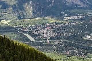
Banff is a resort town in Banff National Park, Alberta, Canada, in Alberta's Rockies along the Trans-Canada Highway, 126 km (78 mi) west of Calgary, 58 km (36 mi) east of Lake Louise, and 1,400 to 1,630 m above sea level.

Mount Brazeau is a mountain in Alberta, Canada.
The Victoria Cross Ranges are a set of mountain ranges in the Canadian Rockies, located to the northwest of Jasper. Of the 19 peaks contained within this range, five are named after Canadian recipients of the Victoria Cross. The area of the ranges is 678 square kilometres (262 sq mi).
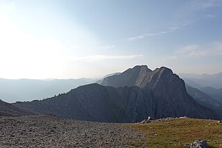
The Fiddle Range is a mountain range of the Canadian Rockies located south of Highway 16 on the east border of Jasper National Park, Canada.

The South Jasper Ranges are mountain ranges of the Rocky Mountains in Alberta and British Columbia, Canada.

Mount Unwin is a 3,268-metre (10,722-foot) mountain summit located on the west side of Maligne Lake in Jasper National Park, in the Queen Elizabeth Range of the Canadian Rockies of Alberta, Canada. Its nearest higher peak is Mount Brazeau, 13.0 km (8.1 mi) to the east-southeast.

Mount Kerkeslin is a 2,984 m (9,790 ft) mountain summit located in the Athabasca River valley of Jasper National Park, in the Canadian Rockies of Alberta, Canada. It is the highest peak of the Maligne Range. It is located in the south part of the Maligne Range, east of the Icefields Parkway and is visible from the Athabasca Falls lookout. Mount Kerkeslin is composed of sedimentary rock laid down during the Cambrian period and pushed east and over the top of younger rock during the Laramide orogeny.
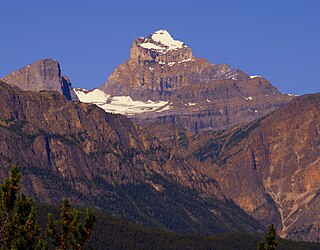
Mount Fryatt is Alberta's 26th highest peak. In 1920, it was named after Captain Charles Fryatt, a British merchant seaman who was executed by the Germans during World War I. It lies within peaks that are between the Athabasca and Whirlpool Rivers in Jasper National Park.
Dungeon Peak is a 3,129-metre (10,266 ft) mountain summit located on the shared border of Jasper National Park in Alberta, and Mount Robson Provincial Park in British Columbia, Canada. Dungeon Peak is part of The Ramparts in the Tonquin Valley. The descriptive name was applied in 1916 by Morrison P. Bridgland (1878-1948), a Dominion Land Surveyor who named many peaks in Jasper Park and the Canadian Rockies. The mountain's name was made official in 1935 by the Geographical Names Board of Canada.

The Siffleur Wilderness Area is a provincially designated wilderness area in the Canadian Rockies of Alberta. It was established in 1961 and it, as one of the three wilderness areas of Alberta, has the strictest form of government protection available in Canada. All development is forbidden and only travel by foot is permitted. Hunting and fishing are not allowed. The other two wilderness areas are White Goat Wilderness Area and Ghost River Wilderness Area and together the three areas total 249,548.80 acres (100,988.82 ha).
Amber Mountain is a 2,565-metre (8,415-foot) mountain summit located in the Maligne Range of Jasper National Park, in the Canadian Rockies of Alberta, Canada. Amber Mountain was so named on account of amber-hued shale outcroppings. The mountain was named in 1916 by Morrison P. Bridgland (1878-1948), a Dominion Land Surveyor who named many peaks in Jasper Park and the Canadian Rockies. The mountain's name was officially adopted in 1947 when approved by the Geographical Names Board of Canada. Its nearest higher peak is The Watchtower, 5.0 km (3.1 mi) to the east. Amber Mountain is composed of sedimentary rock laid down during the Cambrian period and pushed east and over the top of younger rock during the Laramide orogeny.

Roche Bonhomme is a 2,495-metre (8,186-foot) mountain summit located in Jasper National Park in Alberta, Canada. It is located in the Colin Range, which is a sub-range of the Canadian Rockies. The peak is situated 13 km (8.1 mi) northeast of the municipality of Jasper, and is a prominent landmark in the Athabasca Valley visible from Highway 16 and the Canadian. Its nearest higher peak is Grisette Mountain, 2.2 km (1.4 mi) to the east.

Chetamon Mountain is a 2,606-metre (8,550-foot) mountain summit located in Jasper National Park, in the De Smet Range of the Canadian Rockies in Alberta, Canada. The peak is situated 18 kilometres (11 mi) north of the municipality of Jasper, in the Athabasca Valley and is visible from Highway 16 and the Canadian. Its nearest higher peak is Cliff Mountain, 3.5 km (2.2 mi) to the northwest.

Mount Colin is a 2,687-metre (8,816-foot) mountain summit located in Jasper National Park in Alberta, Canada. It is located in the Colin Range, which is a sub-range of the Canadian Rockies. The peak is situated 15 km (9.3 mi) northeast of the municipality of Jasper, and is a prominent landmark in the Athabasca Valley visible from Highway 16 and the Canadian. Its nearest higher peak is Sirdar Mountain, 15 km (9.3 mi) to the southeast. Mount Colin was named in 1859 by James Hector after Colin Fraser of the Hudson's Bay Company in charge of Jasper House from 1835 to 1849, and Sir George Simpson's personal servant. The mountain's name was officially adopted in 1956 by the Geographical Names Board of Canada.

Grisette Mountain is a 2,620-metre (8,600 ft) mountain summit located in Jasper National Park in Alberta, Canada. It is located in the Colin Range, which is a sub-range of the Canadian Rockies. The peak is situated 14 km (8.7 mi) northeast of the municipality of Jasper, and is a prominent landmark in the Athabasca Valley visible from Highway 16 and the Canadian. Its nearest higher peak is Mount Dromore, 2.4 km (1.5 mi) to the east.
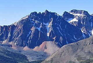
Terminal Mountain is a 2,835-metre (9,301 ft) mountain summit located in Jasper National Park, in the Trident Range of the Canadian Rockies of Alberta, Canada. The town of Jasper is situated 12 kilometers to the north-northeast. Terminal Mountain forms the west buttress of Marmot Pass, and the east buttress is formed by Marmot Mountain, home of the Marmot Basin alpine ski area. Peveril Peak rises to the south across Circus Valley, and the north side towers above the valley of Whistlers Creek. The nearest higher neighbor is Manx Peak, 2.0 km (1.2 mi) to the west.
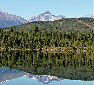
Roche Noire is a 2,920-metre (9,580 ft) mountain located in Alberta, Canada.

Blackhorn Peak is a 3,000-metre (9,800-foot) summit in Alberta, Canada.


