Bhuj Airport is a domestic airport located in Bhuj in the Kutch District of the state of Gujarat, India. It is located 4 km from Bhuj.

Car Nicobar Air Force Base is located in IAF Camp village, on Car Nicobar Island in the Union Territory of the Andaman and Nicobar Islands, India.

Along Airport also known as Aalo Airport is located at Along in the state of Arunachal Pradesh, India.
Pasighat Airport or Passighat Airport is located at Pasighat in the state of Arunachal Pradesh, India.

The Ambala Air Force Station is an air base east of the urban Ambala area. It is used for military and government flights. It is also used to fly in politicians and other key people.
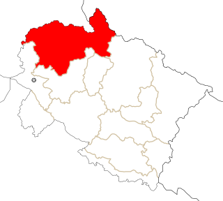
Karnal Airport,, the home of "Karnal Aviation Club", is an airstrip situated about 3 km east of Karnal in the state of Haryana, India. It is being used for General Aviation and Pilot Training. There are no scheduled commercial flight operations. To upgrade this airport to domestic airport under UDAN scheme, provision of INR20 crore each was made in 2017-18 and 2018-19.

Supadio International Airport, formerly known as Sei Durian Airport or Sungai Durian Airport, is an international airport located 17 km from Pontianak, West Kalimantan, Indonesia. The airport is managed by PT. Angkasa Pura II, and takes up 528 ha. The airport serves as the main point of entry to West Kalimantan. The airport serves domestic flights to and from several cities and towns in Indonesia and some limited flights to Kuching and Kuala Lumpur in the neighboring Malaysia. The name of the airport is derived from the Lieutenant Colonel Supadio, an Indonesian Air Force officer who served Pangkowilud II Banjarmasin, which oversees the Sungai Durian Airbase. Lieutenant Colonel Supadio died in an airplane crash with Colonel (PNB) Nurtanio in Bandung in 1966. The airport area and runway is also shared with the Supadio Airbase a Type B airbase of the TNI-AU. It served as the homebase of the Skuadron Udara 1 of the Indonesian Air Force, which consists of a fleet of 18 Hawk 109/209. The airport previously suffered from overcapacity. A major renovation between 2014 and 2017 dramatically increased the airport's capacity, which involves the building of a larger and more spacious terminal. After the renovation, the airport now have four jet bridge and are able to accommodate 3.8 million passengers annually. The renovation includes the widening and extension of the runway to 2,500-meter, building a new and higher Air traffic control tower and widening the airport's apron to accommodate more and larger aircraft.

Tejgaon Airport in Dhaka, Bangladesh served as the country's sole international airport prior to the construction of Shahjalal International Airport.

Jindal Vijaynagar Airport is an airport located in Toranagallu, a village in the Indian state of Karnataka. Because of its location near Vidyanagar Township, the airport is also known as Vidyanagar Airport. It is owned and operated by JSW Steel, which operates a steel mill in Toranagallu. The name Jindal Vijaynagar comes from the company Jindal Vijaynagar Steel Ltd (JVSL), which merged to form JSW Steel in 2005.

Rupshir Airport is an airport located about 15 km (8.1 NM) from Dhubri town, in Assam, India. The airstrip has remained defunct since the 1980s. The Airports Authority of India (AAI) and the Indian Air Force (IAF) have begun work to revive the airfield. Civil operations to the airport will be begun under the Government's Regional Connectivity Scheme.

Indian Mountain LRRS Airport is a military airstrip located south of Utopia Creek, in the Yukon–Koyukuk Census Area of the U.S. state of Alaska. The airstrip is also located 15.8 miles (25.4 km) east-southeast of Hughes, Alaska. It is not open for public use.
Lucknow Air Force Station known as Bakshi Ka Talab Air Force Station is located at Bakshi Ka Talab on the outskirt of Lucknow, Uttar Pradesh, India. It belongs to the Central Air Command. Sole user of this airport is the Indian Air Force. No. 35 Squadron IAF (Rapiers) is based here as an EW and Air superiority unit. It was founded by the British in the run up to WWII as a small airstrip, but expanded after Indian independence.
Deesa Airport, also known as Palanpur Airport, is an airport in Deesa, Gujarat originally built to serve the princely state of Palanpur. It is managed by the Airports Authority of India.

Yongxing Island Airport, also known as Woody Island Airport, is a civilian-military dual-use airport located on Yongxing (Woody) Island, the largest of the disputed Paracel Islands in the South China Sea. Yongxing/Woody Island is occupied and administered by China (PRC) as the seat of Sansha city of Hainan Province. The airport was expanded in 1990 to increase the combat range of Chinese warplanes. Further construction and reclamation of land commenced in 2012 to lengthen the airstrip. This work was completed in October 2014.

Iranamadu Airport is an air force station and domestic airport in Iranamadu in northern Sri Lanka. Located approximately 9.5 km (5.9 mi) south east of the town of Kilinochchi, the airport is also known as Kilinochchi Airport and SLAF Iranamadu. Originally built by the rebel Liberation Tigers of Tamil Eelam in 2003, it was captured by the Sri Lankan military in 2009 and taken over by the Sri Lanka Air Force.
Sirsa Air Force Station or Sirsa AFS is a Forward Support Base Unit (FSBU) of Indian Air Force's (IAF) Western Air Command (WAC), located at Sirsa in the state of Haryana, India.
Bhiwani Airport, also called Bhiwani Air Strip, is a public airport adjacent to Gujrani village in the Bhiwani district of the Indian state of Haryana.

The Saifai Airstrip is an airstrip at Saifai village in Etawah District of Uttar Pradesh with only unscheduled chartered flights. This airstrip has an existing land area of 370 acres and it is suitable for Airbus 320/Boeing 737 with turning pads at both ends.
Narnaul Airport नारनौल विमानतल, also Bachhod/Bachhud Airstrip, is an airstrip adjacent to Bachhaud village 10 km east of Narnaul city in the Indian state of Haryana.. The airstrip is used mainly by Rajiv Gandhi National Centre for Aero Sports, which was inaugurated in 2010. The airstrip is owned by the Civil Aviation Department of Haryana government. It does not have any IATA or ICAO code. The code VINL listed in this article does not exist.
Gurugram Airstrip, also Bhondsi Airstrip and Silokhera Airstrip, is an airstrip located between Silokhera and Bhondsi villages, 10 kilometres (6.2 mi) south of Gurugram city center, in Haryana state of India.