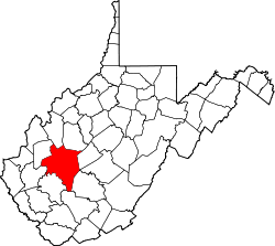
Cinco, West Virginia | |
---|---|
Coordinates: 38°20′13″N81°27′58″W / 38.33694°N 81.46611°W | |
Country | United States |
State | West Virginia |
County | Kanawha |
Elevation | 696 ft (212 m) |
Time zone | UTC-5 (Eastern (EST)) |
• Summer (DST) | UTC-4 (EDT) |
FIPS code | 1554136 [1] |
Cinco is an unincorporated community in Kanawha County, West Virginia, United States.
Cinco is 690 feet [210 m] above sea level. It lies in the Eastern Time Zone (EST/EDT) and observes daylight saving time. The telephone area codes for Cinco are 304 & 681. [2]
The community was named by a mining official, who preferred Cinco brand cigars. [3]
Kanawha County is a county in the U.S. state of West Virginia. As of the 2020 census, the population was 180,745, making it West Virginia's most populous county. The county seat is Charleston, which is also the state capital. Kanawha County is part of the Charleston, WV Metropolitan Statistical Area.
Red House is a small unincorporated community located in Putnam County in the U.S. state of West Virginia. The community is divided into two distinct areas: Red House (Proper) which follows the Kanawha River Valley along WV 62, and Red House Hill along WV 34 which is in the hills just off the Kanawha River Valley. The Red House Post Office is still in service and was founded on September 26, 1840. Some say the town was named for a red house which stood at the town site, while others believe nearby red rock formations account for the name.
The Little Kanawha River is a tributary of the Ohio River, 169 mi (269 km) long, in western West Virginia in the United States. Via the Ohio, it is part of the watershed of the Mississippi River, draining an area of 2,320 mi² (6,009 km²) on the unglaciated portion of the Allegheny Plateau. It served as an important commercial water route in the early history of West Virginia, particularly in the logging and petroleum industries.
Quick is a small unincorporated community in Kanawha County, West Virginia, United States. It is located along Indian Creek Road. The community is where Whitoak Fork and Blue Creek come together and meet. It is also where the abandoned railroad that follows Blue Creek joins the road, and follows it all the way to the community of Hitop, along Pond Fork. Its post office is closed.
Chelyan is a census-designated place (CDP) in Kanawha County, West Virginia, United States. Chelyan is located on the south bank of the Kanawha River, southeast of Chesapeake. It is served by Exit 85 of the West Virginia Turnpike. As of the 2010 census, its population was 776.
Pocatalico is an unincorporated community in Kanawha County, West Virginia, United States. Pocatalico is located along Interstate 77 south of and near Sissonville.
Kanawha Head is an unincorporated community in Upshur County, West Virginia, United States. Kanawha Head is located on West Virginia Route 20, 16.5 miles (26.6 km) south-southwest of Buckhannon. Kanawha Head had a post office with ZIP code 26228.
Hansford is an unincorporated community in Kanawha County, West Virginia, United States. Hansford is located along the Kanawha River and West Virginia Route 61, adjacent to Pratt. Hansford has a post office with ZIP code 25103.
Riverside is an unincorporated community in Kanawha County, West Virginia, United States. Riverside is located on the north bank of the Kanawha River and U.S. Route 60, 1 mile (1.6 km) southeast of Glasgow.
Hugheston is an unincorporated community in Kanawha County, West Virginia, United States. Hugheston is located on the north bank of the Kanawha River across from Pratt. Hugheston has a post office with ZIP code 25110. The average household income is $32,436.
Snow Hill is an unincorporated community in Kanawha County, West Virginia, United States. Snow Hill is 4 miles (6.4 km) southeast of downtown Charleston.
Dickinson, also known as Quincy, is an unincorporated community in Kanawha County, West Virginia, United States. Dickinson is located on the north bank of the Kanawha River, 3 miles (4.8 km) southeast of Belle. The community is served by U.S. Route 60.
Dial is an unincorporated community in Kanawha County, West Virginia, United States.
Jarretts Ford is an unincorporated community in Kanawha County, West Virginia, United States.
Frame is an unincorporated community in Kanawha County, West Virginia, United States.
Blundon is an unincorporated community in Kanawha County, West Virginia, United States.
Brounland is an unincorporated community in Kanawha County, West Virginia, United States.
Joplin is an unincorporated community in Kanawha County, West Virginia, United States. It is likely named after an early white settler in Kanawha County, James Jopling. In the early 19th century, Jopling purchased land alongside the creek later called Joplin Branch, a tributary of the Kanawha River. Many of Jopling's children and grandchildren lived along the creek near the family patriarch, and gave the community its name. James Jopling was described as "a man of powerful frame, and loved adventure. He was a noted trapper, hunter, and Indian fighter, and delighted in relating his narrow escapes and wonderful feats in woods life." Jopling also reportedly killed the last elk in the region, nearby on the Elk River.
Copenhaver was an unincorporated community in Kanawha County, West Virginia, United States. Its post office is closed.
Wevaco is an unincorporated community and former coal town in Kanawha County, West Virginia, United States. It had a post office but is now closed.