Basilisk is a rural locality in the Cassowary Coast Region, Queensland, Australia. In the 2021 census, Basilisk had "no people or a very low population".
Belvedere is a rural locality in the Cassowary Coast Region, Queensland, Australia. In the 2021 census, Belvedere had a population of 943 people.

Boogan is a rural locality in the Cassowary Coast Region, Queensland, Australia. In the 2021 census, Boogan had a population of 138 people.
Lower Cowley is a rural locality in the Cassowary Coast Region, Queensland, Australia. In the 2021 census, Lower Cowley had a population of 55 people.
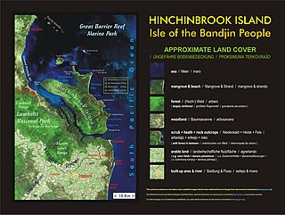
Hinchinbrook is an island group locality in the Cassowary Coast Region, Queensland, Australia. In the 2021 census, Hinchinbrook had a population of 5 people.
Tam O'Shanter is a rural locality in the Cassowary Coast Region, Queensland, Australia. In the 2021 census, Tam O'Shanter had "no people or a very low population".
Djiru is a coastal locality in the Cassowary Coast Region, Queensland, Australia. In the 2021 census, Djiru had "no people or a very low population".
Mount Mackay is a locality in the Cassowary Coast Region, Queensland, Australia. In the 2021 census, Mount Mackay had "no people or a very low population".
Birkalla is a rural locality in the Cassowary Coast Region, Queensland, Australia. In the 2021 census, Birkalla had a population of 156 people.
Bulgun is a rural locality in the Cassowary Coast Region, Queensland, Australia. In the 2021 census, Bulgun had a population of 285 people.
Gulngai is a rural locality in the Cassowary Coast Region, Queensland, Australia. In the 2021 census, Gulngai had "no people or a very low population".
Carruchan is a rural locality in the Cassowary Coast Region, Queensland, Australia. In the 2021 census, Carruchan had a population of 247 people.
Eaton is a rural locality in the Cassowary Coast Region, Queensland, Australia. In the 2021 census, Eaton had a population of 47 people.
Cowley Creek is a rural locality in the Cassowary Coast Region, Queensland, Australia. In the 2021 census, Cowley Creek had "no people or a very low population".
O'Briens Hill is a rural locality in the Cassowary Coast Region, Queensland, Australia. In the 2021 census, O'Briens Hill had a population of 11 people.
Djarawong is a rural locality in the Cassowary Coast Region, Queensland, Australia. In the 2021 census, Djarawong had a population of 103 people.
Friday Pocket is a rural locality in the Cassowary Coast Region, Queensland, Australia. In the 2021 census, Friday Pocket had a population of 39 people.
Kooroomool is a rural locality in the Cassowary Coast Region, Queensland, Australia. In the 2021 census, Kooroomool had "no people or a very low population".
Merryburn is a rural locality in the Cassowary Coast Region, Queensland, Australia. In the 2021 census, Merryburn had a population of 189 people.
McCutcheon is a rural locality in the Cassowary Coast Region, Queensland, Australia. In the 2021 census, McCutcheon had a population of 34 people.
