Mighell, Queensland

Last updated

Map all coordinates using: OpenStreetMap
Mighell
Queensland
Australia Queensland location map.svg
Red pog.svg
Mighell
Coordinates 17°32′26″S146°01′00″E / 17.5405°S 146.0166°E / -17.5405; 146.0166 (Mighell (centre of locality))
Population363 (SAL 2021) [1]
Postcode(s) 4860
Area4.3 km2 (1.7 sq mi)
Time zone AEST (UTC+10:00)
Location
LGA(s) Cassowary Coast Region
State electorate(s) Hill
Federal division(s) Kennedy
Suburbs around Mighell:
Goondi Hill Innisfail East Innisfail
Bamboo Creek Mighell South Innisfail
Bamboo Creek Mundoo South Innisfail

Mighell is a rural locality in the Cassowary Coast Region, Queensland, Australia. [2] In the 2021 census, Mighell had a population of 363 people. [3]

Contents

Geography

The locality is bounded by the South Johnstone River to the east and by its tributary Bamboo Creek to the west and north. [4]

The Bruce Highway enters the locality from the east (South Innisfail) crossing the South Johnstone River on the Centenary Bridge. [5] Once in Mighell, the highway travels north along River Avenue, and then exits the locality to the north (Innisfail) crossing Bamboo Creek on an unnamed bridge. [4]

The North Coast railway line enters the locality from the south (Mundoo) and exits to the north-west (Goondi Hill) crossing Bamboo Creek. There are no railway stations in the locality. [4]

The land use is predominantly growing sugarcane and there is a network of cane tramways to transport the harvested sugarcane to the South Johnstone sugar mill in South Johnstone to the south. There is also grazing on native vegetation in the north-west of the locality. [6]

The land use in the north and north-east of the locality is more suburban in character being an extension of the urban area of Innisfail to the north. [6]

History

The locality was named after Innisfail solicitor and businessman Norman Mighell. [2]

Innisfail State High School opened on 24 January 1955 and operated until the end of 2009 at 2 Stitt Street ( 17°32′12″S146°01′41″E / 17.5367°S 146.0280°E / -17.5367; 146.0280 (Innisfail State High School (former)) ). [7] In 2010, it was amalgamated with the Innisfail Inclusive Education Centre (a special education facility) and Tropical North Queensland TAFE (Innisfail Campus) to form Innisfail State College using the site of the TAFE campus at Innisfail Estate. [8] [9] [10] Innisfail State High School's website was archived. [11]

Demographics

In the 2016 census, Mighell had a population of 380 people. [12]

In the 2021 census, Mighell had a population of 363 people. [3]

Education

There are no schools in Mighell. The nearest government primary schools are Innisfail State School in neighbouring Innisfail to the north and Mundoo State School in neighbouring Mundoo to the south. The nearest government secondary school is Innisfail State College in Innisfail Estate to the north-east. [13]

Amenities

The Innisfail Conservatorium of Music (also known as the Con Theatre) is a performing arts centre at 5 River Avenue ( 17°32′02″S146°01′49″E / 17.5339°S 146.0304°E / -17.5339; 146.0304 (CONSERVATORIUM OF MUSIC) ). [14] [15] [16] [17]

Innisfail Cultural Complex is a community centre off River Avenue ( 17°32′01″S146°01′44″E / 17.5337°S 146.0289°E / -17.5337; 146.0289 (INNISFAIL CULTURAL COMPLEX) ). [18]

Innisfail Cemetery is at 8 Scullen Avenue ( 17°31′54″S146°01′39″E / 17.5316°S 146.0276°E / -17.5316; 146.0276 (Innisfail Cemetery) ). [19] It is operated by the Cassowary Coast Regional Council. [20]

Related Research Articles

<span class="mw-page-title-main">Innisfail, Queensland</span> Town in Queensland, Australia

Innisfail is a regional town and locality in the Cassowary Coast Region, Queensland, Australia. The town was originally called Geraldton until 1910. In the 2016 census, the town of Innisfail had a population of 7,236 people, while the locality of Innisfail had a population of 1,145 people.

<span class="mw-page-title-main">Mission Beach, Queensland</span> Town in Queensland, Australia

Mission Beach is a coastal town and locality in the Cassowary Coast Region, Queensland, Australia. In the 2016 census, the locality of Mission Beach had a population of 815 people.

Mundoo is a rural town and locality in the Cassowary Coast Region, Queensland, Australia. In the 2016 census the locality of Mundoo had a population of 224 people.

<span class="mw-page-title-main">East Innisfail, Queensland</span> Suburb of Cassowary Coast Region, Queensland, Australia

East Innisfail is a suburban locality in the Cassowary Coast Region, Queensland, Australia. In the 2016 census East Innisfail had a population of 1,855 people.

<span class="mw-page-title-main">South Johnstone, Queensland</span> Town in Queensland, Australia

South Johnstone is a rural town and locality in the Cassowary Coast Region, Queensland, Australia. In the 2021 census, the locality of South Johnstone had a population of 456 people.

<span class="mw-page-title-main">Silkwood, Queensland</span> Town in Queensland, Australia

Silkwood is a rural town and locality in the Cassowary Coast Region, Queensland, Australia. In the 2016 census, the locality of Silkwood had a population of 391 people.

<span class="mw-page-title-main">Cowley Beach, Queensland</span> Town in Queensland, Australia

Cowley Beach is a beach, coastal town and locality in the Cassowary Coast Region, Queensland, Australia. In the 2021 census, the locality of Cowley Beach had a population of 65 people.

<span class="mw-page-title-main">Goondi, Queensland</span> Suburb of Cassowary Coast Region, Queensland, Australia

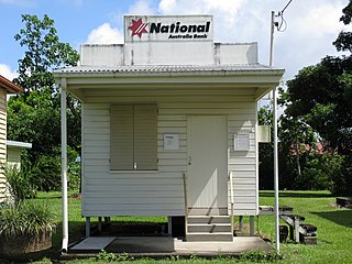
Goondi is a locality in the Cassowary Coast Region, Queensland, Australia.

<span class="mw-page-title-main">Garners Beach, Queensland</span> Suburb of Cassowary Coast Region, Queensland, Australia

Garners Beach is a coastal locality in the Cassowary Coast Region, Queensland, Australia. In the 2016 census, Garners Beach had a population of 25 people.

Coorumba is a rural locality in the Cassowary Coast Region, Queensland, Australia. In the 2016 census, Coorumba had a population of 121 people.

<span class="mw-page-title-main">Daradgee, Queensland</span> Town in Queensland, Australia

Daradgee is a rural town and locality in the Cassowary Coast Region, Queensland, Australia. In the 2016 census, Daradgee had a population of 74 people.

Wangan is a town and a locality in the Cassowary Coast Region, Queensland, Australia. In the 2021 census, the locality of Wangan had a population of 612 people.

Goondi Hill is a semi-urban locality in the Cassowary Coast Region, Queensland, Australia. In the 2016 census, Goondi Hill had a population of 510 people.

Goondi Bend is a mixed-use locality in the Cassowary Coast Region, Queensland, Australia. In the 2016 census, Goondi Bend had a population of 594 people.

Cullinane is a rural locality in the Cassowary Coast Region, Queensland, Australia. In the 2016 census, Cullinane had a population of 524 people.

Innisfail Estate is a semi-rural locality in the Cassowary Coast Region, Queensland, Australia. In the 2016 census, Innisfail Estate had a population of 1,338 people.

Goolboo is a rural locality in the Cassowary Coast Region of Queensland, Australia. In the 2021 census, Goolboo had a population of 25 people.

Currajah is a rural locality in the Cassowary Coast Region, Queensland, Australia. In the 2021 census, Currajah had a population of 57 people.

Upper Daradgee is a rural locality in the Cassowary Coast Region, Queensland, Australia. In the 2016 census, Upper Daradgee had a population of 101 people.

No. 6 Branch is a rural locality in the Cassowary Coast Region, Queensland, Australia. In the 2016 census, No. 6 Branch had a population of 50 people.

References

  1. Australian Bureau of Statistics (28 June 2022). "Mighell (suburb and locality)". Australian Census 2021 QuickStats. Retrieved 28 June 2022.  OOjs UI icon edit-ltr-progressive.svg
  2. 1 2 "Mighell – locality in Cassowary Coast Region (entry 45731)". Queensland Place Names. Queensland Government . Retrieved 29 October 2019.
  3. 1 2 Australian Bureau of Statistics (28 June 2022). "Mighell (SAL)". 2021 Census QuickStats. Retrieved 28 February 2023. OOjs UI icon edit-ltr-progressive.svg
  4. 1 2 3 "Queensland Globe". State of Queensland . Retrieved 24 November 2023.
  5. Google (25 November 2023). "Centenary Bridge across the South Johnstone River" (Map). Google Maps . Google. Retrieved 25 November 2023.
  6. 1 2 "Queensland Globe". State of Queensland . Retrieved 24 November 2023.
  7. "Local government meeting: Agenda" (PDF). Cassowary Coast Regional Council. 28 March 2013. pp. 176–180. Archived (PDF) from the original on 1 October 2020.
  8. "Opening and closing dates of Queensland Schools". Queensland Government . Retrieved 18 April 2019.
  9. "About us". Innisfail State College. 16 April 2020. Archived from the original on 1 October 2020. Retrieved 1 October 2020.
  10. "Queensland state school - centre closures" (PDF). Queensland Government . 20 August 2013. Archived (PDF) from the original on 20 March 2022. Retrieved 6 April 2022.
  11. "Innisfail State High School". Innisfail State High School. 25 October 2009. Archived from the original on 25 October 2009. Retrieved 8 April 2022.
  12. Australian Bureau of Statistics (27 June 2017). "Mighell (SSC)". 2016 Census QuickStats. Retrieved 20 October 2018. OOjs UI icon edit-ltr-progressive.svg
  13. "Layers: Locality; Schools and school catchments". Queensland Globe. Queensland Government. Archived from the original on 19 December 2017. Retrieved 24 November 2023.
  14. "Building areas - Queensland". Queensland Open Data. Queensland Government. 17 November 2020. Archived from the original on 23 October 2020. Retrieved 17 November 2020.
  15. "The Con Theatre Innisfail | Community". Cassowary Coast Informer. Retrieved 24 November 2023.
  16. "Community Venues For Hire". Cassowary Coast Regional Council. Archived from the original on 5 November 2023. Retrieved 24 November 2023.
  17. Google (25 November 2023). "The Con Theatre" (Map). Google Maps . Google. Retrieved 25 November 2023.
  18. "Building points - Queensland". Queensland Open Data. Queensland Government. 17 November 2020. Archived from the original on 25 November 2020. Retrieved 25 November 2020.
  19. "Cemetery Areas - Queensland". Queensland Open Data. Queensland Government. 12 November 2020. Archived from the original on 15 November 2020. Retrieved 12 November 2020.
  20. "Regional Cemeteries". Cassowary Coast Regional Council. Archived from the original on 27 October 2023. Retrieved 24 November 2023.