Goondi Bend, Queensland

Last updated

Goondi Bend
Innisfail,  Queensland
Australia Queensland location map.svg
Red pog.svg
Goondi Bend
Coordinates 17°31′19″S146°00′29″E / 17.5219°S 146.0080°E / -17.5219; 146.0080 (Goondi Bend (centre of locality))
Population570 (2021 census) [1]
 • Density228/km2 (591/sq mi)
Postcode(s) 4860
Area2.5 km2 (1.0 sq mi)
Time zone AEST (UTC+10:00)
Location
LGA(s) Cassowary Coast Region
State electorate(s) Hill
Federal division(s) Kennedy
Suburbs around Goondi Bend:
Goondi Goondi Cullinane
Hudson Goondi Bend Goondi Hill
Hudson Bamboo Creek Goondi Hill

Goondi Bend is a mixed-use locality in the Cassowary Coast Region, Queensland, Australia. [2] In the 2021 census, Goondi Bend had a population of 570 people. [1]

Contents

Geography

The Bruce Highway (known locally as Palmerston Drive) enters the locality from the south-east (Goondi Hill) and exits to the west (Belvedere/Goondi). [3]

The North Coast railway line enters from the east (Goondi Hill) and forms the north-east boundary of the locality, exiting to the north (Goondi / Sundown). [3]

The land use is a mix of residential and crop growing, including sugarcane. [3]

History

The name Goondi is thought to be an Aboriginal word meaning elbow. [2]

Goondi Provisional School opened on 17 February 1898. On 1 January 1909, it became Goondi State School. [4] It was originally located on the south side of Goondi Mill Road in Goondi, [5] [6] but, by 1974, had relocated to the school's present location in Goondi Bend. [7] [8]

Demographics

In the 2016 census, Goondi Bend had a population of 594 people. [9]

In the 2021 census, Goondi Bend had a population of 570 people. [1]

Education

Goondi State School is a government primary (Prep-6) school for boys and girls at 78 Maple Street ( 17°31′22″S146°00′36″E / 17.5228°S 146.0099°E / -17.5228; 146.0099 (Goondi State School) ). [10] [11] In 2017, the school had an enrolment of 374 students with 26 teachers (24 full-time equivalent) and 23 non-teaching staff (14 full-time equivalent). [12] In 2018, the school had an enrolment of 359 students with 24 teachers (23 full-time equivalent) and 22 non-teaching staff (14 full-time equivalent). [13]

There are no secondary schools in Goondi Bend. The nearest government secondary school is Innisfail State College in Innisfail Estate to the east. [3]

Related Research Articles

<span class="mw-page-title-main">Innisfail, Queensland</span> Town in Queensland, Australia

Innisfail is a regional town and locality in the Cassowary Coast Region, Queensland, Australia. The town was originally called Geraldton until 1910. In the 2016 census, the town of Innisfail had a population of 7,236 people, while the locality of Innisfail had a population of 1,145 people.

Mundoo is a rural town and locality in the Cassowary Coast Region, Queensland, Australia. In the 2016 census the locality of Mundoo had a population of 224 people.

<span class="mw-page-title-main">East Innisfail, Queensland</span> Suburb of Cassowary Coast Region, Queensland, Australia

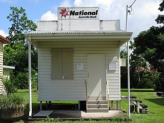
East Innisfail is a suburban locality in the Cassowary Coast Region, Queensland, Australia. In the 2021 census, East Innisfail had a population of 1,757 people.

<span class="mw-page-title-main">Garradunga</span> Suburb of Cassowary Coast Region, Queensland, Australia

Garradunga is a rural locality in the Cassowary Coast Region, Queensland, Australia. In the 2021 census, Garradunga had a population of 170 people.

<span class="mw-page-title-main">Mena Creek, Queensland</span> Suburb of Cassowary Coast Region, Queensland, Australia

Mena Creek is a rural locality in the Cassowary Coast Region, Queensland, Australia. In the 2016 census, Mena Creek had a population of 244 people.

<span class="mw-page-title-main">South Johnstone, Queensland</span> Town in Queensland, Australia

South Johnstone is a rural town and locality in the Cassowary Coast Region, Queensland, Australia. In the 2021 census, the locality of South Johnstone had a population of 456 people.

<span class="mw-page-title-main">Silkwood, Queensland</span> Town in Queensland, Australia

Silkwood is a rural town and locality in the Cassowary Coast Region, Queensland, Australia. In the 2016 census, the locality of Silkwood had a population of 391 people.

<span class="mw-page-title-main">Cowley Beach, Queensland</span> Town in Queensland, Australia

Cowley Beach is a beach, coastal town and locality in the Cassowary Coast Region, Queensland, Australia. In the 2021 census, the locality of Cowley Beach had a population of 65 people.

<span class="mw-page-title-main">Goondi, Queensland</span> Suburb of Cassowary Coast Region, Queensland, Australia

Goondi is a locality in the Cassowary Coast Region, Queensland, Australia.

<span class="mw-page-title-main">Feluga, Queensland</span> Suburb of Cassowary Coast Region, Queensland, Australia

Feluga is a rural locality in the Cassowary Coast Region, Queensland, Australia. In the 2021 census, Feluga had a population of 306 people.

<span class="mw-page-title-main">Lower Tully, Queensland</span> Suburb of Cassowary Coast Region, Queensland, Australia

Lower Tully is a rural locality in the Cassowary Coast Region, Queensland, Australia. In the 2016 census, Lower Tully had a population of 79 people.

<span class="mw-page-title-main">Eubenangee, Queensland</span> Suburb of Cairns Region, Queensland, Australia

Eubenangee is a coastal locality split between the Cairns Region and the Cassowary Coast Region, Queensland, Australia. In the 2021 census, Eubenangee had a population of 247 people.

<span class="mw-page-title-main">Daradgee, Queensland</span> Town in Queensland, Australia

Daradgee is a rural town and locality in the Cassowary Coast Region, Queensland, Australia. In the 2016 census, Daradgee had a population of 74 people.

Wangan is a town and a locality in the Cassowary Coast Region, Queensland, Australia. In the 2021 census, the locality of Wangan had a population of 612 people.

Mighell is a rural locality in the Cassowary Coast Region, Queensland, Australia. In the 2021 census, Mighell had a population of 363 people.

Goondi Hill is a semi-urban locality in the Cassowary Coast Region, Queensland, Australia. In the 2021 census, Goondi Hill had a population of 437 people.

Innisfail Estate is a semi-rural locality in the Cassowary Coast Region, Queensland, Australia. In the 2021 census, Innisfail Estate had a population of 1,454 people.

Upper Daradgee is a rural locality in the Cassowary Coast Region, Queensland, Australia. In the 2016 census, Upper Daradgee had a population of 101 people.

O'Briens Hill is a rural locality in the Cassowary Coast Region, Queensland, Australia. In the 2021 census, O'Briens Hill had a population of 11 people.

Hudson is a rural locality in the Cassowary Coast Region, Queensland, Australia. In the 2021 census, Hudson had a population of 238 people.

References

  1. 1 2 3 Australian Bureau of Statistics (28 June 2022). "Goondi Bend (SAL)". 2021 Census QuickStats. Retrieved 28 February 2023. OOjs UI icon edit-ltr-progressive.svg
  2. 1 2 "Goondi Bend – locality in Cassowary Coast Region (entry 45703)". Queensland Place Names. Queensland Government . Retrieved 29 October 2019.
  3. 1 2 3 4 "Queensland Globe". State of Queensland . Retrieved 5 August 2022.
  4. Queensland Family History Society (2010), Queensland schools past and present (Version 1.01 ed.), Queensland Family History Society, ISBN   978-1-921171-26-0
  5. "Innisfail" (Map). Queensland Government. 1943. Archived from the original on 1 October 2020. Retrieved 5 August 2022.
  6. "Queensland Two Mile series sheet 2m403" (Map). Queensland Government. 1951. Archived from the original on 1 October 2020. Retrieved 5 August 2022.
  7. "8162 Innisfail" (Map). Queensland Government. 1974. Archived from the original on 5 August 2022. Retrieved 5 August 2022.
  8. "Goondi State School". Goondi State School. Archived from the original on 13 March 2022. Retrieved 5 August 2022.
  9. Australian Bureau of Statistics (27 June 2017). "Goondi Bend (SSC)". 2016 Census QuickStats. Retrieved 20 October 2018. OOjs UI icon edit-ltr-progressive.svg
  10. "State and non-state school details". Queensland Government. 9 July 2018. Archived from the original on 21 November 2018. Retrieved 21 November 2018.
  11. "Goondi State School". Goondi State School. 15 April 2019. Archived from the original on 7 March 2022. Retrieved 5 August 2022.
  12. "ACARA School Profile 2017". Archived from the original on 22 November 2018. Retrieved 22 November 2018.
  13. "ACARA School Profile 2018". Australian Curriculum, Assessment and Reporting Authority. Archived from the original on 27 August 2020. Retrieved 28 January 2020.

Further reading