
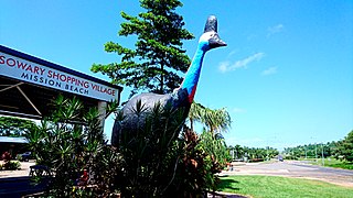
Mission Beach is a coastal town and locality in the Cassowary Coast Region, Queensland, Australia. In the 2021 census, the locality of Mission Beach had a population of 1,014 people.
Silkwood is a rural town and locality in the Cassowary Coast Region, Queensland, Australia. In the 2021 census, the locality of Silkwood had a population of 407 people.

Cowley Beach is a beach, coastal town and locality in the Cassowary Coast Region, Queensland, Australia. In the 2021 census, the locality of Cowley Beach had a population of 65 people.

Bingil Bay is a coastal town, locality and bay in the Cassowary Coast Region, Queensland, Australia. In the 2021 census, the locality of Bingil Bay had a population of 438 people.
Garners Beach is a coastal locality in the Cassowary Coast Region, Queensland, Australia. In the 2021 census, Garners Beach had a population of 31 people.

Daradgee is a rural town and locality in the Cassowary Coast Region, Queensland, Australia. In the 2021 census, the locality of Daradgee had a population of 90 people.
Japoonvale is a rural locality in the Cassowary Coast Region, Queensland, Australia. In the 2021 census, Japoonvale had a population of 107 people.
Wongaling Beach is a tropical beachside coastal town and locality in the Cassowary Coast Region, Queensland, Australia. In the 2021 census, the locality of Wongaling Beach had a population of 1,323 people.
No. 5 Branch is a rural locality in the Cassowary Coast Region, Queensland, Australia. In the 2021 census, No. 5 Branch had "no people or a very low population".

South Mission Beach is a coastal town and locality in the Cassowary Coast Region, Queensland, Australia. In the 2021 census, the locality of South Mission Beach had a population of 968 people.
Bilyana is a coastal locality in the Cassowary Coast Region, Queensland, Australia. In the 2021 census, Bilyana had a population of 190 people.
Tully Heads is a coastal town and locality in the Cassowary Coast Region, Queensland, Australia. In the 2021 census, the locality of Tully Heads had a population of 354 people.
Hull Heads is a coastal town and locality in the Cassowary Coast Region, Queensland, Australia. In the 2021 census, the locality of Hull Heads had a population of 127 people.
Carmoo is a rural locality in the Cassowary Coast Region, Queensland, Australia. In the 2021 census, Carmoo had a population of 179 people.
Tam O'Shanter is a rural locality in the Cassowary Coast Region, Queensland, Australia. In the 2021 census, Tam O'Shanter had "no people or a very low population".
Etty Bay is a coastal town and a locality in the Cassowary Coast Region, Queensland, Australia. In the 2021 census, the locality of Etty Bay had a population of 486 people.
Coconuts is a coastal locality in the Cassowary Coast Region, Queensland, Australia. In the 2021 census, Coconuts had a population of 216 people.

Cowley is a rural locality in the Cassowary Coast Region, Queensland, Australia. In the 2021 census, Cowley had a population of 82 people.
Goolboo is a rural locality in the Cassowary Coast Region of Queensland, Australia. In the 2021 census, Goolboo had a population of 25 people.
Jaffa is a rural locality in the Cassowary Coast Region, Queensland, Australia. In the 2021 census, Jaffa had a population of 35 people.

