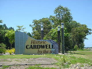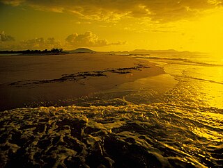
Cardwell is a coastal town and rural locality in the Cassowary Coast Region, Queensland, Australia. In the 2021 census, the locality of Cardwell had a population of 1,320 people.

Kennedy is a coastal locality in the Cassowary Coast Region, Queensland, Australia. In the 2021 census, Kennedy had a population of 136 people.

Feluga is a rural locality in the Cassowary Coast Region, Queensland, Australia. In the 2021 census, Feluga had a population of 306 people.

Lower Tully is a rural locality in the Cassowary Coast Region, Queensland, Australia. In the 2021 census, Lower Tully had a population of 88 people.

Murray Upper is a rural locality in the Cassowary Coast Region, Queensland, Australia. In the 2021 census, Murray Upper had a population of 218 people.

Boogan is a rural locality in the Cassowary Coast Region, Queensland, Australia. In the 2021 census, Boogan had a population of 138 people.

Euramo is a rural locality in the Cassowary Coast Region, Queensland, Australia. In the 2021 census, Euramo had a population of 114 people.
No. 5 Branch is a rural locality in the Cassowary Coast Region, Queensland, Australia. In the 2021 census, No. 5 Branch had "no people or a very low population".

Ellerbeck is a coastal locality in the Cassowary Coast Region, Queensland, Australia. In the 2021 census, Ellerbeck had a population of 207 people.
Rockingham is a rural town and coastal locality in the Cassowary Coast Region, Queensland, Australia. In the 2021 census, the locality of Rockingham had a population of 104 people.

Tully Heads is a coastal town and locality in the Cassowary Coast Region, Queensland, Australia. In the 2021 census, the locality of Tully Heads had a population of 354 people.
Hull Heads is a coastal town and locality in the Cassowary Coast Region, Queensland, Australia. In the 2021 census, the locality of Hull Heads had a population of 127 people.

Kurrimine Beach is a coastal town and locality in the Cassowary Coast Region, Queensland, Australia. In the 2021 census, the locality of Kurrimine Beach had a population of 742 people.
Birkalla is a rural locality in the Cassowary Coast Region, Queensland, Australia. In the 2021 census, Birkalla had a population of 156 people.
Mighell is a rural locality in the Cassowary Coast Region, Queensland, Australia. In the 2021 census, Mighell had a population of 363 people.
Goolboo is a rural locality in the Cassowary Coast Region of Queensland, Australia. In the 2021 census, Goolboo had a population of 25 people.
Currajah is a rural locality in the Cassowary Coast Region, Queensland, Australia. In the 2021 census, Currajah had a population of 57 people.
Jaffa is a rural locality in the Cassowary Coast Region, Queensland, Australia. In the 2021 census, Jaffa had a population of 35 people.
Djarawong is a rural locality in the Cassowary Coast Region, Queensland, Australia. In the 2021 census, Djarawong had a population of 103 people.
Maadi is a rural locality in the Cassowary Coast Region, Queensland, Australia. In the 2021 census, Maadi had a population of 49 people.


