Euramo, Queensland

Last updated

Euramo
Queensland
Euramo QLD 4854, Australia - panoramio (1).jpg
Cane tramway tracks, Davidson Road, 2013
Australia Queensland location map.svg
Red pog.svg
Euramo
Coordinates 18°00′16″S145°53′46″E / 18.0044°S 145.8961°E / -18.0044; 145.8961 (Euramo (centre of locality))
Population114 (2021 census) [1]
 • Density3.725/km2 (9.65/sq mi)
Postcode(s) 4854
Area30.6 km2 (11.8 sq mi)
Time zone AEST (UTC+10:00)
Location
LGA(s) Cassowary Coast Region
State electorate(s) Hinchinbrook
Federal division(s) Kennedy
Suburbs around Euramo:
Jarra Creek Jarra Creek Silky Oak
Munro Plains Euramo Rockingham
Murray Upper Murrigal Rockingham

Euramo is a rural locality in the Cassowary Coast Region, Queensland, Australia. [2] In the 2021 census, Euramo had a population of 114 people. [1]

Contents

Riversdale is a neighbourhood ( 18°00′00″S145°52′00″E / 18.0000°S 145.8666°E / -18.0000; 145.8666 (Riversdale) ) in the west of the locality. [3]

Geography

Tully River at Euramo, 2013 Euramo QLD 4854, Australia - panoramio.jpg
Tully River at Euramo, 2013

Euramo is bounded to the north by the Tully River and to the south by the Murray River. [4]

The Bruce Highway traverses the eastern part of the locality, entering the locality from the south-east (Murrigal) and exiting to the north-east (Silky Oak). The North Coast railway line also traverses the locality immediately to the west of the highway with the locality being served by Euramo railway station ( 18°00′12″S145°56′04″E / 18.0033°S 145.9344°E / -18.0033; 145.9344 (Euramo railway station) ). [4] [5] [6]

Bellenden Plains is a plain spanning much of Euramo and Murrigal to the south, mostly under 10 metres (33 ft) above sea level ( 18°01′00″S145°53′00″E / 18.0166°S 145.8833°E / -18.0166; 145.8833 (Bellenden Plains) ). [7] [4]

Djilgarin Conservation Park is an 88.74-hectare (219.3-acre) protected area in centre of the locality ( 18°00′09″S145°53′59″E / 18.0025°S 145.8997°E / -18.0025; 145.8997 (Djilgarin Conservation Park) ). [8] Apart from that, the land use is predominantly growing sugarcane. [4]

History

Bus service between Tully and Euroma, 1930s StateLibQld 2 388509 White Bus, Tully, 1930s.jpg
Bus service between Tully and Euroma, 1930s

Euramo State School opened on 19 September 1927. In 1930, a "new" school building was relocated from the closed Japoon West State School in Japoonvale to a site in Euramo donated by Mr J.A. Winter. [9] [10] It closed in 1974. [11] The school was on the Bruce Highway (approx 18°00′36″S145°56′05″E / 18.0101°S 145.9346°E / -18.0101; 145.9346 (Euramo State School (former)) ). [6]

Riversdale State School opened on 11 May 1953. It closed on 23 August 1968. [11] It was at approx 917 Davidson Road ( 17°59′44″S145°51′37″E / 17.9956°S 145.8602°E / -17.9956; 145.8602 (Riversdale State School (former)) ) on a site donated by Mrs Bryce Henry. [12] [13] [14] [15] [4]

Demographics

In the 2016 census, Euramo had a population of 147 people. [16]

In the 2021 census, Euramo had a population of 114 people. [1]

Education

There are no schools in Euramo. The nearest government primary schools are Tully State School in Tully to the north and Murray River Upper State School in Murray Upper in the south-west. The nearest government secondary school is Tully State High School in Tully to the north. [4]

Related Research Articles

<span class="mw-page-title-main">Mission Beach, Queensland</span> Town in Queensland, Australia

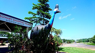
Mission Beach is a coastal town and locality in the Cassowary Coast Region, Queensland, Australia. In the 2016 census, the locality of Mission Beach had a population of 815 people.

<span class="mw-page-title-main">Cardwell, Queensland</span> Town in Queensland, Australia

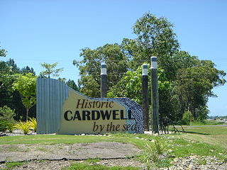
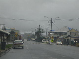
Cardwell is a coastal town and rural locality in the Cassowary Coast Region, Queensland, Australia. In the 2016 census, the locality of Cardwell had a population of 1,309 people.

<span class="mw-page-title-main">Babinda</span> Suburb of Cairns, Queensland, Australia

Babinda is a rural town and locality in the Cairns Region, Queensland, Australia. Babinda and Tully annually compete for the Golden Gumboot, an award for Australia's wettest town. Babinda is usually the winner, recording an annual average rainfall of over 4,279.4 millimetres (168.48 in) each year. In the 2021 census, the locality of Babinda had a population of 1,287 people.

<span class="mw-page-title-main">South Johnstone, Queensland</span> Town in Queensland, Australia

South Johnstone is a rural town and locality in the Cassowary Coast Region, Queensland, Australia. In the 2021 census, the locality of South Johnstone had a population of 456 people.

<span class="mw-page-title-main">Garners Beach, Queensland</span> Suburb of Cassowary Coast Region, Queensland, Australia

Garners Beach is a coastal locality in the Cassowary Coast Region, Queensland, Australia. In the 2021 census, Garners Beach had a population of 31 people.

<span class="mw-page-title-main">Kennedy, Queensland</span> Suburb of Cassowary Coast Region, Queensland, Australia

Kennedy is a coastal locality in the Cassowary Coast Region, Queensland, Australia. In the 2021 census, Kennedy had a population of 136 people.

<span class="mw-page-title-main">Feluga, Queensland</span> Suburb of Cassowary Coast Region, Queensland, Australia

Feluga is a rural locality in the Cassowary Coast Region, Queensland, Australia. In the 2021 census, Feluga had a population of 306 people.

<span class="mw-page-title-main">Lower Tully, Queensland</span> Suburb of Cassowary Coast Region, Queensland, Australia

Lower Tully is a rural locality in the Cassowary Coast Region, Queensland, Australia. In the 2016 census, Lower Tully had a population of 79 people.

<span class="mw-page-title-main">Murray Upper, Queensland</span> Suburb of Cassowary Coast Region, Queensland, Australia

Murray Upper is a rural locality in the Cassowary Coast Region, Queensland, Australia. In the 2016 census Murray Upper had a population of 266 people.

Coorumba is a rural locality in the Cassowary Coast Region, Queensland, Australia. In the 2021 census, Coorumba had a population of 137 people.

Japoonvale is a rural locality in the Cassowary Coast Region, Queensland, Australia. In the 2016 census, Japoonvale had a population of 141 people.

<span class="mw-page-title-main">Wongaling Beach, Queensland</span> Town in Queensland, Australia

Wongaling Beach is a tropical beachside coastal town and locality in the Cassowary Coast Region, Queensland, Australia. In the 2016 census, the locality of Wongaling Beach had a population of 1,245 people.

<span class="mw-page-title-main">Wooroonooran, Queensland</span> Suburb of Cairns Region, Queensland, Australia

Wooroonooran is an undeveloped locality split among the Cairns Region, the Cassowary Coast Region and the Tablelands Region in Queensland, Australia. In the 2021 census, Wooroonooran had a population of 4 people.

<span class="mw-page-title-main">Ellerbeck, Queensland</span> Suburb of Cassowary Coast Region, Queensland, Australia

Ellerbeck is a coastal locality in the Cassowary Coast Region, Queensland, Australia. In the 2021 census, Ellerbeck had a population of 207 people.

Bilyana is a coastal locality in the Cassowary Coast Region, Queensland, Australia. In the 2021 census, Bilyana had a population of 190 people.

<span class="mw-page-title-main">Tully Heads, Queensland</span> Town in Queensland, Australia

Tully Heads is a coastal town and locality in the Cassowary Coast Region, Queensland, Australia. In the 2016 census, the locality of Tully Heads had a population of 354 people.

Hull Heads is a coastal town and locality in the Cassowary Coast Region, Queensland, Australia. In the 2016 census, the locality of Hull Heads had a population of 113 people.

Jaffa is a rural locality in the Cassowary Coast Region, Queensland, Australia. In the 2021 census, Jaffa had a population of 35 people.

Maadi is a rural locality in the Cassowary Coast Region, Queensland, Australia. In the 2021 census, Maadi had a population of 49 people.

Kooroomool is a rural locality in the Cassowary Coast Region, Queensland, Australia. In the 2021 census, Kooroomool had "no people or a very low population".

References

  1. 1 2 3 Australian Bureau of Statistics (28 June 2022). "Euramo (SAL)". 2021 Census QuickStats. Retrieved 28 February 2023. OOjs UI icon edit-ltr-progressive.svg
  2. "Euramo – locality in Cassowary Coast Region (entry 45672)". Queensland Place Names. Queensland Government . Retrieved 18 September 2020.
  3. "Riversdale – locality unbounded in Cassowary Coast Regional (entry 28537)". Queensland Place Names. Queensland Government . Retrieved 18 September 2020.
  4. 1 2 3 4 5 6 "Queensland Globe". State of Queensland . Retrieved 24 April 2022.
  5. "Euramo – railway station in the Cassowary Coast Region (entry 40989)". Queensland Place Names. Queensland Government . Retrieved 30 September 2020.
  6. 1 2 "Kirrama" (Map). Queensland Government. 1946. Archived from the original on 1 October 2020. Retrieved 30 September 2020.
  7. "Bellenden Plains – plain in Cassowary Coast Regional (entry 2186)". Queensland Place Names. Queensland Government . Retrieved 18 September 2020.
  8. "Djilgarin Conservation Park – conservation park in the Cassowary Coast Region (entry 39441)". Queensland Place Names. Queensland Government . Retrieved 30 September 2020.
  9. "Tenders". Cairns Post . No. 8682. Queensland, Australia. 21 November 1929. p. 4. Archived from the original on 1 October 2020. Retrieved 30 September 2020 via National Library of Australia.
  10. "EURAMO NOTES". The Northern Herald . Vol. XLIX, no. 528. Queensland, Australia. 16 April 1930. p. 45. Retrieved 30 September 2020 via National Library of Australia.
  11. 1 2 Queensland Family History Society (2010), Queensland schools past and present (Version 1.01 ed.), Queensland Family History Society, ISBN   978-1-921171-26-0
  12. "MEETINGS". Cairns Post . No. 15, 367. Queensland, Australia. 9 June 1951. p. 2. Archived from the original on 24 April 2022. Retrieved 24 April 2022 via National Library of Australia.
  13. "New State School for Riversdale". The Evening Advocate . Queensland, Australia. 26 November 1952. p. 6. Archived from the original on 24 April 2022. Retrieved 24 April 2022 via National Library of Australia.
  14. "INAUGURAL DANCE". Cairns Post . No. 16, 000. Queensland, Australia. 22 June 1953. p. 4. Archived from the original on 24 April 2022. Retrieved 24 April 2022 via National Library of Australia.
  15. "Queensland Two Mile series sheet 2m401" (Map). Queensland Government. 1953. Archived from the original on 24 April 2022. Retrieved 24 April 2022.
  16. Australian Bureau of Statistics (27 June 2017). "Euramo (SSC)". 2016 Census QuickStats. Retrieved 20 October 2018. OOjs UI icon edit-ltr-progressive.svg