
Cowley Beach is a beach, coastal town and locality in the Cassowary Coast Region, Queensland, Australia. In the 2021 census, the locality of Cowley Beach had a population of 65 people.

Bingil Bay is a coastal town, locality and bay in the Cassowary Coast Region, Queensland, Australia. In the 2016 census the locality of Bingil Bay had a population of 427 people.

Midgenoo is a rural town and locality in the Cassowary Coast Region, Queensland, Australia. In the 2016 census, the locality of Midgenoo had a population of 51 people.
Moresby is a rural town and locality in the Cassowary Coast Region, Queensland, Australia. In the 2016 census, the locality of Moresby had a population of 149 people.
Flying Fish Point is a coastal town, locality and headland in the Cassowary Coast Region, Queensland, Australia. In the 2016 census, Flying Fish Point had a population of 425 people.
Lower Cowley is a rural locality in the Cassowary Coast Region, Queensland, Australia. In the 2016 census, Lower Cowley had a population of 64 people.

Daradgee is a rural town and locality in the Cassowary Coast Region, Queensland, Australia. In the 2016 census, Daradgee had a population of 74 people.
Wongaling Beach is a tropical beachside coastal town and locality in the Cassowary Coast Region, Queensland, Australia. In the 2016 census, the locality of Wongaling Beach had a population of 1,245 people.
No. 5 Branch is a rural locality in the Cassowary Coast Region, Queensland, Australia. In the 2016 census, the population of the locality was 9 people.

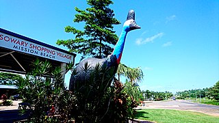
South Mission Beach is a coastal town and locality in the Cassowary Coast Region, Queensland, Australia. In the 2016 census, South Mission Beach had a population of 932 people.
Rockingham is a rural town and coastal locality in the Cassowary Coast Region, Queensland, Australia. In the 2016 census, the locality of Rockingham had a population of 107 people.
Tully Heads is a coastal town and locality in the Cassowary Coast Region, Queensland, Australia. In the 2016 census, the locality of Tully Heads had a population of 354 people.
Hull Heads is a coastal town and locality in the Cassowary Coast Region, Queensland, Australia. In the 2016 census, the locality of Hull Heads had a population of 113 people.
Tam O'Shanter is a locality in the Cassowary Coast Region, Queensland, Australia. In the 2016 census, Tam O'Shanter had a population of 0 people.

Kurrimine Beach is a coastal town and locality in the Cassowary Coast Region, Queensland, Australia. In the 2016 census, the locality of Kurrimine Beach had a population of 729 people.
Etty Bay is a coastal town and a locality in the Cassowary Coast Region, Queensland, Australia. In the 2016 census, the locality of Etty Bay had a population of 397 people.

Mamu is a rural locality in the Cassowary Coast Region, Queensland, Australia. In the 2021 census, Mamu had a population of 0 people.Mamu’s postcode is 4871.
Cowley Creek is a rural locality in the Cassowary Coast Region, Queensland, Australia. In the 2016 census, Cowley Creek had a population of 13 people.
Germantown is a rural locality in the Cassowary Coast Region, Queensland, Australia. The town is a small farming community, currently home to a large cattle farm along with various other farms. In the 2016 census, Germantown had a population of 64 people.
Palmerston is a rural locality split between the Tablelands Region and the Cassowary Coast Region, Queensland, Australia. In the 2016 census, Palmerston had a population of 3 people.
