Historically the suburb was linked to the CBD by the original Jubilee Bridge, which was built in 1923.[4]
Land for a school was secured by the Department of Lands in 1935.[5] Innisfail East State School opened on 6 March 1936.[6]
In 1930, the local Methodists relocated a church from Chillagoe to Mourilyan Road, East Innisfail.[7][8][9]
Radiant Life Christian College opened on 13 February 1982.[6]
Due to deterioration from both age and increased traffic flow, the original Jubilee Bridge was closed on 19 July 2010 after concerns were raised over the safety and integrity of the structure.[4] The new Jubilee Bridge was built, which opened on 2 September 2011.[10]
In early 2011, some residents in low-lying areas of the suburb were evacuated ahead of the passing of Cyclone Yasi.[11] Shortly after there were a number of cases of dengue fever recorded in the suburb.[12]
Darlinga Forest School in February 2021 at 89 Mourilyan Road.[13] However, it was closed in mid-2023 by the Queensland Government's Non-State Schools Accreditation Board.[14]
Demographics
In the 2006 census, East Innisfail had a population of 1,608 people.[15]
In the 2011 census, East Innisfail had a population of 1,828 people.[16]
In the 2016 census, East Innisfail had a population of 1,855 people.[17]
In the 2021 census, East Innisfail had a population of 1,757 people.[1]
Heritage listings
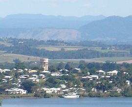
Innisfail Water Tower, 2010
East Innisfail has a number of heritage-listed sites, including:
Radiant Life Christian College is a private primary (Prep-7) school for boys and girls at 1 Riley Street (17°32′22″S146°02′05″E / 17.5395°S 146.0348°E / -17.5395; 146.0348 (Radiant Life College)).[19] In 2017, the school had an enrolment of 83 students with 6 teachers (5 full-time equivalent) and 11 non-teaching staff.[21] The school has an emphasis on education of Indigenous children but is open to all children.[22]
Darlingia Forest School is an independent primary (Prep-4) school for boys and girls at 89 Mourilyan Road. Opened in 2021, the school has an emphasis on hands-on, outdoor education.[23]
↑ "Methodist Church". Cairns Post. No.8630. Queensland, Australia. 21 September 1929. p.8. Archived from the original on 6 February 2021. Retrieved 6 February 2021– via National Library of Australia.
This page is based on this Wikipedia article Text is available under the CC BY-SA 4.0 license; additional terms may apply. Images, videos and audio are available under their respective licenses.