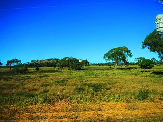
Inkerman is a rural town and locality in the Shire of Burdekin, Queensland, Australia. In the 2016 census, the locality of Inkerman had a population of 145 people.

Paluma is a town in the City of Townsville and a locality split between the City of Townsville and the Charters Towers Region in Queensland, Australia. In the 2016 census, the locality of Paluma had a population of 68 people.

Cowley Beach is a beach, coastal town and locality in the Cassowary Coast Region, Queensland, Australia. In the 2021 census, the locality of Cowley Beach had a population of 65 people.

Kennedy is a coastal locality in the Cassowary Coast Region, Queensland, Australia. In the 2021 census, Kennedy had a population of 136 people.

Guthalungra is a rural town and coastal locality in the Whitsunday Region, Queensland, Australia. In the 2016 census, the locality of Guthalungra had a population of 112 people.

Campaspe is a rural locality in the Charters Towers Region, Queensland, Australia. In the 2021 census, Campaspe had a population of 123 people.

Euramo is a rural locality in the Cassowary Coast Region, Queensland, Australia. In the 2016 census, Euramo had a population of 147 people.

Cape Conway is a coastal locality in the Whitsunday Region, Queensland, Australia. In the 2021 census, Cape Conway had "no people or a very low population".

Barron Gorge is a rural locality in the Cairns Region, Queensland, Australia. In the 2016 census Barron Gorge had a population of 0 people.

Ngatjan is a locality split between the Cassowary Coast Region and the Cairns Region, Queensland, Australia. In the 2016 census, Ngatjan had no population. The term is derived from the ethnonym of the local Ngatjan people.

Danbulla is a locality in the Tablelands Region, Queensland, Australia. In the 2021 census, Danbulla had a population of 88 people.
Tam O'Shanter is a locality in the Cassowary Coast Region, Queensland, Australia. In the 2016 census, Tam O'Shanter had a population of 0 people.
Mount Mackay is a locality in the Cassowary Coast Region, Queensland, Australia. In the 2016 census, Mount Mackay had a population of 0 people.
Doongul is a rural locality in the Fraser Coast Region, Queensland, Australia. In the 2021 census, Doongul had a population of 35 people.

Mamu is a rural locality in the Cassowary Coast Region, Queensland, Australia. In the 2021 census, Mamu had a population of 0 people.Mamu’s postcode is 4871.
Gulngai is a rural locality in the Cassowary Coast Region, Queensland, Australia. In the 2016 census, Gulngai had a population of 0 people.
Jaffa is a rural locality in the Cassowary Coast Region, Queensland, Australia. In the 2021 census, Jaffa had a population of 35 people.
Walter Hill is a rural locality in the Cassowary Coast Region, Queensland, Australia. In the 2016 census, Walter Hill had a population of 0 people.
Maadi is a rural locality in the Cassowary Coast Region, Queensland, Australia. In the 2021 census, Maadi had a population of 49 people.
Kooroomool is a rural locality in the Cassowary Coast Region, Queensland, Australia. In the 2016 census, Kooroomool had a population of 0 people.


