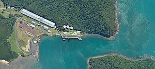
Mourilyan is a town and locality in the Cassowary Coast Region, Queensland, Australia. It was established around the Mourilyan sugar mill which provided much of the employment in the area until it was destroyed by Cyclone Larry on 20 March 2006. In the 2021 census, the locality of Mourilyan had a population of 509 people.
Mundoo is a rural town and locality in the Cassowary Coast Region, Queensland, Australia. In the 2021 census, the locality of Mundoo had a population of 197 people.

East Innisfail is a suburban locality in the Cassowary Coast Region, Queensland, Australia. In the 2021 census, East Innisfail had a population of 1,757 people.

Cowley Beach is a beach, coastal town and locality in the Cassowary Coast Region, Queensland, Australia. In the 2021 census, the locality of Cowley Beach had a population of 65 people.

Mourilyan Harbour is a coastal locality and harbour within the Cassowary Coast Region, Queensland, Australia. In the 2021 census, Mourilyan Harbour had a population of 142 people.

Garners Beach is a coastal locality in the Cassowary Coast Region, Queensland, Australia. In the 2021 census, Garners Beach had a population of 31 people.

Eubenangee is a coastal locality split between the Cairns Region and the Cassowary Coast Region, Queensland, Australia. In the 2021 census, Eubenangee had a population of 247 people.

Daradgee is a rural town and locality in the Cassowary Coast Region, Queensland, Australia. In the 2021 census, the locality of Daradgee had a population of 90 people.
No. 5 Branch is a rural locality in the Cassowary Coast Region, Queensland, Australia. In the 2021 census, No. 5 Branch had "no people or a very low population".

Kurrimine Beach is a coastal town and locality in the Cassowary Coast Region, Queensland, Australia. In the 2021 census, the locality of Kurrimine Beach had a population of 742 people.
New Harbourline is a rural locality in the Cassowary Coast Region, Queensland, Australia. In the 2021 census, New Harbourline had a population of 218 people.
Bombeeta is a rural locality in the Cassowary Coast Region, Queensland, Australia. In the 2021 census, Bombeeta had a population of 147 people.
Cullinane is a rural locality in the Cassowary Coast Region, Queensland, Australia. In the 2021 census, Cullinane had a population of 551 people.

Cowley is a rural locality in the Cassowary Coast Region, Queensland, Australia. In the 2021 census, Cowley had a population of 82 people.
Currajah is a rural locality in the Cassowary Coast Region, Queensland, Australia. In the 2021 census, Currajah had a population of 57 people.
O'Briens Hill is a rural locality in the Cassowary Coast Region, Queensland, Australia. In the 2021 census, O'Briens Hill had a population of 11 people.
Hudson is a rural locality in the Cassowary Coast Region, Queensland, Australia. In the 2021 census, Hudson had a population of 238 people.
No. 6 Branch is a rural locality in the Cassowary Coast Region, Queensland, Australia. In the 2021 census, No. 6 Branch had a population of 73 people.
Germantown is a rural locality in the Cassowary Coast Region, Queensland, Australia. In the 2021 census, Germantown had a population of 52 people.
Sundown is a rural locality in the Cassowary Coast Region, Queensland, Australia. In the 2021 census, Sundown had a population of 145 people.


