Cardstone, Queensland

Last updated

Cardstone
Queensland
Australia Queensland location map.svg
Red pog.svg
Cardstone
Coordinates 17°50′33″S145°42′52″E / 17.8425°S 145.7144°E / -17.8425; 145.7144 (Cardstone (centre of locality)) Coordinates: 17°50′33″S145°42′52″E / 17.8425°S 145.7144°E / -17.8425; 145.7144 (Cardstone (centre of locality))
Population17 (2016 census) [1]
 • Density0.206/km2 (0.534/sq mi)
Postcode(s) 4854
Area82.5 km2 (31.9 sq mi)
Time zone AEST (UTC+10:00)
Location50 km (31 mi) SW of Innisfail
LGA(s) Cassowary Coast Region
State electorate(s) Hinchinbrook
Federal Division(s) Kennedy
Suburbs around Cardstone:
Koombooloomba Koombooloomba Walter Hill
Kooroomool Cardstone Walter Hill
Kooroomool Munro Plains Dingo Pocket

Cardstone is a rural locality in the Cassowary Coast Region, Queensland, Australia. [2] In the 2016 census Cardstone had a population of 17 people. [1]

Contents

It is 50 kilometres (31 mi) south-west of Innisfail. [3]

Geography

Cardstone is a long thin locality following the valley of the Tully River. The northern part of the locality is mostly bushland, but the southern part is farming land. Cardstone village was built near the Tully River to accommodate workers and families of the Kareeya Hydro Power Station. The village and was less than 1 square kilometre (0.39 sq mi) in area. Cardstone was mostly surrounded by the rainforest of the Tully Gorge National Park which forms part of the World Heritage-listed Wet Tropics of Queensland. [4]

History

Construction of the Kareeya Hydro Power Station on the Tully River commenced in 1952 and the power station commenced operation in 1957. The staff and families were provided accommodation in a small village called Cardstone located about 3 miles (4.8 km) downstream from the plant. [5] [6] The power station was instigated jointly by the Cardwell Shire Council and the Johnstone Shire Council and the name Cardstone is an amalgamation of those two names. [7]

Although it was desired to have a post office in Cardstone in 1954, no local person could be found to carry out the duties. [8] Cardstone Post Office did not open until 11 January 1955. It closed in 1990 when the village closed. [9]

Cardstone State School opened on 18 February 1957. From 1959 to 1967 it was downgraded to a Provisional School and was closed on 14 December 1990 when the village closed. [10] [11] [12]

During Cyclone Winifred in late January 1986, rainfall of 400 mm (16 in) was measured at Cardstone along the Tully River [13]

In about 1990, the power station became fully automated and could be operated from Townsville, making many of the Cardstone operating staff redundant. As only a small number of maintenance workers would be required to visit the station, it was decided to close down the village and relocate the maintenance workers to Tully. As the area was in the Wet Tropics of Queensland World Heritage site, the village's buildings, then comprising 29 homes, a single men's barracks, a school and a post office, were sold for relocation. All evidence of the village was bulldozed and the 60 hectares (150 acres) site was replanted with local native species so that it would revert to its natural state. Mature coconut palms and pine trees grown at the village were chopped down during the environmental rehabilitation as they were not local species. There had been a proposal that the village be retained and used as tourist accommodation, but the Cardwell Shire Council opposed the idea believing it would not be cost-effective. [14]

In the 2016 census Cardstone had a population of 17 people. [1]

Related Research Articles

Tully, Queensland Town in Queensland, Australia

Tully is a town and locality in the Cassowary Coast Region, Queensland, Australia. It is adjacent to the Bruce Highway, approximately 140 kilometres (87 mi) south of Cairns by road and 210 kilometres (130 mi) north of Townsville. At the 2016 census, the population was 2,390.

Mission Beach, Queensland Town in Queensland, Australia

Mission Beach is a small coastal town and locality in the Cassowary Coast Region, Queensland, Australia. In the 2016 census Mission Beach and surrounding villages had a total population of 3,597 people.

Cardwell, Queensland Town in Queensland, Australia

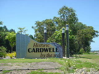
Cardwell is a tropical coastal town and locality in the Cassowary Coast Region in Far North Queensland, Australia. In the 2016 census, Cardwell had a population of 1,309 people. The Bruce Highway National Highway 1 and the North Coast railway line are the dominant transport routes; connecting with the Queensland provincial cities of Cairns and Townsville. Cardwell suffered significant damage from Cyclone Yasi, a category 5 cyclone, in February 2011.

Far North Queensland Region in Queensland, Australia

Far North Queensland (FNQ) is the northernmost part of the Australian state of Queensland. Its largest city is Cairns and it is dominated geographically by Cape York Peninsula, which stretches north to the Torres Strait, and west to the Gulf Country. The waters of Torres Strait include the only international border in the area contiguous with the Australian mainland, between Australia and Papua New Guinea.

Murray Falls

The Murray Falls, a cascade waterfall on the Murray River, is located in the UNESCO World Heritage–listed Wet Tropics in Murray Upper, Cassowary Coast Region in the Far North region of Queensland, Australia.

Herbert River Falls

The Herbert River Falls is a plunge waterfall on the Herbert River that is located in the UNESCO World Heritage–listed Wet Tropics in the Far North region of Queensland, Australia.

The Kareeya Hydro Power Station near Tully in Queensland, Australia in a hydroelectric power station that began generating power in 1957. It has a capacity of 88 megawatts (118,000 hp) which is fed into the National Electricity Market. The power station is owned by CleanCo Queensland.

Koombooloomba, Queensland Town in Queensland, Australia

Koombooloomba is a rural locality in the Tablelands Region, Queensland, Australia. In the 2016 census Koombooloomba had a population of 0 people.

Shire of Johnstone Local government area in Queensland, Australia

The Shire of Johnstone was a local government area of Queensland. It was located on the Coral Sea coast about 90 kilometres (56 mi) south of the city of Cairns. The shire, administered from the town of Innisfail, covered an area of 1,639.1 square kilometres (632.9 sq mi), and existed as a local government entity from 1881 until 2008, when it amalgamated with the Shire of Cardwell to form the Cassowary Coast Region.

Shire of Cardwell Local government area in Queensland, Australia

The Shire of Cardwell was a local government area of Queensland. It was located on the Coral Sea coast about halfway between the cities of Cairns and Townsville. The shire, administered from the town of Tully, covered an area of 3,062.2 square kilometres (1,182.3 sq mi), and existed as a local government entity from 1884 until 2008, when it amalgamated with the Shire of Johnstone to form the Cassowary Coast Region.

Cassowary Coast Region Local government area in Queensland, Australia

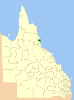
The Cassowary Coast Region is a local government area in the Far North Queensland region of Queensland, Australia, south of Cairns and centred on the towns of Innisfail, Cardwell and Tully. It was created in 2008 from a merger of the Shire of Cardwell and the Shire of Johnstone.

Tully River river in Queensland, Australia

The Tully River is a river located in Far North Queensland, Australia.

Tully Falls

The Tully Falls, a horsetail chute waterfall on the Tully River, is located in the UNESCO World Heritage–listed Wet Tropics in the Far North region of Queensland, Australia. It formed the eastern boundary of the Dyirbal.

Silkwood, Queensland Town in Queensland, Australia

Silkwood is a rural town and locality in the Cassowary Coast Region, Queensland, Australia. In the 2016 census, the locality of Silkwood had a population of 391 people.

Cardwell Divisional Board Hall

Cardwell Divisional Board Hall is a heritage-listed former town hall at 51 Victoria Street, Cardwell, Cassowary Coast Region, Queensland, Australia. It is also known as the Cardwell Shire Chambers, Cardwell Shire Hall, JC Hubinger Memorial Museum, JC Hubinger Museum, and JC Hubinger Memorial Hall. The hall and its World War I honour roll were added to the Queensland Heritage Register on 21 March 2013.

Feluga, Queensland Suburb of Cassowary Coast Region, Queensland, Australia

Feluga is a rural locality in the Cassowary Coast Region, Queensland, Australia. In the 2016 census Feluga had a population of 251 people.

Lower Tully, Queensland Suburb of Cassowary Coast Region, Queensland, Australia

Lower Tully is a rural locality in the Cassowary Coast Region, Queensland, Australia. In the 2016 census Lower Tully had a population of 79 people.

Murray Upper, Queensland Suburb of Cassowary Coast Region, Queensland, Australia

Murray Upper is a rural locality in the Cassowary Coast Region, Queensland, Australia. In the 2016 census Murray Upper had a population of 266 people.

East Feluga, Queensland Suburb of Cassowary Coast Region, Queensland, Australia

East Feluga is a rural locality in the Cassowary Coast Region, Queensland, Australia. In the 2016 census, East Feluga had a population of 245 people.

References

  1. 1 2 3 Australian Bureau of Statistics (27 June 2017). "Cardstone (SSC)". 2016 Census QuickStats. Retrieved 20 October 2018. OOjs UI icon edit-ltr-progressive.svg
  2. "Cardstone – locality in Cassowary Coast Region (entry 45659)". Queensland Place Names. Queensland Government . Retrieved 26 December 2020.
  3. "Place names search, Geoscience Australia, Place Name Search: Cardstone". Government of Australia . Geoscience Australia . Retrieved 12 February 2014.CS1 maint: discouraged parameter (link)
  4. "Queensland Globe". State of Queensland . Retrieved 15 August 2018.
  5. Dunn, Col (1985). The History of Electricity in Queensland. Bundaberg: Col Dunn. pp. 98–103. ISBN   0-9589229-0-X.
  6. "TULLY DISTRICT". Townsville Daily Bulletin . Qld.: National Library of Australia. 2 April 1954. p. 7. Retrieved 19 May 2014.CS1 maint: discouraged parameter (link)
  7. "CARDWELL SHIRE COUNCIL". The Cairns Post . Qld.: National Library of Australia. 26 December 1953. p. 3. Retrieved 18 May 2014.CS1 maint: discouraged parameter (link)
  8. "Cardstone Facilities". The Cairns Post . Qld.: National Library of Australia. 9 July 1954. p. 5. Retrieved 18 May 2014.CS1 maint: discouraged parameter (link)
  9. Premier Postal History. "Post Office List". Premier Postal Auctions. Retrieved 10 May 2014.CS1 maint: discouraged parameter (link)
  10. "Opening and closing dates of Queensland Schools". Queensland Government . Retrieved 17 May 2014.
  11. "Agency ID 5075, Cardstone State School". Queensland State Archives . Retrieved 18 May 2014.
  12. Queensland Family History Society (2010), Queensland schools past and present (Version 1.01 ed.), Queensland Family History Society, ISBN   978-1-921171-26-0
  13. Pie, T.; Wright, J. (3 February 1986). "North braces for flood". The Courier-Mail.
  14. "Automation signs death warrant for Cardstone". The Canberra Times . National Library of Australia. 10 March 1991. p. 21. Retrieved 18 May 2014.CS1 maint: discouraged parameter (link)