East Palmerston, Queensland

Last updated

East Palmerston
Queensland
Australia Queensland location map.svg
Red pog.svg
East Palmerston
Coordinates 17°35′40″S145°50′26″E / 17.5944°S 145.8405°E / -17.5944; 145.8405 (East Palmerston (centre of locality))
Population173 (2016 census) [1]
 • Density4.119/km2 (10.67/sq mi)
Postcode(s) 4860
Area42.0 km2 (16.2 sq mi)
Time zone AEST (UTC+10:00)
LGA(s) Cassowary Coast Region
State electorate(s) Hill
Federal division(s) Kennedy
Suburbs around East Palmerston:
Wooroonooran Nerada Coorumba
Palmerston East Palmerston Mamu
Mamu Mamu Mamu

East Palmerston is a rural locality in the Cassowary Coast Region, Queensland, Australia. [2] In the 2016 census East Palmerston had a population of 173 people. [1]

Contents


East Palmerston is a prominent banana growing region. It encompasses farms belonging to some of Australia's largest banana growers; LMB Farms and Wadda Plantation.

Geography

The Palmerston Highway passes from north-east to south-west through the locality. [3]

History

The locality is presumably so named because it is to the east of neighbouring Palmerston, which in turn is believed to be named after explorer and prospector, Christie Palmerston. [4]

About July 1933 the land of East Palmerston was surveyed to enable 10,400 acres be offered for selection in 55 lots. [5] By September 1938, a large population was living in the area with some farms sufficiently established to supply cream to the Millaa Millaa butter factory. [6]

The Palmerston East State School (sometimes called East Palmerston State School) opened on 19 April 1938. [7] It closed on 26 April 2012. [8] [9] It was located at 2068 Palmerston Highway East ( 17°36′12″S145°50′48″E / 17.6033°S 145.8467°E / -17.6033; 145.8467 (East Palmerston State School) ). [10] The school's website was archived. [11]

On 25 April (Anzac Day) 2008, a memorial was unveiled at Palmerston East State School at 2068 Palmerston Highway commemorating the Australian servicemen and women who served during wars and other conflicts. [12]

In the 2016 census East Palmerston had a population of 173 people. [1]

Community groups

The East Palmerston branch of the Queensland Country Women's Association meets at the Currajah Hotel, Grima Street, Wangan. [13]

Related Research Articles

<span class="mw-page-title-main">Tolga, Queensland</span> Town in Queensland, Australia

Tolga is a rural town and locality in the Tablelands Region, Queensland, Australia. In the 2016 census, Tolga had a population of 2,718 people.

<span class="mw-page-title-main">Millaa Millaa, Queensland</span> Town in Queensland, Australia

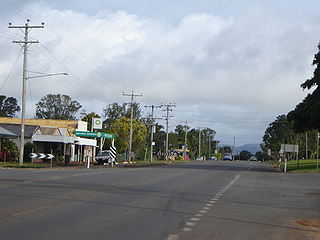
Millaa Millaa is a rural town and locality in the Tablelands Region, Queensland, Australia. In the 2016 census, the locality of Millaa Millaa had a population of 514 people.

<span class="mw-page-title-main">Shire of Eacham</span> Local government area in Queensland, Australia

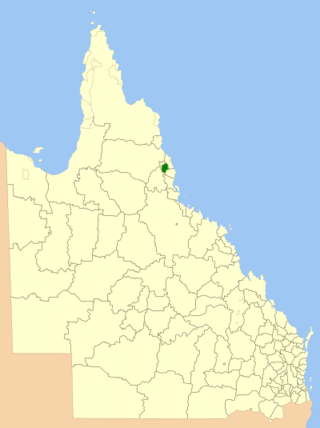
The Shire of Eacham was a local government area of Queensland. It was located on the Atherton Tableland, a plateau forming part of the Great Dividing Range west of the city of Cairns. The shire, administered from the town of Malanda, covered an area of 1,126.4 square kilometres (434.9 sq mi), and existed as a local government entity from 1910 until 2008, when it amalgamated with several other councils in the Tableland area to become the Tablelands Region.

<span class="mw-page-title-main">South Johnstone, Queensland</span> Town in Queensland, Australia

South Johnstone is a rural town and locality in the Cassowary Coast Region, Queensland, Australia. In the 2021 census, the locality of South Johnstone had a population of 456 people.

Belvedere is a rural locality in the Cassowary Coast Region, Queensland, Australia. In the 2016 census Belvedere had a population of 907 people.

<span class="mw-page-title-main">Feluga, Queensland</span> Suburb of Cassowary Coast Region, Queensland, Australia

Feluga is a rural locality in the Cassowary Coast Region, Queensland, Australia. In the 2016 census Feluga had a population of 251 people.

<span class="mw-page-title-main">Lower Tully, Queensland</span> Suburb of Cassowary Coast Region, Queensland, Australia

Lower Tully is a rural locality in the Cassowary Coast Region, Queensland, Australia. In the 2016 census, Lower Tully had a population of 79 people.

Coorumba is a rural locality in the Cassowary Coast Region, Queensland, Australia. In the 2016 census, Coorumba had a population of 121 people.

<span class="mw-page-title-main">Daradgee, Queensland</span> Town in Queensland, Australia

Daradgee is a rural town and locality in the Cassowary Coast Region, Queensland, Australia. In the 2016 census, Daradgee had a population of 74 people.

Ellinjaa is a rural locality in the Tablelands Region, Queensland, Australia. In the 2016 census, Ellinjaa had a population of 31 people.

<span class="mw-page-title-main">Euramo, Queensland</span> Suburb of Cassowary Coast Region, Queensland, Australia

Euramo is a rural locality in the Cassowary Coast Region, Queensland, Australia. In the 2016 census, Euramo had a population of 147 people.

<span class="mw-page-title-main">Peeramon</span> Town in Queensland, Australia

Peeramon is a rural town and locality in the Tablelands Region, Queensland, Australia. In the 2016 census, the locality of Peeramon had a population of 628 people.

Japoonvale is a rural locality in the Cassowary Coast Region, Queensland, Australia. In the 2016 census, Japoonvale had a population of 141 people.

<span class="mw-page-title-main">Tarzali</span> Town in Queensland, Australia

Tarzali is a rural town and locality in the Tablelands Region, Queensland, Australia. In the 2016 census, the locality of Tarzali had a population of 398 people.

<span class="mw-page-title-main">South Mission Beach</span> Town in Queensland, Australia

South Mission Beach is a coastal town and locality in the Cassowary Coast Region, Queensland, Australia. In the 2021 census, the locality of South Mission Beach had a population of 968 people.

<span class="mw-page-title-main">Wooroonooran, Queensland</span> Suburb of Cairns Region, Queensland, Australia

Wooroonooran is a locality split among the Cairns Region, the Cassowary Coast Region and the Tablelands Region in Queensland, Australia. In the 2016 census, Wooroonooran had no population.

Wangan is a town and a locality in the Cassowary Coast Region, Queensland, Australia. In the 2016 census, Wangan had a population of 641 people.

<span class="mw-page-title-main">Mamu, Queensland</span> Suburb of Cassowary Coast Region, Queensland, Australia

Mamu is a rural locality in the Cassowary Coast Region, Queensland, Australia. In the 2021 census, Mamu had a population of 0 people.Mamu’s postcode is 4871.

Goondi Bend is a mixed-use locality in the Cassowary Coast Region, Queensland, Australia. In the 2016 census, Goondi Bend had a population of 594 people.

Nerada is a rural locality in the Cassowary Coast Region, Queensland, Australia. In the 2016 census, Nerada had a population of 97 people.

References

  1. 1 2 3 Australian Bureau of Statistics (27 June 2017). "East Palmerston (SSC)". 2016 Census QuickStats. Retrieved 20 October 2018. OOjs UI icon edit-ltr-progressive.svg
  2. "East Palmerston – locality in Cassowary Coast Region (entry 49824)". Queensland Place Names. Queensland Government . Retrieved 26 December 2020.
  3. "Queensland Globe". State of Queensland . Retrieved 24 September 2017.
  4. "Palmerston – locality in Cassowary Coast Region (entry 45748)". Queensland Place Names. Queensland Government . Retrieved 24 September 2017.
  5. "5,000,000 ACRES IN TWELVE MONTHS". The Brisbane Courier . No. 23, 531. Queensland, Australia. 1 July 1933. p. 13. Archived from the original on 6 April 2022. Retrieved 24 September 2017 via National Library of Australia.
  6. "Topical Talk". The Australian Worker . Vol. 46, no. 36. New South Wales, Australia. 8 September 1937. p. 3. Archived from the original on 6 April 2022. Retrieved 24 September 2017 via National Library of Australia.
  7. Queensland Family History Society (2010), Queensland schools past and present (Version 1.01 ed.), Queensland Family History Society, ISBN   978-1-921171-26-0
  8. "Opening and closing dates of Queensland Schools". Queensland Government . Retrieved 24 September 2017.
  9. "Queensland state school - centre closures" (PDF). Queensland Government . 20 August 2013. Archived (PDF) from the original on 20 March 2022. Retrieved 6 April 2022.
  10. Chiclcott, Tanya; Vlasic, Kimberley (7 June 2013). "Full school asssets sale list". The Courier-Mail . Archived from the original on 30 October 2019. Retrieved 30 October 2019.
  11. "Palmerston East State School". Palmerston East State School. 28 July 2012. Archived from the original on 28 July 2012. Retrieved 8 April 2022.
  12. "East Palmerston State School War Memorial". Monument Australia. Archived from the original on 24 September 2017. Retrieved 24 September 2017.
  13. "Branch Locations". Queensland Country Women's Association. Archived from the original on 26 December 2018. Retrieved 26 December 2018.

Further reading