Wangan, Queensland

Last updated

Map all coordinates using: OpenStreetMap  
Wangan
Queensland
Mundoo State School at Wangan, 2023.jpg
Mundoo State School at Wangan, 2023
Australia Queensland location map.svg
Red pog.svg
Wangan
Coordinates 17°34′26″S146°00′37″E / 17.5738°S 146.0102°E / -17.5738; 146.0102 (Wangan (town centre))
Population612 (SAL 2021) [1]
Postcode(s) 4871
Area3.3 km2 (1.3 sq mi)
Time zone AEST (UTC+10:00)
Location
LGA(s) Cassowary Coast Region
State electorate(s) Hill
Federal division(s) Kennedy
Localities around Wangan:
Bamboo Creek Mundoo Mundoo
Currajah Wangan Stockton
Currajah Currajah Stockton

Wangan is a town and a locality in the Cassowary Coast Region, Queensland, Australia. [2] [3] In the 2021 census, the locality of Wangan had a population of 612 people. [4]

Geography

The locality is bounded to the north-west by the south branch of Bamboo Creek and to the south-east by Scheu Creek. The town is central within the locality. Outside of the town, the land is used for crop-growing, predominately sugarcane. [5]

The North Coast railway line enters the locality from the south-east (Stockton), passes along the western edge of the town, and exits to the north-east (Mundoo). [5] The Wangan railway station on the North Coast line is now abandoned ( 17°34′31″S146°00′50″E / 17.5753°S 146.0139°E / -17.5753; 146.0139 (Wangan railway station) ). [6]

There is a network of cane tramways through the locality for transporting the harvested sugarcane to the South Johnstone sugar mill. The Currajah railway siding ( 17°34′42″S146°00′22″E / 17.5783°S 146.0060°E / -17.5783; 146.0060 (Currajah railway siding) ) in on this network. [7]

History

Mundoo Provisional School opened on 5 August 1895. It became Mundoo State School on 1 January 1909. [8]

St Paul's Catholic Church was built in 1956 from timber. It later closed. It was in Meyer Street (approx 17°34′36″S146°00′34″E / 17.576784°S 146.009527°E / -17.576784; 146.009527 (St Paul's Catholic Church (former)) ). [9]

In the 2016 census, the locality of Wangan had a population of 641 people. [10]

In the 2021 census, the locality of Wangan had a population of 612 people. [4]

Education

Mundoo State School is a government primary (Prep-6) school for boys and girls at 100 Cardier Road ( 17°34′00″S146°00′40″E / 17.5667°S 146.0112°E / -17.5667; 146.0112 (Mundoo State School) ) on the boundary with neighbouring Mundoo. [11] [12] In 2017, the school had an enrolment of 25 students with 3 teachers (2 full-time equivalent) and 5 non-teaching staff (3 full-time equivalent). [13] In 2018, the school had an enrolment of 27 students with 4 teachers (3 full-time equivalent) and 5 non-teaching staff (3 full-time equivalent). [14] In 2022, the school had an enrolment of 47 students. [15]

There are no secondary schools in Wangan. The nearest government secondary school is Innisfail State College in Innisfail Estate to the north. [5]

Community groups

The East Palmerston branch of the Queensland Country Women's Association meets at the Currajah Hotel in Grima Street. [16]

Related Research Articles

<span class="mw-page-title-main">Innisfail, Queensland</span> Town in Queensland, Australia

Innisfail is a regional town and locality in the Cassowary Coast Region, Queensland, Australia. The town was originally called Geraldton until 1910. In the 2016 census, the town of Innisfail had a population of 7,236 people, while the locality of Innisfail had a population of 1,145 people.

<span class="mw-page-title-main">Cardwell, Queensland</span> Town in Queensland, Australia

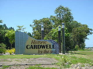
Cardwell is a coastal town and rural locality in the Cassowary Coast Region, Queensland, Australia. In the 2016 census, the locality of Cardwell had a population of 1,309 people.

Mundoo is a rural town and locality in the Cassowary Coast Region, Queensland, Australia. In the 2016 census the locality of Mundoo had a population of 224 people.

<span class="mw-page-title-main">El Arish, Queensland</span> Town in Queensland, Australia

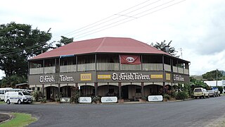
El Arish is a rural town and locality in the Cassowary Coast Region, Queensland, Australia. In the 2016 census, the locality of El Arish had a population of 344 people.

<span class="mw-page-title-main">East Innisfail, Queensland</span> Suburb of Cassowary Coast Region, Queensland, Australia

East Innisfail is a suburban locality in the Cassowary Coast Region, Queensland, Australia. In the 2016 census East Innisfail had a population of 1,855 people.

<span class="mw-page-title-main">South Johnstone, Queensland</span> Town in Queensland, Australia

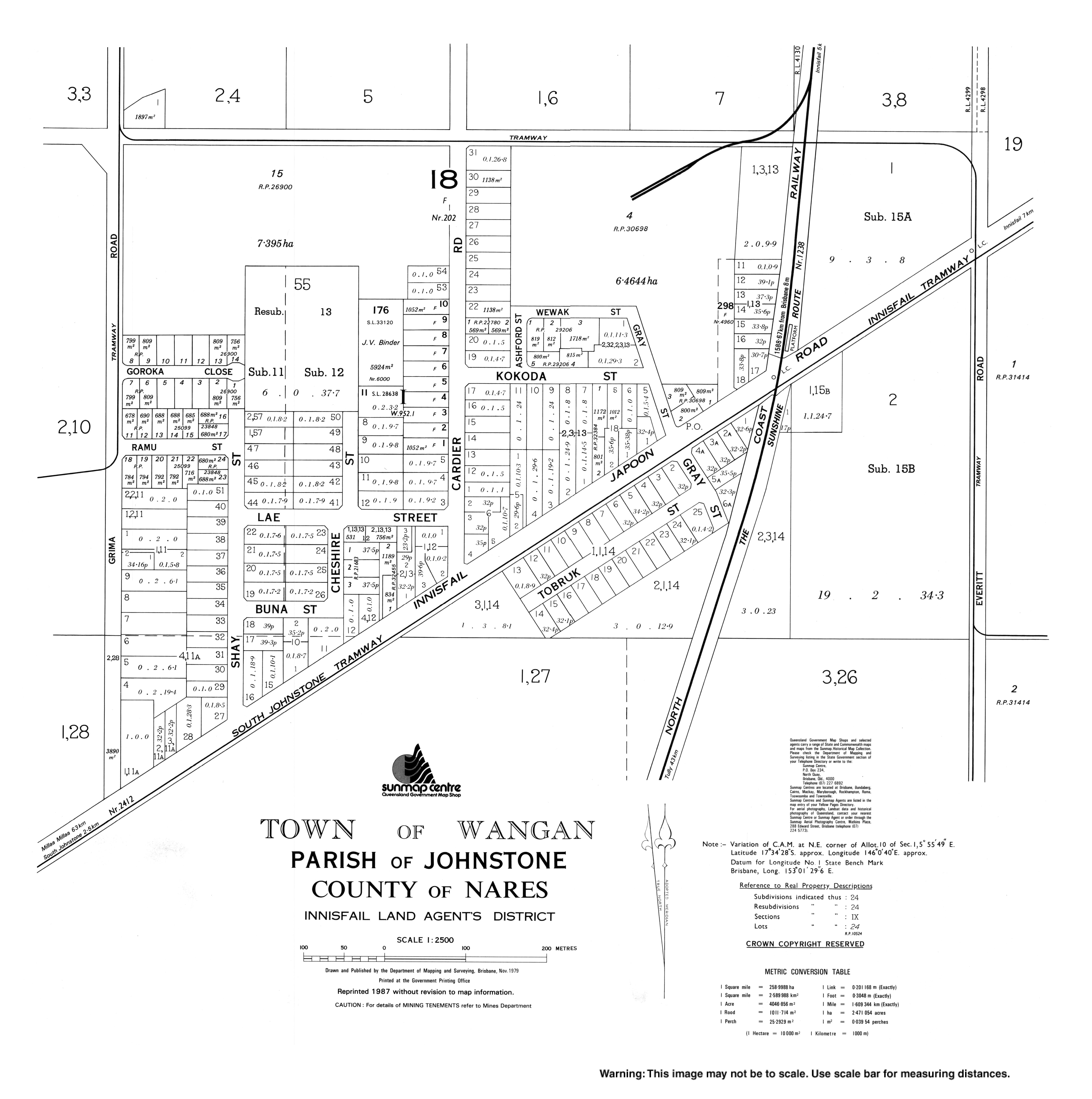
South Johnstone is a rural town and locality in the Cassowary Coast Region, Queensland, Australia. In the 2021 census, the locality of South Johnstone had a population of 456 people.

<span class="mw-page-title-main">Silkwood, Queensland</span> Town in Queensland, Australia

Silkwood is a rural town and locality in the Cassowary Coast Region, Queensland, Australia. In the 2016 census, the locality of Silkwood had a population of 391 people.

<span class="mw-page-title-main">Cowley Beach, Queensland</span> Town in Queensland, Australia

Cowley Beach is a beach, coastal town and locality in the Cassowary Coast Region, Queensland, Australia. In the 2021 census, the locality of Cowley Beach had a population of 65 people.

<span class="mw-page-title-main">Midgenoo, Queensland</span> Town in Queensland, Australia

Midgenoo is a rural town and locality in the Cassowary Coast Region, Queensland, Australia. In the 2016 census, the locality of Midgenoo had a population of 51 people.

<span class="mw-page-title-main">Feluga, Queensland</span> Suburb of Cassowary Coast Region, Queensland, Australia

Feluga is a rural locality in the Cassowary Coast Region, Queensland, Australia. In the 2016 census Feluga had a population of 251 people.

<span class="mw-page-title-main">Lower Tully, Queensland</span> Suburb of Cassowary Coast Region, Queensland, Australia

Lower Tully is a rural locality in the Cassowary Coast Region, Queensland, Australia. In the 2016 census, Lower Tully had a population of 79 people.

East Palmerston is a rural locality in the Cassowary Coast Region, Queensland, Australia. In the 2016 census East Palmerston had a population of 173 people.

<span class="mw-page-title-main">Eubenangee, Queensland</span> Suburb of Cairns Region, Queensland, Australia

Eubenangee is a coastal locality split between the Cairns Region and the Cassowary Coast Region, Queensland, Australia. In the 2016 census, the population of Eubenangee was 242 people.

Coorumba is a rural locality in the Cassowary Coast Region, Queensland, Australia. In the 2016 census, Coorumba had a population of 121 people.

<span class="mw-page-title-main">Daradgee, Queensland</span> Town in Queensland, Australia

Daradgee is a rural town and locality in the Cassowary Coast Region, Queensland, Australia. In the 2016 census, Daradgee had a population of 74 people.

Mighell is a rural locality in the Cassowary Coast Region, Queensland, Australia. In the 2016 census, Mighell had a population of 380 people.

Goondi Hill is a semi-urban locality in the Cassowary Coast Region, Queensland, Australia. In the 2016 census, Goondi Hill had a population of 510 people.

Goondi Bend is a mixed-use locality in the Cassowary Coast Region, Queensland, Australia. In the 2016 census, Goondi Bend had a population of 594 people.

Innisfail Estate is a rural locality in the Cassowary Coast Region, Queensland, Australia. In the 2016 census, Innisfail Estate had a population of 1,338 people.

No. 6 Branch is a rural locality in the Cassowary Coast Region, Queensland, Australia. In the 2016 census, No. 6 Branch had a population of 50 people.

References

  1. Australian Bureau of Statistics (28 June 2022). "Wangan (Suburb and Locality)". Australian Census 2021 QuickStats. Retrieved 28 June 2022.  OOjs UI icon edit-ltr-progressive.svg
  2. "Wangan – town in Cassowary Coast Region (entry 36449)". Queensland Place Names. Queensland Government . Retrieved 30 December 2018.
  3. "Wangan – locality in Cassowary Coast Region (entry 45766)". Queensland Place Names. Queensland Government . Retrieved 30 December 2018.
  4. 1 2 Australian Bureau of Statistics (28 June 2022). "Wangan (SAL)". 2021 Census QuickStats. Retrieved 28 February 2023. OOjs UI icon edit-ltr-progressive.svg
  5. 1 2 3 "Queensland Globe". State of Queensland . Retrieved 21 July 2023.
  6. "Railway stations and sidings - Queensland". Queensland Open Data. Queensland Government. 2 October 2020. Archived from the original on 5 October 2020. Retrieved 5 October 2020.
  7. "Railway stations and sidings - Queensland". Queensland Open Data. Queensland Government. 2 October 2020. Archived from the original on 5 October 2020. Retrieved 5 October 2020.
  8. Queensland Family History Society (2010), Queensland schools past and present (Version 1.01 ed.), Queensland Family History Society, ISBN   978-1-921171-26-0
  9. Blake, Thom. "St Paul's Catholic Church". Queensland Religious Places. Archived from the original on 21 July 2023. Retrieved 23 June 2023.
  10. Australian Bureau of Statistics (27 June 2017). "Wangan (SSC)". 2016 Census QuickStats. Retrieved 20 October 2018. OOjs UI icon edit-ltr-progressive.svg
  11. "State and non-state school details". Queensland Government. 9 July 2018. Archived from the original on 21 November 2018. Retrieved 21 November 2018.
  12. "Mundoo State School". Mundoo State School. 29 November 2020. Archived from the original on 1 March 2023. Retrieved 21 July 2023.
  13. "ACARA School Profile 2017". Archived from the original on 22 November 2018. Retrieved 22 November 2018.
  14. "ACARA School Profile 2018". Australian Curriculum, Assessment and Reporting Authority. Archived from the original on 27 August 2020. Retrieved 28 January 2020.
  15. "School annual report 2022" (PDF). Mundoo State School. p. 2. Archived (PDF) from the original on 21 July 2023. Retrieved 21 July 2023.
  16. "Branch Locations". Queensland Country Women's Association. Archived from the original on 26 December 2018. Retrieved 26 December 2018.