Crumlin, County Antrim

Last updated

Crumlin
United Kingdom Northern Ireland adm location map.svg
Red pog.svg
Location within Northern Ireland
Population5,366 (2021 Census)
District
County
Country Northern Ireland
Sovereign state United Kingdom
Post town CRUMLIN
Postcode district BT29
Dialling code 028
UK Parliament
NI Assembly
List of places
UK
Northern Ireland
Antrim
54°37′N6°14′W / 54.62°N 6.23°W / 54.62; -6.23

Crumlin (from Irish Cromghlinn, meaning "crooked glen") [1] is a village in County Antrim, Northern Ireland.

Contents

Overview

Crumlin is 20 miles (32 km) west of Belfast city centre and 3 miles (4.6km) from Belfast International Airport at Aldergrove. It is part of Antrim and Newtownabbey district and had a population of 5,366 people in the 2021 Census. [2]

Crumlin covers 1.28 square km or 0.5 square miles.

The Crumlin river (also known as the Camlin river) flows through the village from Divis Mountain to Lough Neagh.

History

There are records of a settlement at Crumlin going back to at least 1306. The Taxation of the Dioceses, compiled in that year 1306, notes "The Church of Camelyn, 2 marks, Tenth 2s. 8d." Bishop Reeves says, "It is so called from a tortuous stream" (the crooked line). Camlin was anciently a Bishop's Mensal, and services were held in the church up to 1661, but it was destroyed by the army of King James II in 1689 after which the locals moved to Glenavy Parish Church. [3]

According to a survey carried out in 1808, it had a population of 430 people, a school and a post-office. Linen weaving and labouring were the main forms of employment. By 1849 it had its own electoral division. [4]

The town's old linen mill was built in 1809.

A stone clock tower, built in 1897 as a memorial to a member of the Pakenham family who were landlords in the area, stands at the top of the village near the former railway station.

in 13 September 1902, the Crumlin meteorite landed near the village. When it first hit the atmosphere it was travelling at 30,000 miles an hour, and the sonic boom was heard up to 10 miles away. Locals heard various strange noises and some of them likened it to a train running off the track or a boiler exploding in the nearby mill or a swarm of bees. It landed on Andrew Walker's farm and was soon bought and taken away to the Natural History Museum in London. It has now been loaned to the Ulster Museum in Belfast for 3 years and came back to Northern Ireland in February 2023. [5]

In 1972, during The Troubles, a bomb went off prematurely near Crumlin, killing two IRA members.

Crumlin’s proximity to Belfast has led to it becoming a local business area, with international venues, including hosting the headquarters of Randox Laboratories and Lidl in Northern Ireland.

Education

Irish language

In recent years, a growing Irish-speaking community has evolved in the area and Crumlin now caters for both pre-school and primary school education through the medium of Irish. Naíscoil and Gaelscoil Ghleann Darach [6] now has almost 70 children attending the Irish medium school and almost 30 in the nursery, with 15 members of staff. The Gaelscoil (primary school) is recognised by the Department of Education.

Two voluntary groups, Cumann Gaeilge and Cairde Ghleann Darach, encourage and support the school and promotion of the Irish language. The local societies help organise fund-raisers for the local schools and clubs and organise Irish language classes, an annual Irish language funday, a céilí, a bi-lingual pub quiz, and other events in the area.

Sport

Crumlin United F.C provides association football for more than 300 men, women, boys and girls, from under-6 to senior level. Broader membership of approx. 400. Crumlin United own a 9-acre ground with grass playing surfaces and a full size 3G playing service. The team entered the County Antrim Senior Shield in 2018, bringing competitive Senior Football to the village of Crumlin for the first time in history.

St James' Aldergrove GAC is a well established Gaelic Athletic Association with 13 teams incorporating men's and ladies football as well as being strongly represented at all levels underage. The club currently has a player base in excess of 300 and broader membership of approx. 500. The Club provides structured Gaelic football for boys and girls, as well as social and cultural events. The senior men's team was promoted to Division 1 in 2012 for the first time in the club's history and stayed there until relegation in 2017. They also won the Antrim Intermediate Championship in 2019 for the first time since 1977 and represented Antrim in the Ulster Intermediate Championship.

Crumlin river hosts fishing and angling for salmon and dollaghan. [7]

Community Netball is also offered Crumlin Leisure Centre as well as martial arts.

Community relations

In the past, Orange Order parades occurred without incident and the main street in July is decorated with an Orange Arch which flies unionist flags from it. [8]

In 2012, The Twelfth celebration for a wider area was held in Crumlin for the first time in 12 years, a march which surpassed previous parades in terms of size and the number of bands and participants taking part. Some pre-march tension was evident and a Parades Commission determination appeared to rule in favour of the residents opposed to the parade based on its size and because they felt they weren't given adequate notice by the organisers of the parade. [9]

Talks were held between the residents and organisers, leading to the parade passing off peacefully. The agreement was heralded as a success and as a possible blueprint for other contentious marches. [10]

Demography

2021 Census

On Census day in (21 March 2021) Crumlin had a population of 5,366 people. [2] Of these:

2011 Census

In the 2011 Census Crumlin had a population of 5,140 people (1,777 households). [15] On Census day in 2011:

Crumlin has several churches, including Presbyterian, Church of Ireland, Evangelical Presbyterian and Non-Subscribing. Catholic Mass is held regularly at St Joseph’s Primary School.

Transport

Crumlin railway station opened on 13 November 1871 but is now closed.

Translink runs an Ulsterbus service from Crumlin to Lisburn, Antrim, Belfast International Airport and Belfast city centre.

Notable people

Related Research Articles

<span class="mw-page-title-main">County Antrim</span> Historic Northern Ireland county

County Antrim is one of the six counties of Northern Ireland, located within the historic province of Ulster. Adjoined to the north-east shore of Lough Neagh, the county covers an area of 3,086 square kilometres (1,192 sq mi) and has a population of 651,321, as of the 2021 census. County Antrim has a population density of 211 people per square kilometre or 546 people per square mile. It is also one of the thirty-two traditional counties of Ireland.

<span class="mw-page-title-main">Lisburn</span> City in Northern Ireland

Lisburn is a city in Northern Ireland. It is 8 mi (13 km) southwest of Belfast city centre, on the River Lagan, which forms the boundary between County Antrim and County Down. First laid out in the 17th century by English and Welsh settlers, with the arrival of French Huguenots in the 18th century, the town developed as a global centre of the linen industry.

<span class="mw-page-title-main">Bushmills, County Antrim</span> Village in County Antrim, Northern Ireland

Bushmills is a village on the north coast of County Antrim, Northern Ireland. Bushmills had a population of 1,247 in the 2021 Census. It is located 60 miles (97 km) from Belfast, 11 miles (18 km) from Ballycastle and 9 miles (14 km) from Coleraine. The village owes its name to the River Bush and to a large watermill that was built there in the early 17th century. It is home to the Old Bushmills Distillery, which produces Irish whiskey, and is near the Giant's Causeway.

<span class="mw-page-title-main">Ballynahinch, County Down</span> Town in County Down, Northern Ireland

Ballynahinch is a town in County Down, Northern Ireland. It had a population of 6,164 people in the 2021 Census.

<span class="mw-page-title-main">Saintfield</span> Human settlement in Northern Ireland

Saintfield is a village and civil parish in County Down, Northern Ireland. It is about halfway between Belfast and Downpatrick on the A7 road. It had a population of 3,588 in the 2021 Census, made up mostly of commuters working in both south and central Belfast, which is about 18 km away. The population of the surrounding countryside is mostly involved in farming.

<span class="mw-page-title-main">Antrim, County Antrim</span> Town in County Antrim, Northern Ireland

Antrim is a town and civil parish in County Antrim in the northeast of Northern Ireland, on the banks of the Six Mile Water, on the northeast shore of Lough Neagh. It had a population of 25,606 people in the 2021 Census. It is the county town of County Antrim and was the administrative centre of Antrim Borough Council until its 2015 merger with Newtownabbey Borough Council to form Antrim and Newtownabbey Borough Council. It is 22 miles (35 km) northwest of Belfast.

<span class="mw-page-title-main">Ballymoney</span> Town in County Antrim, Northern Ireland

Ballymoney is a town and civil parish in County Antrim, Northern Ireland. It is within the Causeway Coast and Glens Borough Council area. The civil parish of Ballymoney is situated in the historic baronies of Dunluce Upper and Kilconway in County Antrim, as well as the barony of North East Liberties of Coleraine in County Londonderry. It had a population of 11,048 people at the 2021 Census.

<span class="mw-page-title-main">Dromore, County Down</span> Town and civil parish in County Down, Northern Ireland

Dromore is a small market town and civil parish in County Down, Northern Ireland. It lies within the local government district of Armagh City, Banbridge and Craigavon. It is 19 miles (31 km) southwest of Belfast, on the A1 Belfast–Dublin road. The 2011 Census recorded a population of 6,395.

<span class="mw-page-title-main">Whitehead, County Antrim</span> Human settlement in Northern Ireland

Whitehead is a large seaside village on the east coast of County Antrim, Northern Ireland, lying almost midway between the towns of Carrickfergus and Larne. It lies within the civil parish of Templecorran, the historic barony of Belfast Lower, and is part of Mid and East Antrim Borough Council. Before the Plantation of Ulster its name was recorded as both Whitehead and Kinbaine.

<span class="mw-page-title-main">Kinallen</span> Village in Northern Ireland

Kinallen is a small village and townland in County Down, Northern Ireland. It is four miles from Dromore and two miles from Dromara.

<span class="mw-page-title-main">Stoneyford, County Antrim</span> Village in County Antrim, Northern Ireland

Stoneyford is a small village in County Antrim, Northern Ireland. It is between Glenavy and Milltown, about 5 miles (8 km) north of Lisburn. In the 2001 Census it had a population of 318 people. It is situated in the Lisburn and Castlereagh City Council area.

<span class="mw-page-title-main">A26 road (Northern Ireland)</span> Road in Northern Ireland

The A26 is a road in Northern Ireland. It travels in a north–south direction from Coleraine, County Londonderry to Banbridge, County Down.

<span class="mw-page-title-main">Lisburn–Antrim line</span> Railway line in Northern Ireland

The Lisburn–Antrim line is a 20-mile (32 km) railway line of Northern Ireland Railways. It links Knockmore Junction on the Belfast–Newry line with Antrim on the Belfast–Derry line. It has been closed to passenger services since 2003.

<span class="mw-page-title-main">Randalstown</span> Town in County Antrim, Northern Ireland

Randalstown is a townland and small town in County Antrim, Northern Ireland, between Antrim and Toome. It has a very prominent disused railway viaduct and lies beside Lough Neagh and the Shane's Castle estate. The town is bypassed by the M22 motorway with junctions at both the eastern and western ends of the town. It had a population of 5,151 people in the 2021 Census.

<span class="mw-page-title-main">Antrim and Newtownabbey Borough Council</span> Local authority in Northern Ireland

Antrim and Newtownabbey Borough Council is a local authority that was established on 1 April 2015. It replaces Antrim Borough Council and Newtownabbey Borough Council. A statutory transition committee was established in 2013 to prepare for the merger. The first elections to the authority were on 22 May 2014 with 73 candidates standing for 40 seats. The authority acted in shadow form until the formal creation of the Antrim and Newtownabbey district on 1 April 2015.

<span class="mw-page-title-main">Massereene Upper</span> Place in Northern Ireland, United Kingdom

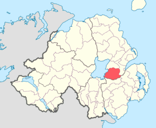
Massereene Upper is a barony in southwest County Antrim, Northern Ireland. It roughly matches the former district of Killultagh. It includes settlements such as Crumlin, Glenavy, Lower Ballinderry, Maghaberry and Aghalee. To its east lies Belfast Lough, and it is bordered by four other baronies: Massereene Lower to the north; Belfast Upper to the east; Castlereagh Upper to the south-east; and Iveagh Lower, Lower Half to the south-west.

References

  1. Placenames Database of Ireland
  2. 1 2 "Settlement 2015". NISRA. Retrieved 21 August 2023.
  3. ‘’Lisburn city website’’, Retrieved 2023-04-03
  4. ‘’Statistical Account of … Glenavy, Camlin & Tullyrusk’’ and ‘’Thom’s Almanac & Official Directory’’, as listed in ‘’Glenavy History’’, Retrieved 2023-04-03
  5. BBC website, Retrieved 2023-04-03
  6. "Gaelscoil Ghleann Darach". www.gleanndarach.com. Retrieved 14 September 2017.
  7. Crumlin Angling Club
  8. Photograph of Crumlin Orange Arch PhotographersDirect
  9. "Twelfth Timebomb" Archived 27 December 2015 at the Wayback Machine Antrim Guardian 12 July 2012
  10. "Why Crumlin's parade compromise is being hailed as a blueprint" BBC News 13 July 2012
  11. "Religion or religion brought up in". NISRA. Retrieved 21 August 2023.
  12. "National Identity (Irish)". NISRA. Retrieved 21 August 2023.
  13. "National Identity (British)". NISRA. Retrieved 21 August 2023.
  14. "National Identity (Northern Irish)". NISRA. Retrieved 21 August 2023.
  15. "Census 2011 Population Statistics for Crumlin Settlement". Northern Ireland Statistics and Research Agency (NISRA). Retrieved 30 July 2019.