Doylestown Township, Bucks County, Pennsylvania

Last updated
Doylestown Township
Fretz Mansion, Doylestown PA 02.JPG
Motto(s): 
"A Township with a sense of place" [1]
Bucks county - Doylestown Township.png
Location of Doylestown Township in Bucks County
USA Pennsylvania location map.svg
Red pog.svg
Doylestown Township
Location in Pennsylvania and the United States
Usa edcp location map.svg
Red pog.svg
Doylestown Township
Doylestown Township (the United States)
Coordinates: 40°18′46″N75°07′37″W / 40.3129°N 75.1270°W / 40.3129; -75.1270 Coordinates: 40°18′46″N75°07′37″W / 40.3129°N 75.1270°W / 40.3129; -75.1270
CountryUnited States
StatePennsylvania
County Bucks
Founded1818
Area
[2]
  Total15.63 sq mi (40.5 km2)
  Land15.44 sq mi (40.0 km2)
  Water0.19 sq mi (0.5 km2)
Elevation
299 ft (91 m)
Population
 (2010)
  Total17,565
  Estimate 
(2016) [3]
17,559
  Density1,100/sq mi (430/km2)
Time zone UTC-5 (EST)
  Summer (DST) UTC-4 (EDT)
Area codes 215, 267 and 445
FIPS code 42-017-19792
Website www.doylestownpa.org

Doylestown Township is a township in Bucks County, Pennsylvania, United States. The population was 17,565 at the 2010 census. Adjacent to the county seat, many county offices and the county correctional facility are located in this township. Doylestown Central Park is a park in the township.

Contents

History

Doylestown includes a number of villages which were formerly independent communities, including Bennetts Corner, Castle Valley, Cross Keys, Dyerstown, Edison, Fountainville, Furlong, Greers Corner, Paul Valley, Tradesville, The Turk, and Vauxtown. [1] [4] Fordhook Farm and Tabor Home for Needy and Destitute Children were listed on the National Register of Historic Places in 1987. [5] It was also the location of the formerly listed Fretz Farm.

Geography

According to the United States Census Bureau, the township has a total area of 15.6 square miles (40 km2), of which, 15.5 square miles (40 km2) of it is land and 0.1 square miles (0.26 km2) of it (0.51%) is water. It is drained by the Neshaminy Creek into the Delaware River.

Natural features include Almshouse Hill, Featherbed Hill, Flatiron Hill, Fretz Valley, Iron Hill, Little Buckingham Mountain, Mill Creek, Neshaminy Creek, Pebble Hill, and Pine Run. [4]

Neighboring municipalities

Demographics

Historical population
CensusPop.
1930 1,371
1940 1,4717.3%
1950 2,36460.7%
1960 3,79560.5%
1970 6,61374.3%
1980 11,82478.8%
1990 14,51022.7%
2000 17,61921.4%
2010 17,565−0.3%
2020 17,9712.3%
[6] [7]

As of the 2010 census, the township was 92.4% White, 1.3% Black or African American, 0.1% Native American, 1.9% Asian, 0.1% Native Hawaiian or other Pacific Islander, and 1.5% were two or more races. 2.8% of the population were of Hispanic or Latino ancestry. [8]

As of the census [9] of 2000, there were 17,619 people, 5,999 households, and 4,445 families residing in the township. The population density was 1,136.7 people per square mile (438.9/km2). There were 6,200 housing units at an average density of 400.0/sq mi (154.4/km2). The racial makeup of the township was 95.22% White, 2.59% African American, 0.06% Native American, 1.25% Asian, 0.02% Pacific Islander, 0.20% from other races, and 0.64% from two or more races. Hispanic or Latino of any race were 1.40% of the population.

There were 5,999 households, out of which 35.1% had children under the age of 18 living with them, 66.7% were married couples living together, 5.6% had a female householder with no husband present, and 25.9% were non-families. 22.0% of all households were made up of individuals, and 11.7% had someone living alone who was 65 years of age or older. The average household size was 2.63 and the average family size was 3.11.

In the township the population was spread out, with 23.7% under the age of 18, 5.4% from 18 to 24, 27.2% from 25 to 44, 25.7% from 45 to 64, and 18.0% who were 65 years of age or older. The median age was 42 years. For every 100 females there were 96.7 males. For every 100 females age 18 and over, there were 94.1 males.

The median income for a household in the township was $81,226, and the median income for a family was $93,984. Males had a median income of $62,853 versus $36,180 for females. The per capita income for the township was $38,031. About 1.6% of families and 3.7% of the population were below the poverty line, including 2.6% of those under age 18 and 4.8% of those age 65 or over.

Climate

According to the Köppen climate classification system, Doylestown Twp has a Hot-summer, Humid continental climate (Dfa). Dfa climates are characterized by at least one month having an average mean temperature ≤ 32.0 °F (0.0 °C), at least four months with an average mean temperature ≥ 50.0 °F (10.0 °C), at least one month with an average mean temperature ≥ 71.6 °F (22.0 °C) and no significant precipitation difference between seasons. Although most summer days are slightly humid in Doylestown Twp, episodes of heat and high humidity can occur with heat index values > 106 °F (41 °C). Since 1981, the highest air temperature was 103.0 °F (39.4 °C) on 07/22/2011, and the highest daily average mean dew point was 75.3 °F (24.1 °C) on 08/12/2016. The average wettest month is July which corresponds with the annual peak in thunderstorm activity. Since 1981, the wettest calendar day was 7.23 inches (184 mm) on 09/16/1999. During the winter months, the average annual extreme minimum air temperature is −0.7 °F (−18.2 °C). [10] Since 1981, the coldest air temperature was −11.8 °F (−24.3 °C) on 01/22/1984. Episodes of extreme cold and wind can occur with wind chill values < −11 °F (−24 °C). The average annual snowfall (Nov-Apr) is between 30 inches (76 cm) and 36 inches (91 cm). Ice storms and large snowstorms depositing ≥ 12 inches (30 cm) of snow occur once every few years, particularly during nor’easters from December through February.

Climate data for Doylestown Twp, Elevation 272 ft (83 m), 1981-2010 normals, extremes 1981-2018
MonthJanFebMarAprMayJunJulAugSepOctNovDecYear
Record high °F (°C)70.9
(21.6)
77.8
(25.4)
87.1
(30.6)
93.9
(34.4)
94.6
(34.8)
95.8
(35.4)
103.0
(39.4)
99.4
(37.4)
97.4
(36.3)
89.4
(31.9)
80.8
(27.1)
75.2
(24.0)
103.0
(39.4)
Average high °F (°C)39.1
(3.9)
42.4
(5.8)
50.8
(10.4)
62.7
(17.1)
72.7
(22.6)
81.5
(27.5)
85.6
(29.8)
84.0
(28.9)
77.1
(25.1)
65.7
(18.7)
54.7
(12.6)
43.3
(6.3)
63.4
(17.4)
Daily mean °F (°C)30.5
(−0.8)
33.3
(0.7)
40.9
(4.9)
51.6
(10.9)
61.3
(16.3)
70.5
(21.4)
75.1
(23.9)
73.5
(23.1)
66.2
(19.0)
54.5
(12.5)
44.8
(7.1)
34.9
(1.6)
53.2
(11.8)
Average low °F (°C)21.9
(−5.6)
24.1
(−4.4)
30.9
(−0.6)
40.4
(4.7)
49.8
(9.9)
59.6
(15.3)
64.6
(18.1)
63.1
(17.3)
55.4
(13.0)
43.3
(6.3)
34.9
(1.6)
26.5
(−3.1)
43.0
(6.1)
Record low °F (°C)−11.8
(−24.3)
−4.2
(−20.1)
2.5
(−16.4)
16.8
(−8.4)
33.4
(0.8)
40.9
(4.9)
47.4
(8.6)
42.1
(5.6)
34.9
(1.6)
23.5
(−4.7)
11.2
(−11.6)
−2.4
(−19.1)
−11.8
(−24.3)
Average precipitation inches (mm)3.24
(82)
2.62
(67)
3.73
(95)
3.91
(99)
4.34
(110)
4.30
(109)
5.01
(127)
4.06
(103)
4.44
(113)
4.17
(106)
3.63
(92)
3.90
(99)
47.35
(1,203)
Average relative humidity (%)66.663.458.858.062.367.467.270.071.570.068.968.866.1
Average dew point °F (°C)20.7
(−6.3)
22.2
(−5.4)
27.6
(−2.4)
37.3
(2.9)
48.3
(9.1)
59.2
(15.1)
63.5
(17.5)
63.1
(17.3)
56.7
(13.7)
44.9
(7.2)
35.2
(1.8)
25.7
(−3.5)
42.1
(5.6)
Source: PRISM [11]

Ecology

According to the A. W. Kuchler U.S. potential natural vegetation types, Doylestown Twp would have a dominant vegetation type of Appalachian Oak (104) with a dominant vegetation form of Eastern Hardwood Forest (25). [12] The plant hardiness zone is 6b with an average annual extreme minimum air temperature of −0.7 °F (−18.2 °C). [10] The spring bloom typically begins by April 11 and fall color usually peaks by October 30.

Transportation

US 202 parkway in Doylestown Township US 202 NB past Bristol Road.jpeg
US 202 parkway in Doylestown Township

Major roads in Doylestown Township include U.S. Route 202, which runs southwest–northeast through the township along a two-lane expressway-grade parkway before becoming a four-lane freeway that bypasses Doylestown to the south; Pennsylvania Route 611, which runs north–south along Easton Road before becoming a four-lane freeway that bypasses Doylestown to the west, U.S. Route 202 Business, which runs along State Street from New Britain east to an interchange with the PA 611 freeway, where State Street continues into Doylestown; Pennsylvania Route 263, which runs north–south along York Road along the eastern border of the township; Pennsylvania Route 313, which runs northwest–southeast along Swamp Road on the northeastern border of the township; Almshouse Road, which runs east–west through the southern portion of the township; and Lower State Road, which runs southwest–northeast through the township and heads into Doylestown. [13] SEPTA provides bus service to Doylestown Township along the SEPTA City Bus Route 55 line, which follows Pennsylvania Route 611 and Easton Road through the Township, heading north to Doylestown and south to Willow Grove and Olney Transportation Center in North Philadelphia. SEPTA Regional Rail's Lansdale/Doylestown Line stops at the Delaware Valley University station in Doylestown Township along its route between Doylestown and Center City Philadelphia. [14]

Notable residents

Related Research Articles

Bedminster Township, Bucks County, Pennsylvania Township in Pennsylvania, United States

Bedminster Township is a township in Bucks County, Pennsylvania, United States. The population was 6,574 at the 2010 census. Bedminster is part of Pennridge School District.

Bensalem Township, Pennsylvania Township in Pennsylvania, United States

Bensalem Township is a township in Bucks County, Pennsylvania, United States and borders the northeast section of Philadelphia. The township is composed of many communities, including Andalusia, Bensalem, Bridgewater, Cornwells Heights, Eddington, Flushing, Oakford, Siles, Trappe, and Trevose. Bensalem Township has no incorporated municipalities within its boundaries.

Bridgeton Township, Bucks County, Pennsylvania Township in Pennsylvania, United States

Bridgeton Township is a township in Bucks County, Pennsylvania, United States. The population was 1,277 at the 2010 census. The township was originally a part of adjacent Nockamixon Township, but a division was arranged and signed on May 24, 1890. This accord split an area of Nockamixon which ran west from the banks of the Delaware River to about one third the breadth of the original township. This smaller area was unsurprisingly named "Bridgeton", as it was the site of Upper Black Eddy-Milford Bridge covered wooden truss bridge built in 1842, which connected the towns of Upper Black Eddy and Milford, New Jersey. The original covered bridge was replaced by a truss bridge in 1933. The township originally contained several tiny hamlets, such as the aforementioned Upper Black Eddy, Narrowsville, and Rupletown. Upper Black's Eddy, as it was originally called, and Raubsville were named for notable landholders, while Narrowsville was named for a particularly thin portion of the Delaware River. With the construction of a centralized post office in Upper Black Eddy, the usage of separate names for the smaller towns ceased in an official capacity, and the everyday errands of residents became centered on the largest of the towns. What little commercial trade exists in the township is now centered solely in Upper Black Eddy, with any evidence of there being any distinctive, smaller villages existing only on outdated road-signs and maps. Ringing Rocks Park is located within the township, as well as state game hunting lands. Bridgeton Township is also home to the Homestead General Store, the oldest continually operating general store on the Delaware Canal.

Bristol Township, Bucks County, Pennsylvania Township in Pennsylvania, United States

Bristol Township is a township in Bucks County, Pennsylvania, United States. The population was 54,582 at the 2010 census, making it the 13th largest municipality in the state. Bristol Township, along with Bristol Borough, is a cultural hub for Lower Bucks County, hosting celebrations of African and Latino heritage. Parts of the township consist of the neighborhoods of Fairless Hills and Levittown, Pennsylvania.

Buckingham Township, Bucks County, Pennsylvania Township in Pennsylvania, United States

Buckingham Township is a township in Bucks County, Pennsylvania, United States. The population was 20,075 at the 2010 census. Buckingham takes its name from Buckingham in Buckinghamshire, England. Buckingham Township was once known as Greenville and was once the historic county seat of the English Bucks County.

Doylestown, Pennsylvania Borough in Pennsylvania, United States

Doylestown is a borough and the county seat of Bucks County in the Commonwealth of Pennsylvania, United States. It is located 15 miles (24 km) northwest of Trenton, New Jersey, 25 miles (40 km) south of Easton, Pennsylvania, 25 miles (40 km) north of Center City Philadelphia and 65 miles (105 km) southwest of New York City. As of the 2010 census, the borough population was 8,380.

Durham Township, Bucks County, Pennsylvania Township in Pennsylvania, United States

Durham Township is a township in Bucks County, Pennsylvania, United States. The population was 1,144 at the 2010 census. It was first organized in 1775 and is located in the extreme north of Bucks County. It was the location of Durham Furnace, Durham Boat Company and Durham Mills.They were known in the early 2000s for their dominating Little League Baseball, and for many consecutive years went undefeated and won championships.

East Rockhill Township, Bucks County, Pennsylvania Township in Pennsylvania, United States

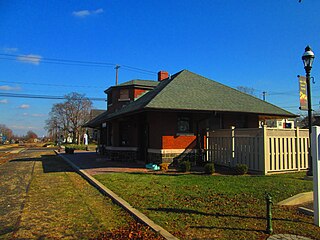
East Rockhill Township is a township in Bucks County, Pennsylvania, United States. The original Rockhill Township was established in 1740 and was divided into East and West Rockhill Townships in 1890. The population was 5,706 at the 2010 Census. East Rockhill is part of Pennridge School District. Pennridge Airport is located in East Rockhill Township.

Falls Township, Bucks County, Pennsylvania Township in Pennsylvania, United States

Falls Township is a Suburban Philadelphia township in Bucks County, Pennsylvania, United States. The population was 34,300 at the 2010 census. Portions of Fairless Hills and Levittown, Pennsylvania, are located in the township. Portions of Falls Township are called Morrisville and Yardley, due to the location of the Morrisville Post Office outside the Borough of Morrisville in Falls Township. As originally Chartered in 1692, the villages of Morrisville and Tullytown were part of Falls Township. Morrisville was granted Borough status in 1804. Tullytown was erected as a Borough in 1891.

Haycock Township, Bucks County, Pennsylvania Township in Pennsylvania, United States

Haycock Township is a township in Bucks County, Pennsylvania, United States. The population was 2,225 at the 2010 census.

Hilltown Township, Bucks County, Pennsylvania Township in Pennsylvania, United States

Hilltown Township is a township in Bucks County, Pennsylvania, United States. The population was 15,029 at the 2010 census. Most of Hilltown is part of Pennridge School District, while a small portion in Line Lexington is part of North Penn School District.

Lower Southampton Township, Bucks County, Pennsylvania Township in Pennsylvania, United States

Lower Southampton Township is a township in Bucks County, Pennsylvania, United States. The population was 18,909 at the 2010 census.

Milford Township, Bucks County, Pennsylvania Township in Pennsylvania, United States

Milford Township is a township in Bucks County, Pennsylvania, United States. The population was 9,902 at the 2010 census. It is home to the Quakertown interchange of the Pennsylvania Turnpike Northeast Extension.

Northampton Township, Bucks County, Pennsylvania Township in Pennsylvania, United States

Northampton Township is a township in Bucks County, Pennsylvania, United States, about 12 miles northeast of Philadelphia. The population was 39,726 at the 2010 census.

Upper Southampton Township, Bucks County, Pennsylvania Township in Pennsylvania, United States

Upper Southampton Township is a township in Bucks County, Pennsylvania, United States. The population was 15,152 at the 2010 census.

Warminster Township, Bucks County, Pennsylvania Township in Pennsylvania, United States

Warminster Township is located in Bucks County, Pennsylvania, United States and was formally established in 1711. It is 13.7 miles north of Philadelphia and had a population of 32,682 according to the 2010 U.S. census.

Warrington Township, Bucks County, Pennsylvania Township in Pennsylvania, United States of America

Warrington Township is a township in Bucks County, Pennsylvania, United States. Warrington Township is a northern suburb of Philadelphia. The population was 23,418 at the 2010 census.

Warwick Township, Bucks County, Pennsylvania Township in Pennsylvania, United States

Warwick Township is a township in Bucks County, Pennsylvania, United States. The population was 14,437 at the 2010 census.

Montgomery Township, Montgomery County, Pennsylvania Township in Pennsylvania, United States

Montgomery Township is a township in Montgomery County, Pennsylvania, United States. It is the location of the Montgomery Mall, a regional shopping mall serving the Route 309 corridor of the Philadelphia suburbs. Much of Montgomery Township's development is suburban in character, with newer tract houses and strip shopping centers. Homes in Montgomery Township have North Wales and Lansdale addresses, but businesses that are located within the township boundaries are given the Montgomeryville ZIP code. The township is in the North Penn School District and is part of the North Penn Valley region that is centered around the borough of Lansdale.

Telford, Pennsylvania Borough in Pennsylvania, United States

Telford is a borough in Bucks and Montgomery counties in the U.S. state of Pennsylvania. The population was 4,872 at the time of the 2010 census. Of this, 2,665 were in Montgomery County, and 2,207 were in Bucks County.

References

  1. 1 2 "Doylestown Township, Pennsylvania". Doylestown Township, Pennsylvania. Retrieved August 10, 2012.
  2. "2016 U.S. Gazetteer Files". United States Census Bureau. Retrieved Aug 13, 2017.
  3. "Population and Housing Unit Estimates" . Retrieved June 9, 2017.
  4. 1 2 MacReynolds, George, Place Names in Bucks County, Pennsylvania, Doylestown, Bucks County Historical Society, Doylestown, PA, 1942.
  5. "National Register Information System". National Register of Historic Places . National Park Service. July 9, 2010.
  6. "Archived copy". Archived from the original on 2019-04-09. Retrieved 2014-03-21.{{cite web}}: CS1 maint: archived copy as title (link)
  7. "Census 2020".
  8. "Census 2010: Pennsylvania". Usatoday.Com. Retrieved 2013-07-22.
  9. "U.S. Census website". United States Census Bureau . Retrieved 2008-01-31.
  10. 1 2 "USDA Interactive Plant Hardiness Map". United States Department of Agriculture . Retrieved October 22, 2019.
  11. "PRISM Climate Group, Oregon State University" . Retrieved October 22, 2019.
  12. "U.S. Potential Natural Vegetation, Original Kuchler Types, v2.0 (Spatially Adjusted to Correct Geometric Distortions)" . Retrieved October 22, 2019.
  13. Bucks County, Pennsylvania Highway Map (PDF) (Map). PennDOT. 2020. Retrieved September 20, 2020.
  14. SEPTA Official Transit & Street Map Suburban (PDF) (Map). SEPTA. Retrieved May 2, 2016.