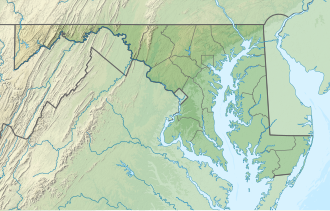
Franklin Point State Park | |
---|---|
Location | Anne Arundel County, Maryland, United States |
Nearest town | Shady Side, Maryland |
Coordinates | 38°48′49″N76°30′44″W / 38.81361°N 76.51222°W |
Area | 484 acres (196 ha) [1] |
Established | 2015 |
Administered by | Maryland Department of Natural Resources |
Designation | Maryland state park |
Website | Official website |
Franklin Point State Park is an undeveloped Maryland public recreation area bordering Chesapeake Bay in Shady Side in Anne Arundel County. The state park is a day-use area suitable for wildlife viewing, hiking, and paddling. [2]
Franklin Point is one of Maryland's newest provincial parks, opening after long-running efforts to prevent the area from being developed. The area was originally Deep Creek Airport which closed in the 1980s, and was then purchased by a real estate developer who planned on building 300 houses on the property. This effort was stopped by a local citizens group, who were later sued by the developer for defamation, but ended up winning the case. The property was then bought by Maryland Department of Natural Resources who turned it over the county, whose plan on developing the area included baseball diamonds and a parking lot. This plan was rejected by the Critical Area Commission owing to the sensitive shoreline. After this, the county lost interest in the project and the area stood unused for a decade. The park was later opened with the help of volunteers in 2015, who helped demolish abandoned structures and created trails as well as a boat launch. [3]
The park's 484 acres (196 ha) feature a wide array of habitats including woodlands and tidal marshes. It is one of the last intact areas of undeveloped woodland on the west side of Chesapeake Bay. It also is host to a number of important species such as the rare and elusive Black rail, and the endangered beakrush. Common birds in the park include Yellow-throated warbler, Swamp sparrow, Bald eagle, Snowy egret, Saltmarsh sparrow, Pine warbler, Merlin, Barred owl, and Prairie warbler as well as many species of ducks, sandpipers, gulls, and plovers. It also has 4 recorded species of turtles (Diamondback terrapin, Common snapping turtle, Eastern mud turtle, and Common box turtle) and many different species of snakes and frogs. The interior woodlands host black oak, pin oak, American sweetgum and loblolly pine.
The Northeastern coastal forests are a temperate broadleaf and mixed forests ecoregion of the northeast and middle Atlantic region of the United States. The ecoregion covers an area of 34,630 sq miles (89,691 km2) encompassing the Piedmont and coastal plain of seven states, extending from coastal southwestern Maine, southeastern New Hampshire, eastern Massachusetts, and Rhode Island, southward through Connecticut, New York State, New Jersey, southeast Pennsylvania, Delaware and Maryland.
Jones Lake State Park is a North Carolina state park in Bladen County, North Carolina in the United States near Elizabethtown. It covers 2,208-acre (8.94 km2), including the Carolina bay lakes of Jones Lake and Salters Lake. Jones Lake State Park is north of Elizabethtown on North Carolina Highway 242 in North Carolina's Coastal Plain region. The park offers year-round recreation, including fishing, swimming, boating, hiking, picnicking and environmental and historical education programs.
The Piney Woods is a temperate coniferous forest terrestrial ecoregion in the Southern United States covering 54,400 square miles (141,000 km2) of East Texas, southern Arkansas, western Louisiana, and southeastern Oklahoma. These coniferous forests are dominated by several species of pine as well as hardwoods including hickory and oak. Historically the most dense part of this forest region was the Big Thicket though the lumber industry dramatically reduced the forest concentration in this area and throughout the Piney Woods during the 19th and 20th centuries. The World Wide Fund for Nature considers the Piney Woods to be one of the critically endangered ecoregions of the United States. The United States Environmental Protection Agency (EPA) defines most of this ecoregion as the South Central Plains.
Colton Point State Park is a 368-acre (149 ha) Pennsylvania state park in Tioga County, Pennsylvania, in the United States. It is on the west side of the Pine Creek Gorge, also known as the Grand Canyon of Pennsylvania, which is 800 feet (240 m) deep and nearly 4,000 feet (1,200 m) across at this location. The park extends from the creek in the bottom of the gorge up to the rim and across part of the plateau to the west. Colton Point State Park is known for its views of the Pine Creek Gorge, and offers opportunities for picnicking, hiking, fishing and hunting, whitewater boating, and camping. Colton Point is surrounded by Tioga State Forest and its sister park, Leonard Harrison State Park, on the east rim. The park is on a state forest road in Shippen Township 5 miles (8 km) south of U.S. Route 6.
Leonard Harrison State Park is a 585-acre (237 ha) Pennsylvania state park in Tioga County, Pennsylvania, in the United States. It is on the east rim of the Pine Creek Gorge, also known as the Grand Canyon of Pennsylvania, which is 800 feet (240 m) deep and nearly 4,000 feet (1,200 m) across here. It also serves as headquarters for the adjoining Colton Point State Park, its sister park on the west rim of the gorge. Leonard Harrison State Park is known for its views of the Pine Creek Gorge, and offers hiking, fishing and hunting, whitewater boating, and camping. The park is in Shippen and Delmar Townships, 10 miles (16 km) west of Wellsboro at the western terminus of Pennsylvania Route 660.
Simon B. Elliott State Park is a 318-acre (129 ha) Pennsylvania state park located in Pine Township, Clearfield County, Pennsylvania in the United States. The park is surrounded by Moshannon State Forest. The park is entirely wooded with second growth forests of mixed oak species, including northern red oak, chestnut oak, shagbark hickory, red maple, and tulip poplar, and northern hard woods, including sugar maple, black cherry, aspen, birch, hemlock, and ash. S. B. Elliott State park is 9 miles (14 km) north of Clearfield on Pennsylvania Route 153 just off exit 111 of Interstate 80.
The Maryland Department of Natural Resources (DNR) is a government agency in the state of Maryland charged with maintaining natural resources including state parks, public lands, state forests, state waterways, wildlife, and recreation areas. Its headquarters are in Annapolis.
The U.S. state of Maryland has a varied geography. It has an area of 12,406.68 square miles (32,133.2 km2) and is comparable in overall area with Belgium [11,787 square miles (30,530 km2)]. It is the 42nd largest and 9th smallest state and is closest in size to the state of Hawaii, the next smallest state. The next largest state, its neighbor West Virginia, is almost twice the size of Maryland. Maryland borders Pennsylvania to the north, Delaware to the northeast, the Atlantic Ocean to the east, and to the west and south by West Virginia and Virginia.
Pocomoke River State Park is a public recreation area lying on both banks of the Pocomoke River between Snow Hill and Pocomoke City in Worcester County, Maryland. The state park comprises two areas within Pocomoke State Forest: Shad Landing on the south bank of the river and Milburn Landing on the north bank.
North Point State Park is a public recreation area located on Chesapeake Bay in Edgemere, Baltimore County, Maryland. The state park includes the site of the former Bay Shore Park, which was one of the state's premiere amusement parks during the first half of the 20th century. The park features restored remnants of the old amusement park as well as facilities for swimming, picnicking, bicycling, and hiking. Black Marsh, a 667-acre (270 ha) state wildlands area, makes up half the park's area. The park is administered by the Maryland Department of Natural Resources.
Spread Eagle Barrens State Natural Area is a 7,155-acre (2,896 ha) protected area just off of U.S. 2 in Florence County, Wisconsin, USA. The nearest unincorporated community is Spread Eagle, Wisconsin, but the closest large city is Iron Mountain, Michigan; 6 miles (10 km) away. The Spread Eagle Barrens is owned by the Wisconsin Department of Natural Resources and the Wisconsin Energy Corporation, and was designated a State Natural Area in 1995.
The eastern woodlands of the United States covered large portions of the southeast side of the continent until the early 20th century. These were in a fire ecology of open grassland and forests with low ground cover of herbs and grasses.
Wapack National Wildlife Refuge is a National Wildlife Refuge of the United States located in southern New Hampshire. It was the state's first refuge and was established through a donation by Lawrence and Lorna Marshall in 1972. The 1,672-acre (677 ha) refuge is located about 20 miles (32 km) west of Nashua, New Hampshire and encompasses the 2,278-foot (694 m) North Pack Monadnock Mountain.
The natural environment of Virginia encompasses the physical geography and biology of the U.S. state of Virginia. Virginia has a total area of 42,774.2 square miles (110,784.67 km2), including 3,180.13 square miles (8,236.5 km2) of water, making it the 35th-largest state by area. Forests cover 65% of the state, wetlands and water cover 6% of the land in the state, while 5% of the state is a mixture of commercial, residential, and transitional.
Greenleaf Lake State Recreation Area is a state park unit of Minnesota, USA, currently in development. It includes undeveloped shoreline on both Greenleaf and Sioux Lakes, halfway between the cities of Hutchinson and Litchfield in Meeker County. Portions of the state recreation area (SRA) are open to the public for day-use recreation, but there are no facilities yet on site. The park boundaries were set by the Minnesota Legislature and the state is still acquiring land from willing sellers; two-thirds of the property remain privately owned.
Chiwaukee Prairie is a 485-acre (1.96 km2) prairie in Pleasant Prairie, Wisconsin managed by the Wisconsin Department of Natural Resources. It is located on Lake Michigan at the Illinois state line and includes grassy wetlands, wooded areas, and the Kenosha Sand Dunes at its northern tip. It is home to an abundance of wildlife. It was designated a Wisconsin State Natural Area in 1967 and a National Natural Landmark in 1973.
Missouri is home to a diversity of flora, fauna and funga. There is a large amount of fresh water present due to the Mississippi River, Missouri River, and Lake of the Ozarks, with numerous smaller rivers, streams, and lakes. North of the Missouri River, the state is primarily rolling hills of the Great Plains, whereas south of the Missouri River, the state is dominated by the oak-hickory Central U.S. hardwood forest.
Frances A. Crane Wildlife Management Area is a wildlife management area (WMA) in Falmouth, Massachusetts, operated by the state Department of Fish and Game.
The Leola Marsh Wildlife Area is a 1,875 acres (759 ha) tract of protected land located in Adams County, Wisconsin, managed by the Wisconsin Department of Natural Resources. The Wildlife Area was founded at the same time as the Buena Vista Wildlife Area and the Rachel Carson National Wildlife Refuge, located in Portage County, Wisconsin and Cumberland County, Maine respectively.
The Big Beaver Creek Wildlife Area is a 572-acre (231 ha) tract of protected land located in Dunn County, Wisconsin, managed by the Wisconsin Department of Natural Resources (WDNR). Land to be used for the wildlife area was first acquired in 1959 to provide access to the Big Beaver Creek and Little Beaver Creek, along with the associated wetlands complex. The other major goal was to open up the area to state-sponsored timber harvesting, specifically that of tamarack.