
The M6 motorway is the longest motorway in the United Kingdom. It is located entirely within England, running for just over 230 miles (370 km) from the Midlands to the border with Scotland. It begins at Junction 19 of the M1 and the western end of the A14 at the Catthorpe Interchange, near Rugby before heading north-west. It passes Coventry, Birmingham, Wolverhampton, Stoke-on-Trent, Preston, Lancaster and Carlisle before terminating at Junction 45 near Gretna. Here, just short of the Scottish border it becomes the A74(M) which continues to Glasgow as the M74. Its busiest sections are between junctions 4 and 10a in the West Midlands, and junctions 16 to 19 in Cheshire; these sections have now been converted to smart motorways.

The M1 motorway connects London to Leeds, where it joins the A1(M) near Aberford, to connect to Newcastle. It was the first inter-urban motorway to be completed in the UK; the first motorway in the country was the Preston By-pass, which later became part of the M6.

The A41 in the UK is a trunk road between London and Birkenhead. Now, in parts, replaced by motorways, it passes through or near Watford, Kings Langley, Hemel Hempstead, Aylesbury, Bicester, Solihull, Birmingham, West Bromwich, Wolverhampton, Newport, Whitchurch, Chester and Ellesmere Port.

The A38, parts of which are known as Devon Expressway, Bristol Road and Gloucester Road, is a major A-class trunk road in England.

The A38(M), commonly known as the Aston Expressway, is a motorway in Birmingham, England. It is 2 miles (3.2 km) long and was opened on 24 May 1972. It forms part of the much longer A38 route, connecting the M6 motorway to Aston and Central Birmingham.

Birmingham is a major transport hub, due in part to its location in central England. The city is well connected by rail, road, and water. Public transport and key highways in the city are overseen by Transport for West Midlands (TfWM).
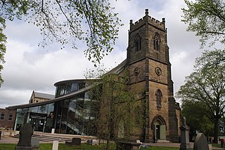
Erdington is a suburb and ward of Birmingham that is historically part of Warwickshire. It is 4 miles (6 km) northeast of central Birmingham, England and borders Sutton Coldfield. It was also a council constituency, managed by its own district committee. The former council district consisted of the ward of Erdington, and Tyburn,, Stockland Green and Kingstanding, although all of Kingstanding and most of both Tyburn and Stockland Green wards lie outside the historical boundaries of Erdington. Stockland Green was formerly part of Aston, Kingstanding part of Perry Barr and Tyburn partially split between Aston and Hodge Hill. Erdington (ward) was part of the Sutton Coldfield constituency before 1974.

Perry Barr is a suburban area in north Birmingham, England. It is also the name of a council constituency, managed by its own district committee. Birmingham Perry Barr is also a parliamentary constituency; its Member of Parliament is Khalid Mahmood.

Gravelly Hill is an area of Birmingham, United Kingdom.
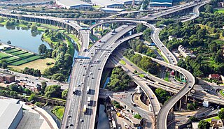
Spaghetti junction is a nickname sometimes given to a complicated or massively intertwined road traffic interchange that is said to resemble a plate of spaghetti. Such interchanges may incorporate a variety of interchange design elements in order to maximize connectivity.
Stockland Green is an area of Birmingham, England.

Aston railway station serves the districts of Aston and Nechells in Birmingham, England. The passenger entrance is on Lichfield Road. The station is on the Cross-City Line and the Chase Line. It is one of two local stations for Aston Villa Football Club and near to the Aston Expressway and to Gravelly Hill Interchange.
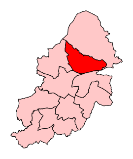
Birmingham Erdington is a parliamentary constituency in Birmingham, England, represented in the House of Commons of the Parliament of the United Kingdom since 2022 by Paulette Hamilton of the Labour Party.

The A5127 is a major road in England which runs between Birmingham and Lichfield, Staffordshire. For much of the route the road follows the old route of the A38 which has since been moved in order to by-pass places such as Erdington and Sutton Coldfield and form a relief road from Birmingham city centre to Spaghetti Junction.
The Central Motorway Junction or CMJ, is the intersection of State Highways 1 and 16, just south of the central business district of Auckland. A multilevel structure, it has been described as a "fiendishly complicated, multi-layered puzzle of concrete, steel and asphalt". Carrying around 200,000 vehicles a day, it is one of the busiest stretches of road in New Zealand.
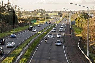
The Auckland Southern Motorway is the major route south out of the Auckland Region of New Zealand. It is part of State Highway 1.
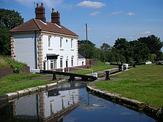
The Tame Valley Canal is a relatively late (1844) canal in the West Midlands of England. It forms part of the Birmingham Canal Navigations. It takes its name from the roughly-parallel River Tame.
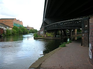
Salford Junction is the canal junction of the Grand Union and Tame Valley Canals with the Birmingham and Fazeley Canal. It is in the north of the administrative city of Birmingham, England and historically marked a tripoint between two divisions of Aston to the south and Erdington to the north. It is directly east of most of the Gravelly Hill Interchange. With Aston and Bordesley Junctions it forms a circuit, at the heart of Birmingham's thirty-five miles of canals.

Bromford is an industrial and residential area of Birmingham, situated between Ward End, Alum Rock, Hodge Hill, Washwood Heath, Shard End, Stechford, Castle Bromwich and Tyburn. The industrial area is predominantly situated on the north side of the M6 motorway, including The Bromford Gate industrial park, Fort Shopping Park, and Fort Dunlop, with one industrial site sitting east of the M6 called Bromford Central. The residential area sits adjacent to the East of the M6 comprising two neighbourhoods, Bromford built along Bromford Drive, and The Firs built along Chipperfield Road. The industrial and residential areas have increasingly become two separate distinguishable places, and not recognised locally as joined or one. This is signified by the M6 & River Tame dividing the two areas, poor public transport links between the two areas, and the areas sitting within three different local authority wards, and two parliamentary constituencies (industrial area situated within Birmingham Erdington and residential area situated within Birmingham Hodge Hill.

The Bromford Viaduct carries the M6 motorway between Castle Bromwich and Gravelly Hill along the River Tame valley in Birmingham, England. This elevated stretch of motorway above the Tame itself is 3+1⁄2 miles long, which makes it the longest viaduct in Great Britain, being 1⁄4 mile longer than the Second Severn Crossing. It was constructed during the period 1964–1972.


