Greater Gwalior Metro

Last updated

Gwalior Metro
Madhya Pradesh Metro Rail Corporation Limited.png
Overview
OwnerMadhya Pradesh Metro Rail Corporation & Government of Madhya Pradesh
Area served Gwalior, Gwalior West, Madhya Pradesh
Locale Gwalior, Madhya Pradesh
Transit type Rapid transit
Number of lines3 (Proposed)
Number of stations21 (Proposed)
Daily ridership300,000 (projected)
Chief executiveShri Alok Sharma, Smt Malini Gour
Headquarters Gwalior Metropolitan Region
Websitewww.gwaliormetrorail.com
Operation
Operator(s) Madhya Pradesh Metro Rail Corporation
CharacterElevated Tracks, At Grade Tracks, and Underground Tracks
Technical
System length58.1 km
Track gauge 1,435 mm (4 ft 8 1⁄2 in) Standard gauge
Electrification 25 kV, 50 Hz AC OHE
System map

Gwalior

The Gwalior Metro is a proposed rapid transit system to serve Gwalior, Gwalior West and other nearby towns in Gwalior Metropolitan Region in the Indian state of Madhya Pradesh. The project was announced by current state Chief Minister Shivraj Singh Chouhan on 17 October 2014. The survey has been started. It is so far the third metro system proposed in the Indian state of Madhya Pradesh after Indore Metro, and Bhopal Metro.The network consists of three colour-coded regular lines proposed to serve 21 stations with a total length of 58.1 kilometres (36.1 mi). The system will have a mix of underground, at-grade, and elevated stations using standard-gauge tracks.

Madhya Pradesh Metro Rail Corporation, a company developed under the Government of Madhya Pradesh, will build and operate the Gwalior Metro.

History

The Union Minister Jyotiraditya Scindia had demanded metro train for the Gwalior city, he had written to the present Chief Minister of Madhya Pradesh, Shivraj Singh Chauhan. As the state government have started work of metro train in Bhopal and in Indore, the leader from Gwalior Chambal region had raised the demand to set up the metro train facility in Gwalior. In his letter he stated that the Gwalior city is facing huge traffic pressure and to reduce the pressure it needs metro train. He asked the CM to institute a team which can conduct a feasibility study to establish the metro in the city. He had also written to the district collector to forward the letter to the department.

The concept of a mass rapid transit for Gwalior first emerged from a traffic and travel characteristics study which was carried out in the city in 1992 when the satellite district of Gwalior-West was getting developed under National Capital Region to attract the population of Delhi and act as a Counter Magnet for Delhiites. Gwalior was first city out of 5 Counter Magnets selected by the government. Gwalior West lies 15 km from Gwalior and 8 km east of the Tigra Dam.

From several years, many official committees by a variety of Government departments were commissioned to examine issues related to technology, route alignment, and Governmental jurisdiction. On 17 October 2014 the project of developing a rapid transit metro rail system in Gwalior was announced by current state Chief Minister Shivraj Singh Chouhan.

While extensive technical studies and the raising of finance for the project are in progress, the city expanded significantly resulting in a 15.2174% increase [1] [2] in population between 2014 and 2020. Consequently, traffic congestion and pollution soared, as an increasing number of commuters took to private vehicles as there was no proper transportation system in the city other than auto rickshaw, this merely compounded the problem with inexperienced operators plying poorly maintained, noisy and polluting buses on lengthy routes, resulting in long waiting times, unreliable service, extreme overcrowding, unqualified drivers, speeding and reckless driving which even led to road accidents. To rectify the situation, the Government of Madhya Pradesh set up a company called the Madhya Pradesh Metro Rail Corporation with Shri. Ranjit Singh Deol, Indian Administrative Service as the managing director.

Network

The Gwalior Metro is being built in phases. It has been found out that it will be built in 3 Phases out of which the 1st Phase is in Planning Stage. The network consists of Three colour-coded regular lines proposed to serve 21 stations with a total length of 58.1 kilometers (36.1 mi). The system will have a mix of underground, at-grade, and elevated stations using standard-gauge tracks.

Line No.Line nameStationsLength (km)TerminalsTrack GaugeEstimated Opening Date
1Red Line930.3 km Gwalior Airport Sithouli Railway Station 1435 MM2025
2Blue Line1022.7 km Jiwaji University Circle

(City Center Chaurah)

Kampoo 1435 MM2025
3Yellow Line205.1 km Jayendraganj Scindi Colony 1435 MM2025

Proposed lines

Red Line (Line 1)

The Red Line will be the initial line of the Metro to be opened and will connect Gwalior Airport in the North to Sithouli Railway Station in the South, i.e. it will act to provide North-South Connectivity across Gwalior City, covering a distance of 30.3 kilometres (18.82 mi) and is the longest line (projected). It is the most important line as it will connect the Airport to the Gwalior Railway Station and Satellite Railway Station of Sithouli. The Red Line will be partly elevated and partly at grade and will cross the Gwalior Railway Station of the Indian-Railways between Gole Ka Mandir and Phool Bagh stations. It will be Elevated from Gwalior Airport Metro Station to Phool Bagh Metro Station after which, near DD Mall the next stretch from Jayendraganj Chowk Metro Station to Kampoo Metro Station it will be built underground due to the heavy Population Density around the area. Then the corridor will be built elevated from Gudagudi ka Naka which will help transit to the nearby Agra Bombay Road (AB Road), just 6.3 Km from it. From there it will run approximately parallel to the Shivpuri Link Road and take a Perpendicular turn at Vicky Factory Tiraha and pass near from Railway Crossing; the track will run straight southwards for 4.1 km and will terminate at Sithouli Railway Station - Metro Station, which will also act as a Depot Station for the Red Line. The red line will have interchange station, at Gole Ka Mandir and Kampoo with the Blue Line and Yellow Line at Jayendraganj Chaurah .

Blue Line (Line 2) {Ring Line}

The Blue Line will be the second line of the Metro to be opened and the first to connect areas in Congested Parts of Central Gwalior in a Box-Ring Shape manner. Half elevated and half underground, it will connect Jiwaji University Circle (City-Center Chaurah) in the East with the Sub-City of Kampoo in the West, providing an east–west connectivity across Gwalior City covering a distance of 22.7 kilometres (14.1 mi). It will be the most used line of Gwalior Metro by Gwaliorites as it passes form most densely populates places of the city and major markets. The first section of this line between Jiwaji University and Govindpuri will be built on elevated racks and subsequent section between Govindpuri7 Number Chauraha will be underground due to unavailability of land. The Train will go elevated from 7 Number ChaurahaGole Ka Mandir where it will have interchange with the Red Line, and will have an extradosed bridge across the Indian Railways mainlines near Hazira. From Gole Ka Mandir it will reach its terminal station Kampoo through Jiwaji Ganj .

Yellow Line (Line 3)

The Yellow Line will be the third line of the Metro. It will run for 5.1 kilometres (3.16 mi) from Central Gwalior to South West Gwalior and will connect Jayendraganj with Scindi Colony in Gwalior. Presently, it is the shortest projected line in Gwalior. It will help to connect Central Gwalior with the South-Western Scindi Colony and the Nearby Agra Bombay Road (Bypass) which is also a National Highway.

Route map

A Detailed Explanation Model and DPR for the routes has been presented by a Youtuber RoastFlix in his Recent Video which are up-to date and can be referred for additional visualisation. The route maps can be found here:

Red Line Map

Blue Line Map

Yellow Line Map

Proposed stations

Red Line (Line 1)

1.Gwalior Airport

2.DD Nagar

3.Gole Ka Mandir

4.Gwalior Railway Station

5.Phool Bagh

6.Jayendra Ganj

7.Kampoo

8.Gudagudi Ka Naka

9.Sithouli Railway Station

Blue Line (Line 2)

1.Jiwaji University

2.Govindpuri

3.DB City

4.Baradari, Morar

5.7 Number Chaurah

6.Gole Ka Mandir

7.Hazira

8.Urwai Gate-Gwalior Fort

9.Jiwaji Ganj

10.Kampoo

Yellow Line (Line 3)

1.Jayendra Ganj

2.Scindi Colony

Signalling and telecommunication

The Gwalior Metro will use cab signalling along with a centralised automatic train control system consisting of automatic operation, protection and signalling modules. A 380 MHz digital trunked TETRA radio communication system from Motorola Solutions is used on all lines to carry both voice and data information. For Blue Line Siemens Mobility will supply the electronic interlocking Sicas, the operation control system Vicos OC 500 and the automation control system LZB 700 M. An integrated system comprising optical fibre cable, on-train radio, CCTV, and a centralised clock and public address system is used for telecommunication during train operations as well as emergencies. For Red and Yellow lines ALSTOM has supplied signalling system.

https://dainik-b.in/VudxzvG2e7

Related Research Articles

<span class="mw-page-title-main">Madhya Pradesh</span> State in central India

Madhya Pradesh is a state in central India. Its capital is Bhopal, and the largest city is Indore, with Gwalior, Jabalpur, Ujjain, Dewas, Sagar, Satna, and Rewa being the other major cities. Madhya Pradesh is the second largest Indian state by area and the fifth largest state by population with over 72 million residents. It borders the states of Uttar Pradesh to the northeast, Chhattisgarh to the east, Maharashtra to the south, Gujarat to the west, and Rajasthan to the northwest.

<span class="mw-page-title-main">Gwalior</span> Metropolis in Madhya Pradesh, India

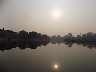
Gwalior is a major city in the central Indian state of Madhya Pradesh; it lies in northern part of Madhya Pradesh and is one of the Counter-magnet cities. Located 343 kilometres (213 mi) south of Delhi, the capital city of India, 120 kilometres (75 mi) from Agra and 414 kilometres (257 mi) from Bhopal, the state capital, Gwalior occupies a strategic location in the Gird region of India. The historic city and its fortress have been ruled by several historic Indian kingdoms. From the Kachchhapaghatas in the 10th century, Tomars in the 13th century, it was passed on to the Mughal Empire, then to the Maratha in 1754, and the Scindia Dynasty of Maratha Empire in the 18th century. In April 2021, It was found that Gwalior had the best air quality index amongst the 4 major cities in Madhya Pradesh.

<span class="mw-page-title-main">Goregaon</span> Suburb of Mumbai, Maharashtra, India

Goregaon ([ɡoːɾeɡaːʋ]) is a suburb of Mumbai city, in the Mumbai Suburban district of India. It has a railway station on the Mumbai suburban railway on the Western Line. An extension of the Harbour Line was completed in 2018 because of which it has regular trains to CSMT on the Harbour line. This is in addition to existing trains to Churchgate on the Western Line. Owing to the rapid urbanization and growing population of metropolitan Mumbai, Goregaon, which was once merely a hilly forest region is now a crowded suburb of Mumbai.

<span class="mw-page-title-main">Nehru Place</span> Neighborhood of Delhi in South East Delhi, India

Nehru Place is a large commercial center in Delhi, India. Although its importance as a financial center has declined in recent years, Nehru Place is still a prominent commercial area in South Delhi and houses the headquarters of several Indian firms and rivals with other financial centers in the metropolis like Connaught Place, Bhikaji Cama Place and Rajendra Place.

Chhindwara is a city in India and a Municipal Corporation in Chhindwara district in the Indian state of Madhya Pradesh. The city is the administrative headquarters of Chhindwara District. Chhindwara is reachable by rail or road from adjacent cities Betul, Jabalpur and Nagpur. The nearest airport is in Nagpur (130 km); however there is a small airport located in the city which is not serviceable for passenger planes.

<span class="mw-page-title-main">Lalitpur district, India</span> District in Uttar Pradesh, India

Lalitpur District is one of the districts of Uttar Pradesh state of India. Lalitpur district is a part of Jhansi Division. Lalitpur is the main town and administrative headquarters. The district occupies an area of 5,039 km².

<span class="mw-page-title-main">Orai</span> City in Uttar Pradesh, India

Orai is a city in Uttar Pradesh, India, and the administrative headquarters of Jalaun District. All administrative offices of Jalaun District, including the District Collectorate, police, telecom and various other government organizations are located in this city. In 2019, Orai received the award of 'Fastest Mover' Small City among India under Swachh Survekshan, an annual cleanliness survey carried by the Quality Council of India.

<span class="mw-page-title-main">Transport in Delhi</span> Overview of transport in Delhi, India

Delhi has significant reliance on its transport infrastructure. The city has developed a highly efficient public transport system with the introduction of the Delhi Metro, which is undergoing a rapid modernization and expansion since 2006. There are 16.6 million registered vehicles in the city as of 30 June 2014, which is the highest in the world among all cities, most of which do not follow any pollution emission norm, while the Delhi metropolitan region has 11.2 million vehicles. Delhi and NCR lose nearly 42 crore man-hours every month while commuting between home and office through public transport, due to the traffic congestion. Therefore, serious efforts, including a number of transport infrastructure projects, are under way to encourage usage of public transport in the city.

Sabalgarh is a municipality in Morena district in the Indian state of Madhya Pradesh.

<span class="mw-page-title-main">Bhopal–Gwalior Intercity Express</span> Train in India

The Bhopal–Gwalior Intercity Express is a superfast inter-city train service which runs between Bhopal Junction railway station of Bhopal City, the capital of Madhya Pradesh and Gwalior Junction railway station in north Madhya Pradesh. The train runs via Bina jn, Guna Jn, Shivpuri. It is the only train which connects Shivpuri to State Capital Bhopal.

<span class="mw-page-title-main">Green Line (Delhi Metro)</span> Line on the Delhi Metro system

The Green Line is a metro rail line of the Delhi Metro, a rapid transit system in Delhi, India. The line consists of 24 stations covering a total length of 28.79 km. It runs between Inderlok and Brigadier Hoshiyar Singh with a branch line connecting the line's Ashok Park Main station with Kirti Nagar station.

<span class="mw-page-title-main">Govindpuri metro station</span> Metro station in Delhi, India

Govindpuri is a Delhi Metro station in Delhi. It is located between Kalkaji Mandir and Harkesh Nagar Okhla stations on the Violet Line. The station was opened with the first section of the Line on 3 October 2010, in time for the Commonwealth Games opening ceremony on the same day.

<span class="mw-page-title-main">Delhi Metro</span> Rapid transit system in India serving Delhi NCR

The Delhi Metro is a mass rapid transit (MRT) system serving Delhi and its adjoining satellite cities such as Ghaziabad, Faridabad, Gurugram, Noida and Bahadurgarh, in the National Capital Region of India.

<span class="mw-page-title-main">Indore Metro</span> Rapid transit system in Indore, India

The Indore Metro is a rapid transit system which is under construction for the city of Indore, India. The total system consists of 11 corridors (lines) covering a distance of 124 kilometres (77 mi). This project will cost approximately 12,000 crore (US$1.5 billion). The cost per km will be 182 crores and total cost is 15,000 crores. The metro system will be elevated, underground and on ground. The Indore Metro project has been subject to serious contestation due to the inappropriate shifting of Seismic zone-II to Seismic zone-IV category which has led to increase in budgetary cost for the entire project.

<span class="mw-page-title-main">Krishna Nagar metro station (Lucknow)</span> Lucknow Metros Red Line metro station

Krishna Nagar is an important elevated metro station on the North-South Corridor of the Red Line of Lucknow Metro in the city of Lucknow, Uttar Pradesh, India, which is used for commuting hub for the residential areas of Krishna Nagar, LDA and Aashiyana.

<span class="mw-page-title-main">Agra–Bhopal section</span> Railway section in India

The Agra–Bhopal section is a railway line connecting, Agra, one of large city in Uttar Pradesh, and Bhopal, capital of the Indian state of Madhya Pradesh. This 508 km (316 mi) track is part of the Delhi–Chennai line. The line is under the jurisdiction of North Central Railway and West Central Railway.

Dada Nagar is an area situated in the southern part of Kanpur district in the Indian state of Uttar Pradesh.

The Jabalpur Metro, also known as Jabalpur Metro Rail, is a rapid transit system proposed for the city of Jabalpur in Jabalpur Metropolitan Region in the Indian state of Madhya Pradesh. The project was announced by state Chief Minister Shivraj Singh Chouhan on 13 March 2014. The Chief Minister has again declared in a meeting at Jabalpur on 27th September 2023 that Jabalpur will get Metro Railway.The feasibility of this project was being questioned through a study. The work for the feasibility report has been completed in December 2017 and report was released in January 2018.

Jhansi railway division is one of the three railway divisions under North Central Railway zone of Indian Railways. This railway division was formed on 5 November 1951 and its headquarters are located at Jhansi in the state of Uttar Pradesh of India.

The Gorakhpur Metrolite is a light rapid transit system proposed for the city of Gorakhpur, Uttar Pradesh, India. The network will consist of 2 elevated lines serving 27 stations with a total length of 27.41 kilometres. The project is estimated to cost 4,672 crore (US$590 million). It is expected to be completed by 2024.

References

  1. LLC, CalculatorSoup. "Percentage Increase Calculator". CalculatorSoup. Retrieved 19 July 2020.
  2. "Gwalior, India Metro Area Population 1950-2020". www.macrotrends.net. Retrieved 19 July 2020.

3. https://indiarailinfo.com/news/post/now-metro-train-will-coming-gwalior-stoppage-at-every-500-meter-in-gwalior-www-bhaskar-com-indian-railways-news/275009

4. https://www.patrika.com/gwalior-news/metro-will-be-start-in-gwalior-and-jabalpur-railway-will-survey-for-this-1469580/

5. https://dainik-b.in/VudxzvG2e7

6. https://www.patrika.com/gwalior-news/metro-train-1-5216950/