Green Hill Queensland | |||||||||||||||
---|---|---|---|---|---|---|---|---|---|---|---|---|---|---|---|
Coordinates | 17°01′23″S145°50′00″E / 17.0230°S 145.8333°E | ||||||||||||||
Population | 159 (2016 census) [1] | ||||||||||||||
• Density | 4.206/km2 (10.89/sq mi) | ||||||||||||||
Postcode(s) | 4865 | ||||||||||||||
Area | 37.8 km2 (14.6 sq mi) | ||||||||||||||
Time zone | AEST (UTC+10:00) | ||||||||||||||
Location |
| ||||||||||||||
LGA(s) | Cairns Region | ||||||||||||||
State electorate(s) | Mulgrave | ||||||||||||||
Federal division(s) | Kennedy | ||||||||||||||
|
Green Hill is a rural locality in the Cairns Region, Queensland, Australia. [2] In the 2016 census, Green Hill had a population of 159 people. [1]
Pine Creek Yarrabah Road forms the western boundary of the locality, while the eastern boundary is formed by the ridgeline of the Malbon Thompson Range. The land in the west of the locality is lower-lying (10–50 metres above sea level) freehold land used for agriculture (predominantly sugarcane) and some rural residences. The land in the east of the locality is mountainous and undeveloped land rising rapidly from 50 metres (160 ft) above sea level to the mountain ridge on the eastern boundary, where the highest peak is Grey Peaks in the south-east of the locality in the Malbon Thompson Range ( 17°02′45″S145°51′55″E / 17.0458°S 145.8652°E ) at 644 metres (2,113 ft) above sea level. [3] [4]
The north-east of the locality is protected as the Malbon Thompson Forest Reserve, while the south-east of the locality is the Grey Peaks National Park. [3] There are no access roads tand no public facilities in the Grey Peaks National Park. Due to the steep terrain, the area has not been logged and contains a mixture of sclerophyll and rainforest vegetation. The sclerophyll forest contains red mahogany Eucalyptus pellita and red turpentine Syncarpia glomulifera trees. [5]
Apart from these protected areas, the land in the locality is almost entirely used to grow sugarcane. [3] There is a network of cane tramways in the western part of the locality to transport the harvested sugarcane to the Mulgrave Sugar Mill. [3]
Green Hill is in the south-west of the locality ( 17°02′24″S145°48′31″E / 17.0401°S 145.8086°E ) at 131 metres (430 ft) above sea level. [3] [6] The hill is the remnant of a volcano that erupted about 986,000 years ago. It is believed that the volcano's eruption altered the course of the Mulgrave River so that instead of having its mouth on Trinity Inlet, the mouth become directly onto the Coral Sea some 40 km further south. [7] However, further research has shown river sediments above the basalt flows and it is now believed that other factors such as alluvial sediments may have altered the river's course and that perhaps it has alternated between the two mouths over time. [8]
Green Hill is situated in the Yidinji traditional Aboriginal country. [9]
The locality was originally called Crescent Hill, but was renamed Green Hill around the 1890s. [10]
In the 2016 census, Green Hill had a population of 159 people. [1]
There are no schools in the locality. The nearest primary and secondary schools are Gordonvale State School and Gordonvale State High School both in neighbouring Gordonvale to the south-west. [3]
Cairns is a city in Queensland, Australia, on the tropical north east coast of Far North Queensland. The population as of the Census 2021 was 169,312, having grown on average 1.02% annually over the preceding five years. The city is the 5th-most-populous in Queensland, and 15th in Australia.
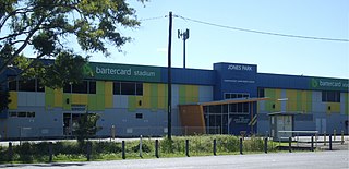
Gordonvale is a rural sugar-growing town and locality situated on the southern side of Cairns in the Cairns Region, Queensland, Australia. In the 2021 census, the locality of Gordonvale had a population of 6,944 people.
Edmonton is a town and suburb in the Cairns Region, Queensland, Australia. In the 2016 census, Edmonton had a population of 10,753 people.
Aloomba is a town and a locality in the Cairns Region, Queensland, Australia. In the 2016 census, Aloomba had a population of 529 people.
The Cairns Region is a local government area in Far North Queensland, Queensland, Australia, centred on the regional city of Cairns. It was established in 2008 by the amalgamation of the City of Cairns and the Shires of Douglas and Mulgrave. However, following public protest and a referendum in 2013, on 1 January 2014, the Shire of Douglas was de-amalgamated from the Cairns Region and re-established as a separate local government authority.
The Mulgrave River, incorporating the East Mulgrave River and the West Mulgrave River, is a river system in Far North Queensland, Australia. The 70-kilometre (43 mi)-long river flows towards the Coral Sea and is located approximately 50 kilometres (31 mi) south of Cairns.
Mirriwinni is a rural town and locality in the Cairns Region, Queensland, Australia. The spelling Miriwinni has also been used historically, but Mirriwinni is the official spelling from 8 October 2010. In the 2016 census, the locality of Mirriwinni had a population of 447 people.
Woopen Creek is a rural locality in the Cairns Region, Queensland, Australia. In the 2016 census, Woopen Creek had a population of 141 people.
East Trinity is a coastal rural locality in the Cairns Region, Queensland, Australia. It was formerly known as Trinity East. In the 2016 census, East Trinity had a population of 212 people.
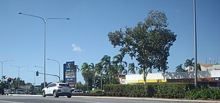
Earlville is a suburb of Cairns in the Cairns Region, Queensland, Australia. In the 2016 census, Earlville had a population of 4,030 people.
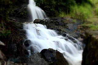
Fishery Falls is a locality in the Cairns Region, Queensland, Australia. In the 2021 census, Fishery Falls had a population of 205 people.
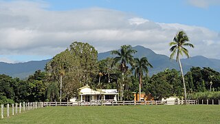
Mount Peter is a locality in the Cairns Region, Queensland, Australia. In the 2016 census, Mount Peter had a population of 92 people.
Little Mulgrave is a locality in the Cairns Region, Queensland, Australia. In the 2016 census, Little Mulgrave had a population of 249 people.
Wrights Creek is a locality in the Cairns Region, Queensland, Australia. In the 2016 census, Wrights Creek had a population of 156 people.
Barron is a suburb of Cairns in the Cairns Region, Queensland, Australia. In the 2016 census Barron had a population of 42 people.
Barron Gorge is a rural locality in the Cairns Region, Queensland, Australia. In the 2016 census Barron Gorge had a population of 0 people.
Glen Boughton is a rural locality in the Cairns Region, Queensland, Australia. In the 2021 census, Glen Boughton had a population of 19 people.
Lamb Range is a locality in the Cairns Region, Queensland, Australia. In the 2016 census, Lamb Range had a population of 0.
Goldsborough is a locality in the Cairns Region, Queensland, Australia. In the 2021 census, Goldsborough had a population of 1,099 people.
Packers Camp is a rural locality in the Cairns Region, Queensland, Australia. In the 2016 census, Packers Camp had a population of 106 people.