
The following is an alphabetical list of articles related to the Commonwealth of Puerto Rico .
The following is an alphabetical list of articles related to the Commonwealth of Puerto Rico .


This section is empty.You can help by adding to it.(July 2010) |

This section is empty.You can help by adding to it.(July 2010) |

Ponce is both a city and a municipality on the southern coast of Puerto Rico. The city is the seat of the municipal government.

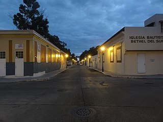
Barrio Playa, also known as Playa de Ponce, Ponce Playa, or La Playa, is one of the thirty-one barrios that comprise the municipality of Ponce, Puerto Rico. Along with Bucaná, Canas, Vayas, and Capitanejo, Playa is one of the municipality's five coastal barrios. Barrio Playa also incorporates several islands, the largest of which is Caja de Muertos. It was founded in 1831.

Canas is one of the 31 barrios in the municipality of Ponce, Puerto Rico. Along with Anón, Coto Laurel, Guaraguao, Quebrada Limón, Real, San Patricio, and Marueño, and the coastal barrio of Capitanejo, Canas is one of the municipality's nine bordering barrios. It borders the municipality of Peñuelas. Along with Playa, Bucana, Vayas and Capitanejo, Canas is also one of Ponce's five coastal barrios. It was founded in 1831.

San Antón is one of the 31 barrios of the municipality of Ponce, Puerto Rico. Along with Canas Urbano, Machuelo Abajo, Magueyes Urbano, and Portugués Urbano, San Antón is one of the municipality's five originally rural barrios that are now also part of the urban zone of the city of Ponce. It is totally enclosed within the Ponce city limits. It was founded in 1818.
Segundo is one of the 31 barrios of the municipality of Ponce, Puerto Rico. Along with Primero, Tercero, Cuarto, Quinto, and Sexto, Segundo is one the municipality's six core urban barrios. It was organized in 1878. Barrio Segundo has 3 subbarrios: Baldority de Castro, Clausells, and Reparada.

Canas Urbano is one of the 31 barrios of the municipality of Ponce, Puerto Rico. Along with Machuelo Abajo, Magueyes Urbano, Portugués Urbano, and San Antón, Canas Urbano is one of the municipality's five originally rural barrios that are now also part of the urban zone of the city of Ponce. The name of this barrio is of native indigenous origin. It was created in 1953.
Timoteo Luberza de San Martín was a nineteenth-century Puerto Rican engineer from Ponce, Puerto Rico. He was responsible for the 1875 Ponce water supply system, including the dam in Rio Portugues, and the Calle del Agua masonry arch aqueduct in barrio Portugues Urbano in Ponce. In 1864, he served briefly as mayor of the nearby town of Yauco. He is best remembered for designing Plaza del Mercado de Ponce.
The following is a timeline of the history of the city of Ponce, Puerto Rico.

San Juan Bay is the inlet adjacent to Old San Juan in northeastern Puerto Rico. It is about 3.5 miles (5.6 km) in length, the largest body of water in an estuary of about 97 square miles (250 km2) of channels, inlets and eight interconnected lagoons. The San Juan bay is home to the island's busiest harbor and its history dates back to at least 1508.

The Puente Río Portugués is a historic bridge over the former course of the Río Portugués in barrio Playa in the municipality of Ponce, Puerto Rico. The bridge was added to the U.S. National Register of Historic Places in 2015. The bridge is prominent as "the oldest longitudinal steel beams / reinforced concrete bridge built within the historic Carretera Central". It is located on Avenida Hostos, just south of its intersection with Ponce By Pass.
Noemí Ruiz is a Puerto Rican painter, graphic artist and teacher. She is said to be a pioneer of abstraction in Puerto Rico. Her works can be found in many significant collections, and she has represented Puerto Rico in many international exhibitions.

Segundo Cardona FAIA is a Puerto Rican architect and developer. His work has been recognized by the American Institute of Architects (AIA), by the Colegio de Arquitectos y Arquitectos Paisajistas de Puerto Rico as well as by the International Union of Architects. In 2006 Cardona was elected as Fellow of the American Institute of Architects. In 1992, he was awarded the Henry Klumb Award.

Bahía de Ponce is a bay in Barrio Playa, Ponce, Puerto Rico. The Bay is home to the most important commercial harbor on the Puerto Rico south coast and the second largest in Puerto Rico. The Cardona Island Light is located on the Bay to mark the way into the Bay from the nearby Caja de Muertos Light.
![]()
| History |
| ||||||||
|---|---|---|---|---|---|---|---|---|---|
| Geography | |||||||||
| Ecology |
| ||||||||
| Politics | |||||||||
| Economy | |||||||||
| Society |
| ||||||||