List of secondary highways in Thunder Bay District
Last updated
List of Ontario secondary highways
This is a list of secondary highways in Thunder Bay District, most of which serve as logging roads or provide access to the isolated and sparsely populated areas in the Thunder Bay District of northern Ontario.
The Gull Bay First Nation occupies one of the few permanent settlements on Highway 527, Gull Bay Reserve, situated on the western shore of Lake Nipigon about 70 kilometres south of Armstrong. The highway also passes the start of Highway811 along its route.
Highway 527 was created in the 1950s as a forest access road and designated Highway800 in 1963. Throughout the 1960s, the route was gradually extended until it reached what is now Highway811 in 1969. The route was designated Highway527 in 1976. Except within the communities of Armstrong and Gull Bay, there are no services or development along this road.
Secondary Highway 580, commonly referred to as Highway 580 is a secondary highway in the Canadian province of Ontario. It is served to connect between Highway 11 near Beardmore to Poplar Lodge near Lake Nipigon. It is also known as The Spruce River Road.
Highway 582 is itself a former route of Highway 17, which was given its current number when a new alignment of Highway 17 between the two endpoints was later constructed.
Secondary Highway 584, commonly referred to as Highway 584 is a secondary highway in the Canadian province of Ontario. The southern terminus is north of the town of Geraldton in Greenstone, while the northern terminus is at Warren Street in Nakina, a length of 53.1 kilometres (33.0mi). The road is signed as Michael Power Boulevard, First Avenue North, Third Street North, and Center Street.
Secondary Highway 586, commonly referred to as Highway 586 is a secondary highway in the Canadian province of Ontario. The western terminus is a dead end near the shores of the Shebandowan Lakes, while the eastern terminus is at an intersection with Highway11, a length of 5.2 kilometres (3.2mi). The route was assigned in 1956, when Highway11 was known as Highway120.
Highway 587 started out as a logging road in the 1800s and a connection to the silver mines at Silver Islet, Ontario. Later about the 1870s Sleeping Giant Provincial Park was incorporated and Highway587 was in the planning stages. Finally about 1940 it was finished. The route was assumed as a provincial highway in 1956.
Highway 591 is an 8 kilometre road in the Thunder Bay District of Northwestern Ontario, starting at Highway 589 in Lappe. It travels west then north and terminates at the corners of Gilbride and Island Lake Roads, 8 kilometres (5.0mi) northwest of Lappe.
Highway 593 is a 52 kilometre road in the Thunder Bay District of Northwestern Ontario, starting at Highway 61, three kilometres north of the Pigeon River border crossing at the Canada–US border. It travels west then north and terminates at Highway 588 between Suomi and Nolalu.
Secondary Highway625, commonly referred to as Highway625, is a secondary highway in the Canadian province of Ontario, located in Thunder Bay District. The route begins at Tamarac Drive in the community of Caramat. It travels north 29.6 kilometres (18.4mi) and ends at Highway11 (the Trans-Canada Highway) approximately 16 kilometres (9.9mi) east of Longlac.[1] Highway625 was assumed on April17, 1958.[4]
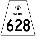
Highway628 was assumed by the Department of Highways, predecessor to the Ministry of Transportation on July28, 1961.[7] It remained unchanged from then until 2015, when construction began on four laning Highway11/17 between Red Rock Road9 and Stillwater Creek. The route was extended approximately 350m (1,150ft) west in June 2019 to the newly opened four lane highway.[8]
Secondary Highway643, commonly referred to as Highway643, is a secondary highway in the Canadian province of Ontario, located in Thunder Bay District. Its total length is approximately 19.6 kilometres (12.2mi) and runs roughly on a northwest–southeast orientation. The northern terminus intersects Exton Road northwest of Aroland First Nation while the southern terminus intersects Highway584 near Exton. A proposed all-season access road would connect Marten Falls First Nation to Highway643.[10]
Highway643 was assumed by the Department of Highways, predecessor to the modern Ministry of Transportation, in 1963. Although a short 1km section within Danford Township was assumed on November7, the majority of its length through Rupert Township and Exton Township was assumed on November21.[9]
↑ Ontario Road Map (Map). Cartography by C.P. Robins. Ontario Department of Highways. 1956.
↑ "Ontario Secondary Roads Now Designated 500, 600". The Globe and Mail. Vol.112, no.33, 119. February 4, 1956. p.4. Two new Ontario road numbers appear on the province's 1956 official road map which will be ready for distribution next week. The new numbers are the 500 and 600 series and designate hundreds of miles of secondary roads which are wholly maintained by the Highways Department. More than 100 secondary roads will have their own numbers and signs this year. All of these secondary roads were taken into the province's main highways system because they form important connecting links with the King's Highways
↑ Ontario Department of Highways (March 31, 1959). "Appendix No. 3A – Schedule of designations and Re-designations of Sections of the King's Highway and Secondary Highway Systems for the Fiscal Year Ending March 31, 1961". Annual Report (Report). pp.237–239. Retrieved February 7, 2021.
↑ Ontario Department of Highways (March 31, 1959). "Appendix No. 3A – Schedule of designations and Re-designations of Sections of the King's Highway and Secondary Highway Systems for the Fiscal Year Ending March 31, 1959". Annual Report (Report). pp.237–239. Retrieved February 7, 2021.
↑ Ontario Road Map (Map). Cartography by Photogrammetrey Office. Ministry of Transportation and Communications. 1982–83. §M9.
1 2 Ontario Department of Highways (March 31, 1961). "Appendix No. 3A – Schedule Of designations And Re-designations Of Sections of the King's Highway and Secondary Highway Systems for the Fiscal Year Ending March 31, 1961". Annual Report (Report). pp.241–242. Retrieved February 7, 2021.
This page is based on this Wikipedia article Text is available under the CC BY-SA 4.0 license; additional terms may apply. Images, videos and audio are available under their respective licenses.