
Timiskaming is a district and census division in Northeastern Ontario in the Canadian province of Ontario. The district was created in 1912 from parts of Algoma, Nipissing, and Sudbury districts. In 1921, Cochrane District was created from parts of this district and parts of Thunder Bay District.
King's Highway 101, commonly referred to as Highway 101, is a provincially maintained highway in the Canadian province of Ontario. The 473.3-kilometre (294.1 mi) highway connects Highway 17 west of Wawa with Highway 11 in Matheson before continuing east to the Ontario–Quebec border where it becomes Route 388. The highway forms one of the only connections between the two routes of the Trans-Canada Highway between Nipigon and Temagami, and crosses some of the most remote regions of Northern Ontario. Major junctions are located with Highway 129 near Chapleau and Highway 144 southwest of Timmins, though the distance between these junctions is significant.

Armstrong is a township in the Timiskaming District of Ontario. The only population centre in the township is the community of Earlton.
King's Highway 66, commonly referred to as Highway 66, is a provincially-maintained highway in the Canadian province of Ontario. Located in the Timiskaming District, the highway begins at Matachewan near a junction with Highway 65. It extends eastward for 107.0 kilometres (66.5 mi) to the Quebec boundary just east of Kearns. At the provincial boundary, the highway continues eastward as Route 117. From Highway 11 at Kenogami Lake eastwards to the Quebec boundary, Highway 66 is designated as part of the Trans-Canada Highway.
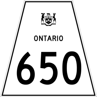
Secondary Highway 650, commonly referred to as Highway 650, is a provincially maintained highway in the Canadian province of Ontario. The highway is 7.6 kilometres (4.7 mi) in length, connecting Highway 112 in Dane with the now abandoned Adams Mine site. The route was designated in 1964, shortly after the mine opened. It is sparsely travelled, but paved throughout its length.
King's Highway 65, commonly referred to as Highway 65, is a provincially maintained highway in the Canadian province of Ontario. The route begins at Highway 66 and travels 123.3 kilometres (76.6 mi) southeast to the Quebec border. At its midpoint, the route is concurrent with Highway 11.
King's Highway 112, commonly referred to as Highway 112, is a provincially maintained highway in the northern portion of the Canadian province of Ontario. Formerly part of the Ferguson Highway, the route was designated with its own number in 1953, prior to which it formed a part of Highway 11. It travels east of the current Highway 11, around Round Lake and through Dane before ending at Highway 66 southwest of Kirkland Lake.
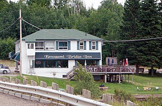
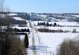
Kenogami Lake is an unincorporated place and community in the Unorganized West Part of Timiskaming District in northeastern Ontario, Canada. It is located on Kenogami Lake on the Blanche River in the Saint Lawrence River drainage basin.

Tertiary Highway 810, commonly referred to as Highway 810, is a provincially maintained access road, extending from Bull Lake to Richie Falls alongside the River aux Sables north of Massey. A northerly extension of Highway 553, the road was established in 1974 and has remained unchanged since then.

Secondary Highway 672, commonly referred to as Highway 672, is a provincially maintained secondary highway in the Canadian province of Ontario. The 47.6-kilometre (29.6 mi) route lies within Timiskaming and Cochrane district, connecting Highway 66 — part of the Trans-Canada Highway — in the south with Highway 101 in the north. It is the only highway to provide access to Esker Lakes Provincial Park. Though the highway was first assumed by the province in 1990, the existing road had been built north from Highway 66 to the provincial park in 1977 and extended to Highway 101 in the late 1980s.
Kenogami Lake Station is an unincorporated place and railway point in the Unorganized West Part of Timiskaming District in northwestern Ontario, Canada. It is located on the Blanche River in the Saint Lawrence River drainage basin.

The Blanche River is a river in the Saint Lawrence River drainage basin in Timiskaming District in northeastern Ontario, Canada. The river is a tributary of Lake Timiskaming and its name is from the French for the colour "white".

The Larder River is a river in Timiskaming District, in Northeastern Ontario, Canada. It is in the Saint Lawrence River drainage basin, and flows from its source at Larder Lake in geographic McFadden Township to its mouth as a left tributary of the Blanche River in the municipal township of Evanturel.


