List of secondary highways in Parry Sound District

Last updated

This is a list of secondary highways in Parry Sound District, many of which provide access to isolated settlements and recreational properties within the Parry Sound District of Ontario.

Contents

Highway 510

Ontario Highway 510.svg
Highway 510
Route information
Maintained by the Ministry of Transportation of Ontario
Length2.8 km [1]  (1.7 mi)
Major junctions
South endOntario Highway 520.svg  Highway 520 in Magnetawan
North endOntario 124 crown.svg  Highway 124Parry Sound, Sundridge
Location
Country Canada
Province Ontario
Districts Parry Sound
Highway system
Ontario Highway 505.svg Highway 505 Ontario Highway 516.svg Highway 516

Secondary Highway 510, commonly referred to as Highway 510, is a provincially maintained highway in the Canadian province of Ontario. The highway is 2.8 kilometres (1.7 mi) in length, connecting Highway 520 in Magnetawan with Highway 124.

Highway 518

Ontario Highway 518.svg
Highway 518
Route information
Maintained by the Ministry of Transportation of Ontario
Length72.7 km [1]  (45.2 mi)
Existed1956 [2] –present
Major junctions
West endOntario 400 crown.svg  Highway 400Parry Sound
East end Kearney
Location
Country Canada
Province Ontario
Districts Parry Sound
Major cities Orrville, Bear Lake, Sprucedale, Emsdale
Highway system
Ontario Highway 516.svg Highway 516 Ontario Highway 519.svg Highway 519

Secondary Highway 518, commonly referred to as Highway 518, is a provincially maintained secondary highway in the Canadian province of Ontario. Highway 518 spans 72.7 kilometres (45.2 mi) between Parry Sound and Kearney. It serves as one of the many links between Highway 400 and Highway 11. The highway was assumed in 1956, and has remained generally unchanged since, aside from being truncated slightly at both ends.

Highway 520

Ontario Highway 520.svg
Highway 520
Route information
Maintained by the Ministry of Transportation of Ontario
Length68 km [1]  (42 mi)
Major junctions
West end Ardbeg CN station
Major intersectionsOntario 124 crown.svg  Highway 124
Ontario Highway 510.svg  Highway 510Magnetawan
East endOntario 11 crown.svg  Highway 11Burk's Falls
Location
Country Canada
Province Ontario
Districts Parry Sound
Highway system
Ontario Highway 519.svg Highway 519 Ontario Highway 522.svg Highway 522

Secondary Highway 520, commonly referred to as Highway 520, is a provincially maintained highway in the Canadian province of Ontario. The highway is 68 kilometres (42 mi) in length, connecting several small communities in Parry Sound District with Highway 124 and Highway 11.

The highway links several remote First Nation hamlets to the major highway routes of the region. However, the only places of noteworthy size are the village of Magnetawan and the town of Burk's Falls. It is concurrent with Highway 124 for 15.4 kilometres (9.6 mi).

Highway 522

Ontario Highway 522.svg
Highway 522
Route information
Maintained by the Ministry of Transportation of Ontario
Length109.6 km [1]  (68.1 mi)
Major junctions
West endOntario 69 crown.svg  Highway 69Cranberry
East endOntario 11 crown.svg  Highway 11Powassan
Location
Country Canada
Province Ontario
Districts Parry Sound
Highway system
Ontario Highway 520.svg Highway 520 Ontario Highway 522B.svg Highway 522B

Secondary Highway 522, commonly referred to as Highway 522, is a provincially maintained highway in the Canadian province of Ontario. The highway is 109.6 kilometres (68.1 mi) in length, connecting Highway 69 near Cranberry with Highway 11 in Powassan. Highway 522 serves as the only link between these two routes south of Highway 17 and north of Highway 124. It is often used to access Grundy Lake Provincial Park, a popular camping area for northbound travellers.

Highway 522B

Ontario Highway 522B.svg
Highway 522B
Route information
Maintained by the Ministry of Transportation of Ontario
Length1.9 km [1]  (1.2 mi)
ExistedOctober 2002 [3] –present
Major junctions
South endOntario Highway 522.svg  Highway 522
Major intersectionsOntario 11 crown.svg  Highway 11North Bay
North endHemlock Road
(continues north as McCarthy Street)
Location
Country Canada
Province Ontario
Districts Parry Sound
Highway system
Ontario Highway 522.svg Highway 522 Ontario Highway 523.svg Highway 523

Secondary Highway 522B, commonly referred to as Highway 522B, is a provincially maintained highway in the Canadian province of Ontario. The highway is 1.9 kilometres (1.2 mi) in length, connecting Highway 522 within Trout Creek with Highway 11 to the north. The highway was created in late 2002 when the Trout Creek Bypass of Highway 11 opened; Highway 522B forms a portion of the former routing.

Highway 524

Ontario Highway 524.svg
Highway 524
Route information
Maintained by the Ministry of Transportation of Ontario
Length4.6 km [1]  (2.9 mi)
Existed1956 [2] –present
Major junctions
South endOntario Highway 522.svg  Highway 522 at Farley's Corners.
North endOntario Highway 534.svg  Highway 534 near Restoule
Location
Country Canada
Province Ontario
Districts Parry Sound
Highway system
Ontario Highway 523.svg Highway 523 Ontario Highway 525.svg Highway 525

Secondary Highway 524, commonly referred to as Highway 524, is a provincially maintained highway in the Canadian province of Ontario. The highway is 4.6 kilometres (2.9 mi) in length, connecting Highway 520 at Farley's Corners with Highway 534, which leads to Restoule.

Highway 526

Ontario Highway 526.svg
Highway 526
Route information
Maintained by the Ministry of Transportation of Ontario
Length3.9 km [1]  (2.4 mi)
Existed1956–present
Major junctions
West endBritt post office
East endOntario 69 crown.svg  Highway 69
Location
Country Canada
Province Ontario
Districts Parry Sound
Villages Britt
Highway system
Ontario Highway 525.svg Highway 525 Ontario Highway 527.svg Highway 527

Secondary Highway 526, commonly referred to as Highway 526, is a provincially maintained secondary highway in the Canadian province of Ontario. It is a short and lightly travelled route that connects Highway 69 with the community of Britt.

Highway 529

Ontario Highway 529.svg
Highway 529
Route information
Maintained by the Ministry of Transportation of Ontario
Length25.8 km [1]  (16.0 mi)
Major junctions
South endOntario 69 crown.svg  Highway 69 near Pointe au Baril
North endOntario 69 crown.svg  Highway 69 at Magnetawan River
Location
Country Canada
Province Ontario
Districts Parry Sound
Major cities Manbert, Naiscoot, Naiscoutaing
Highway system
Ontario Highway 528.svg Highway 528 Ontario Highway 529A.svg Highway 529A

Secondary Highway 529, commonly referred to as Highway 529, is a secondary highway in the Canadian province of Ontario. Located within Parry Sound District, the highway follows a 25.8-kilometre (16.0 mi) route, from its southern terminus at Highway 69 near Pointe au Baril to its northern terminus at Highway 69's crossing of the Magnetawan River near Byng Inlet.

Highway 529A

Ontario Highway 529A.svg
Highway 529A
Route information
Maintained by the Ministry of Transportation of Ontario
Length4.5 km [1]  (2.8 mi)
Existed1961–present
Major junctions
West endBayfield Lodge
East endOntario Highway 529.svg  Highway 529 at Manbert
Location
Country Canada
Province Ontario
Districts Parry Sound
Villages Bayfield Inlet, Manbert
Highway system
Ontario Highway 529.svg Highway 529 Ontario Highway 531.svg Highway 531

Secondary Highway 529A, commonly referred to as Highway 529A, is a provincially maintained secondary highway in the Canadian province of Ontario. Located within Parry Sound District, the highway is a short spur of Highway 529, extending from Manbert to Bayfield Inlet.

Highway 534

Highway 559

Ontario Highway 559.svg
Highway 559
Route information
Maintained by Ministry of Transportation of Ontario
Length18.2 km [1]  (11.3 mi)
Major junctions
Southwest endBlind Bay Road at Killbear Provincial Park
Northeast endOntario 400 crown.svg  Highway 400 at Nobel
Location
Country Canada
Province Ontario
Districts Parry Sound
Major cities Carling
Highway system
Ontario Highway 558.svg Highway 558 Ontario Highway 560.svg Highway 560

Secondary Highway 559, commonly referred to as Highway 559, is a secondary highway in the Canadian province of Ontario, located within the township of Carling in Parry Sound District. The 18.2-kilometre (11.3 mi) highway extends from the entrance to Killbear Provincial Park, near the shores of Georgian Bay, to an interchange with Highway 400 (Exit 247) north of Nobel.

The highway serves as an access road to most of the communities in Carling Township, as well as the current northern terminus of Highway 400 as of 2010. [4]

Highway 592

Ontario Highway 592.svg
Highway 592
Route information
Maintained by Ministry of Transportation of Ontario
Length16.4 km [1]  (10.2 mi)
ExistedMarch 23, 1961 [5] –present
Major junctions
South endOntario 11 crown.svg  Highway 11 (Exit 235) at Novar
Major intersectionsOntario Highway 518.svg  Highway 518 in Emsdale
North endKatrine Road (Highway 7188 near Katrine
Location
Country Canada
Province Ontario
Districts Parry Sound District
Towns Novar, Emsdale
Highway system
Ontario Highway 591.svg Highway 591 Ontario Highway 593.svg Highway 593

Secondary Highway 592, commonly referred to as Highway 592, is a secondary highway in the Canadian province of Ontario. Located in the Parry Sound District, the highway provides access to Novar, Emsdale, and others. It is the former routing of Highway 11 between Novar and Katrine. Highway 592 was assumed by the Department of Highways, predecessor to the modern Ministry of Transportation, on March 23, 1961. [5]

Highway 612

Ontario Highway 612.svg
Highway 612
Route information
Maintained by the Ministry of Transportation of Ontario
Length4.4 km [1]  (2.7 mi)
ExistedOctober 20, 1960 [6] –present
Major junctions
South end Parry SoundMuskoka boundary
North endLake Joseph Road (Highway 7289) at Gordon Bay
Location
Country Canada
Province Ontario
Divisions Parry Sound
Major cities Seguin
Highway system
Ontario Highway 611.svg Highway 611 Ontario Highway 613.svg Highway 613
Highway 612 at Highway 69 Highway 612.png
Highway 612 at Highway 69

Secondary Highway 612, commonly referred to as Highway 612, is a secondary highway in the Canadian province of Ontario. Located in the Parry Sound District, the highway extends for 4.4 kilometres (2.7 mi) from a junction with Lake Joseph Road, the former route of Highway 69, outside of Gordon Bay to the boundary of Parry Sound District with the regional municipality of Muskoka near a junction with Healey Lake Road.

At the boundary, the roadway continues southward as Muskoka Road 11 through MacTier. Prior to 1997, this county road was also part of Highway 612.

A previous iteration of Highway 612 existed in Algoma District between 1956 and 1958, which was renumbered as Highway 108 in late 1957 and 1958.

Highway 632

Ontario Highway 632.svg
Highway 632
Route information
Maintained by the Ministry of Transportation of Ontario
Length10.7 km (6.6 mi)
ExistedJuly 20, 1961 [7] –present
Major junctions
South end Parry Sound/Muskoka boundary
North endOntario 141 crown.svg  Highway 141 in Rosseau
Location
Country Canada
Province Ontario
Districts Parry Sound
Major cities Seguin
Highway system
Ontario Highway 631.svg Highway 631 Ontario Highway 633.svg Highway 633

Secondary Highway 632, commonly referred to as Highway 632, is a secondary highway in the Canadian province of Ontario, located in Parry Sound District. The highway extends for 10.7 kilometres (6.6 mi) from a junction with Highway 141 in Rosseau to the boundary between Parry Sound District and the Muskoka. At the boundary, the roadway continues southward as Muskoka Road 7 through the communities of Minett, Gregory and Port Sandfield. Prior to 1997, this county road was also part of Highway 632.

Highway 632 was first assumed by the Department of Highways, predecessor to the modern Ministry of Transportation, in Parry Sound District on July 20, 1961 at a length of 10.5 kilometres (6.5 mi). One week later, on July 29, another 16.1 kilometres (10.0 mi) within what was then just Muskoka District was assumed as part of the highway. [5]

When the District Municipality of Muskoka was created in 1971, secondary highways within its boundaries were transferred to Muskoka and redesignated as part of its county road network.
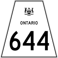
Highway 644

Ontario Highway 644.svg

Secondary Highway 644 commonly referred to as Highway 644, is a secondary highway in the Canadian province of Ontario. It is a very minor and extremely short route, and holds the distinction of being Ontario's shortest posted highway at only 800 metres (1/2 mile) in length.

It is located in Pointe au Baril in Parry Sound District and simply acts as an access road to the community from Highway 69.

Highway 645

Ontario Highway 645.svg
Highway 645
Route information
Maintained by Ministry of Transportation of Ontario
Length4.0 km [1]  (2.5 mi)
ExistedApril 1, 1964 [8] –present
Major junctions
West endTramway Avenue at Byng Inlet
East endOntario Highway 529.svg  Highway 529 near Magnetawan First Nation
Location
Country Canada
Province Ontario
Districts Parry Sound
Highway system
Ontario Highway 643.svg Highway 643 Ontario Highway 647.svg Highway 647
Former provincial highways
 Ontario Highway 644.svg  Highway 644 Highway 646 Ontario Highway 646.svg 

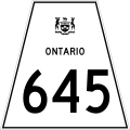
Secondary Highway 645, commonly referred to as Highway 645, is a secondary highway in the Canadian province of Ontario. Located within Parry Sound District, the highway extends for 4.0 kilometres (2.5 mi) from Highway 529 to the community of Byng Inlet. The route was established on April 1, 1964, [9] and has remained unchanged since then.

Highway 654

Ontario Highway 654.svg
Highway 654
Route information
Maintained by the Ministry of Transportation of Ontario
Length22.9 km [1]  (14.2 mi)
ExistedAugust 26, 1964 [9] –present
Major junctions
South endOntario Highway 534.svg  Highway 534 near Nipissing, Ontario
Major intersectionsOntario 94 crown.svg  Highway 94
East endOntario 11 crown.svg  Highway 11 at Callander
Location
Country Canada
Province Ontario
Districts Parry Sound
Highway system
Ontario Highway 653.svg Highway 653 Ontario Highway 655.svg Highway 655

Secondary Highway 654, commonly referred to as Highway 654, is a secondary highway in the Canadian province of Ontario. The highway is 22.9 kilometres (14.2 mi) in length, connecting Highway 534 south of Nipissing with Highway 11 in Callander. The route was designated through North Himsworth on August 26, 1964, and through Nipissing on August 28, [9] and has remained unchanged since then, aside from a short extension to the Highway 11 Callander Bypass. It is sparsely travelled, but paved throughout its length.

Related Research Articles

King's Highway 69, commonly referred to as Highway 69, is a provincially maintained north–south highway in the central portion of the Canadian province of Ontario. In conjunction with Highway 400, it links Toronto with the city of Greater Sudbury at Highway 17, via Parry Sound. It is part of the Trans-Canada Highway and the National Highway System. From its southern terminus of Highway 559 at Carling, Highway 69 begins as Highway 400 narrows from a four-laned freeway to a two lane highway. It travels northerly for approximately 68 kilometres (42 mi) to south of the French River before widening back to a divided four lane freeway for approximately 64 kilometres (40 mi) into Sudbury. The final 6 kilometres (3.7 mi) of the route, connecting to Highway 17, is a five lane arterial road that will be converted to freeway as the final phase of the four-laning.

Secondary Highway 510, commonly referred to as Highway 510, is a provincially maintained highway in the Canadian province of Ontario. The highway is 2.4 kilometres (1.5 mi) in length, connecting Highway 520 in Magnetawan with Highway 124. It was established in 1956, along with most of the secondary highway system in the province, and is little changed since then.

King's Highway 124, commonly known as Highway 124, is a provincially maintained highway in the Canadian province of Ontario. The highway connects Highway 400 in Parry Sound with Highway 11 in Sundridge, a distance of 91.2 km (56.7 mi), including a 15.4 km (9.6 mi) concurrency with Highway 520. It is one of several highways in central Ontario to provide this connection through the Muskoka and Parry Sound region, and the northernmost King's Highway south of Highway 17.

Secondary Highway 522, commonly referred to as Highway 522, is a provincially maintained highway in the Canadian province of Ontario. The highway is 109.6 kilometres (68.1 mi) in length, connecting Highway 69 near Cranberry with Highway 11 at the community of Trout Creek. Highway 522 serves as the only link between these two routes south of Highway 17 and north of Highway 124. It is often used to access Grundy Lake Provincial Park, a popular camping area for northbound travellers.

Secondary Highway 524, commonly referred to as Highway 524, is a provincially maintained highway in the Canadian province of Ontario. The highway is 4.6 kilometres (2.9 mi) in length, connecting Highway 522 at Farley's Corners with Highway 534, which leads to Restoule. It was established in 1956, along with most of the secondary highway system in the province, and has remained unchanged since then.

Secondary Highway 520, commonly referred to as Highway 520, is a provincially maintained highway in the Canadian province of Ontario. The highway is 67.9 kilometres (42.2 mi) in length, connecting several small communities in Parry Sound District with Highway 124 and Highway 11.

Secondary Highway 522B, commonly referred to as Highway 522B, is a provincially maintained highway in the Canadian province of Ontario. The highway is 1.9 kilometres (1.2 mi) in length, connecting Highway 522 within Trout Creek with Highway 11 to the north. The highway was created in late 2002 when the Trout Creek Bypass of Highway 11 opened; Highway 522B forms a portion of the former routing.

Secondary Highway 526, commonly referred to as Highway 526, is a provincially maintained secondary highway in the Canadian province of Ontario. It is a short and lightly travelled route that connects Highway 69 with the community of Britt.

Secondary Highway 532, commonly referred to as Highway 532, is a provincially maintained secondary highway in the Canadian province of Ontario. The route connects several mining and milling towns in Unorganized Algoma District, notably Searchmont. The route is remote, ending at a mine access road 14.2 kilometres (8.8 mi) north of Highway 556, its southern terminus.

King's Highway 103, commonly referred to as Highway 103, was a provincially maintained highway in the Canadian province of Ontario. Located in the District Municipality of Muskoka and Simcoe County, the highway extended from Highway 12 at Waubaushene to Highway 69 at Foot's Bay. Established in 1944, it was originally a short gravel highway connecting Waubaushene to Port Severn. In 1950 it was chosen as the future route of the Trans-Canada Highway and extended to Foot's Bay. It existed until 1976, when a series of renumberings eliminated the designation, replacing it with Highway 69; Highway 400 has since been built over the majority of the former route.

Secondary Highway 529, commonly referred to as Highway 529, is a provincially maintained secondary highway in the Canadian province of Ontario. Located within Parry Sound District, the highway follows a 25.7-kilometre (16.0 mi) route, from its southern terminus at Highway 69 near Pointe au Baril to its northern terminus at the Highway 69 crossing of the Magnetawan River near Byng Inlet. Two spur routes, Highway 529A and Highway 645, branch off the highway to serve the communities of Bayfield Inlet and Byng Inlet, respectively. The route was established along the present alignment of Highway 529A in 1956. It was relocated in 1961 along the former routing of Highway 69 when a bypass opened through the area, with the former alignment being renumbered as Highway 529A.

Secondary Highway 529A, commonly referred to as Highway 529A, is a provincially maintained secondary highway in the Canadian province of Ontario. Located within Parry Sound District, the highway is a short spur of Highway 529, extending from Manbert to Bayfield Inlet.

Secondary Highway 501, commonly referred to as Highway 501, was a provincially maintained secondary highway in the Canadian province of Ontario. The highway was 13.1 kilometres (8.1 mi) long, connecting Highway 103 north of Port Severn with Honey Harbour.

References

  1. 1 2 3 4 5 6 7 8 9 10 11 12 13 14 Ministry of Transportation of Ontario (2007). "Annual Average Daily Traffic (AADT) counts". Archived from the original on July 6, 2011. Retrieved July 7, 2011.
  2. 1 2 "Ontario Secondary Roads Now Designated 500, 600". Vol. 112, no. 33, 119. The Globe and Mail. February 4, 1956. p. 4. Two new Ontario road numbers appear on the province's 1956 official road map which will be ready for distribution next week. The new numbers are the 500 and 600 series and designate hundreds of miles of secondary roads which are wholly maintained by the Highways Department. More than 100 secondary roads will have their own numbers and signs this year. All of these secondary roads were taken into the province's main highways system because they form important connecting links with the King's Highways
  3. "Status of Construction Activity". Archived from the original on 2011-07-06. Retrieved 2011-07-10.
  4. Ginn, Cameron (October 27, 2010). "$177-million section of highway now open". Cottage Country Now. Metroland Media Group. Retrieved October 28, 2010.
  5. 1 2 3 Ontario Department of Highways (March 31, 1961). "Appendix No. 3A - Schedule of Designations and Re-designations of Sections of the King's Highway and Secondary Highway Systems for the Fiscal Year Ending March 31, 1961". Annual Report (Report). pp. 241–242. Retrieved February 8, 2021.
  6. Ontario Department of Highways (March 31, 1951). "Appendix No. 3A - Schedule Of designations And Re-designations Of Sections of the King's Highway and Secondary Highway Systems for the Fiscal Year Ending March 31, 1961". Annual Report (Report). pp. 241–242. Retrieved February 7, 2021.
  7. Ontario Department of Highways (March 31, 1961). "Appendix No. 3A - Schedule of Designations and Re-designations of Sections of the King's Highway and Secondary Highway Systems for the Fiscal Year Ending March 31, 1961". Annual Report (Report). pp. 237–242. Retrieved February 8, 2021.
  8. A.A.D.T. Traffic Volumes 1955–1969 And Traffic Collision Data 1967–1969. Ontario Department of Highways. 1970. p. 145.
  9. 1 2 3 Ontario Department of Highways (March 31, 1965). "Appendix 21 – Schedule of designations and re-designations of sections of King's Highway, Secondary Highway and Tertiary Road Systems for the Fiscal Year Ending March 31, 1965". Annual Report (Report). pp. 297–301. Retrieved February 8, 2021.