Long Point Township | |
---|---|
Township | |
Location in Livingston County | |
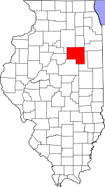
Livingston County's location in Illinois | |
Country | United States |
State | Illinois |
County | Livingston |
Established | November 3, 1857 |
Area | |
• Total | 36.42 sq mi (94.3 km2) |
• Land | 36.42 sq mi (94.3 km2) |
• Water | 0 sq mi (0 km2) 0% |
Population (2010) | |
• Estimate (2016) [1] | 476 |
• Density | 13.7/sq mi (5.3/km2) |
Time zone | CST (UTC-6) |
• Summer (DST) | CDT (UTC-5) |
FIPS code | 17-105-44589 |
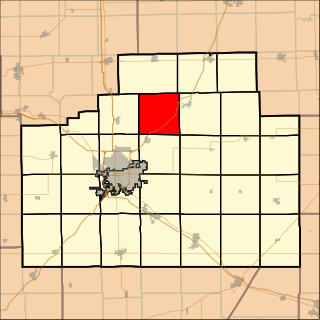
Long Point Township is located in Livingston County, Illinois. As of the 2010 census, its population was 498 and it contained 218 housing units. [2]
Livingston County is a county located in the U.S. state of Illinois. According to the 2010 census, it has a population of 38,950. Its county seat is Pontiac.
Illinois is a state in the Midwestern and Great Lakes region of the United States. It has the fifth largest gross domestic product (GDP), the sixth largest population, and the 25th largest land area of all U.S. states. Illinois is often noted as a microcosm of the entire United States. With Chicago in northeastern Illinois, small industrial cities and immense agricultural productivity in the north and center of the state, and natural resources such as coal, timber, and petroleum in the south, Illinois has a diverse economic base, and is a major transportation hub. Chicagoland, Chicago's metropolitan area, encompasses over 65% of the state's population. The Port of Chicago connects the state to international ports via two main routes: from the Great Lakes, via the Saint Lawrence Seaway, to the Atlantic Ocean and from the Great Lakes to the Mississippi River, via the Illinois Waterway to the Illinois River. The Mississippi River, the Ohio River, and the Wabash River form parts of the boundaries of Illinois. For decades, Chicago's O'Hare International Airport has been ranked as one of the world's busiest airports. Illinois has long had a reputation as a bellwether both in social and cultural terms and, through the 1980s, in politics.
According to the 2010 census, the township has a total area of 36.42 square miles (94.3 km2), all land. [2]
Historical population | |||
---|---|---|---|
Census | Pop. | %± | |
Est. 2016 | 476 | [1] | |
U.S. Decennial Census [3] |
Groveland Township is located in LaSalle County, Illinois. It is at the very southern end of LaSalle County. As of the 2010 census, its population was 628 and it contained 299 housing units. Groveland Township was formed from Eagle Township sometime prior to September, 1856.
Anchor Township is located in McLean County, Illinois. As of the 2010 census, its population was 286 and it contained 139 housing units. Anchor Township formed from Cropsey Township in 1877. The township's name most likely is derived from the hymn "My Soul Is Anchored in the Cross".
Bellflower Township is located in McLean County, Illinois. As of the 2010 census, its population was 585 and it contained 267 housing units. Bellflower Township changed its name from Prairie Township on May 17, 1858.
Blue Mound Township is located in McLean County, Illinois. As of the 2010 census, its population was 441 and it contained 202 housing units.
Cropsey Township is located in McLean County, Illinois. As of the 2010 census, its population was 222 and it contained 90 housing units. It was named after Col. A. J. Cropsey, the owner of a large farm in the area. In 1860 there were 25 families living in the township; by the 2000 census the total population was reported at 256.
Money Creek Township is located in McLean County, Illinois. As of the 2010 census, its population was 1,085 and it contained 511 housing units.
Towanda Township is located in McLean County, Illinois. As of the 2010 census, its population was 1,296 and it contained 555 housing units. It contains the entirety of the town of Towanda and a portion of the town of Normal.
Yates Township is located in McLean County, Illinois. As of the 2010 census, its population was 287 and it contained 121 housing units. Yates Township formed as Union Township from Chenoa Township on June 5, 1862. Union was changed to Yates sometime prior to 1920.
Broughton Township is located in Livingston County, Illinois. As of the 2010 census, its population was 313 and it contained 139 housing units. Broughton Township changed its name from Broughtonville Township on October 3, 1860.
Esmen Township is located in Livingston County, Illinois. As of the 2010 census, its population was 326 and it contained 141 housing units.
Nebraska Township is located in Livingston County, Illinois. As of the 2010 census, its population was 1,433 and it contained 627 housing units.
Pleasant Ridge Township is located in Livingston County, Illinois. As of the 2010 census, its population was 252 and it contained 90 housing units. Pleasant Ridge Township formed from Saunemin Township in April, 1859.
Rooks Creek Township is located in Livingston County, Illinois. As of the 2010 census, its population was 567 and it contained 233 housing units.
Saunemin Township is located in Livingston County, Illinois, United States. As of the 2010 census, its population was 666 and it contained 281 housing units. It is named after, and contains, Saunemin, Illinois.
Sullivan Township is located in Livingston County, Illinois. As of the 2010 census, its population was 724 and it contained 354 housing units. Sullivan Township formed from Saunemin Township in 1863.
Waldo Township is located in Livingston County, Illinois. As of the 2010 census, its population was 255 and it contained 100 housing units.
Douglas Township is one of twenty-six townships in Iroquois County, Illinois, USA. As of the 2010 census, its population was 2,104 and it contained 923 housing units. Douglas Township was formed from a portion of Onarga Township in May 1858.
Richland Township is located in Marshall County, Illinois. As of the 2010 census, its population was 446 and it contained 195 housing units.
Friends Creek Township is located in Macon County, Illinois. As of the 2010 census, its population was 1,450 and it contained 601 housing units.
Maroa Township is located in Macon County, Illinois. As of the 2010 census, its population was 2,100 and it contained 883 housing units.
Coordinates: 40°58′21″N88°52′20″W / 40.97250°N 88.87222°W
A geographic coordinate system is a coordinate system that enables every location on Earth to be specified by a set of numbers, letters or symbols. The coordinates are often chosen such that one of the numbers represents a vertical position and two or three of the numbers represent a horizontal position; alternatively, a geographic position may be expressed in a combined three-dimensional Cartesian vector. A common choice of coordinates is latitude, longitude and elevation. To specify a location on a plane requires a map projection.
This Livingston County, Illinois location article is a stub. You can help Wikipedia by expanding it. |