
Route 28 is a state highway in the central part of New Jersey, United States that is 26.44 mi (42.55 km) long. Its western terminus is at U.S. Route 22 (US 22) in Bridgewater Township, Somerset County, while its eastern terminus is at Route 27 in Elizabeth, Union County. From its western terminus, Route 28 heads east through Raritan, intersecting County Route 567 (CR 567) and then US 202 and US 206 at the Somerville Circle before heading through the central part of Somerville. Past Somerville, the route has interchanges with Interstate 287 (I-287) in Bridgewater Township before intersecting many 500-series county roads including CR 525 and CR 527 in Bound Brook, CR 529 in Dunellen, Middlesex County, CR 531 in Plainfield, Union County, and CR 509 in Westfield. Route 28 continues east, intersecting Route 59 and the Garden State Parkway in Cranford before heading to Elizabeth, where it crosses Route 439 before ending at Route 27. Route 28 is a two- to four-lane road its entire length that passes through suburban areas and runs within a close distance of New Jersey Transit’s Raritan Valley Line for much of its length.

Bound Brook is a borough in Somerset County, in the U.S. state of New Jersey, located along the Raritan River. As of the 2020 United States census, the borough's population was 11,988, an increase of 1,586 (+15.2%) from the 2010 census count of 10,402, which in turn reflected an increase of 247 (+2.4%) from the 10,155 counted in the 2000 census,.

Bridgewater Township is a township in Somerset County in the U.S. state of New Jersey, located within the heart of the Raritan Valley region. Situated within Central New Jersey and crisscrossed by several major highways, the township is known for being both the regional commercial hub for Somerset County and as a suburban bedroom community of New York City within the New York metropolitan area. The township is located roughly 32 miles (51 km) away from Manhattan and about 20 miles (32 km) away from Staten Island.
The Raritan River is a river of the U.S. state of New Jersey. Its watershed drains much of the mountainous areas in the northern and central sections of the state, emptying into the Raritan Bay near Staten Island on the Atlantic Ocean.

The South Branch Raritan River is a 50-mile-long (80 km) tributary of the Raritan River in New Jersey.

The North Branch Raritan River is a tributary of the Raritan River in central New Jersey.
Manalapan Brook is a tributary of the South River in Monmouth and Middlesex counties, New Jersey in the United States.

The Millstone River is a 38.6-mile-long (62.1 km) tributary of the Raritan River in central New Jersey in the United States.

The Lamington River, known as the Black River upstream of Pottersville, is a tributary of the North Branch Raritan River in central New Jersey in the United States.
North Branch is an unincorporated community and hamlet located mostly within Branchburg, in Somerset County, New Jersey, United States. A portion of North Branch is located in Bridgewater. The hamlet of North Branch, located on both sides of the North Branch of the Raritan River, brings the ambiance of a small village and charm to the area.

Schooley's or, officially, Schooleys Mountain is a mountain ridge in northern New Jersey that stretches from Lake Hopatcong in the north to Hampton in the south. It is centrally located within the southern Highlands, positioned almost equidistantly from the Kittatinny Valley in the west and the Piedmont plateau in the east. Schooley's Mountain is also one of the largest ridges in a group of geologically similar and parallel mountains, which include Allamuchy Mountain, Pohatcong Mountain, Scotts Mountain, and Jenny Jump Mountain.

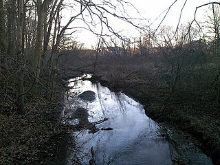
Peters Brook is a tributary of the Raritan River that flows south through Bridgewater Township and Somerville, New Jersey, in the United States. Some of its tributaries include Ross Brook and Mac's Brook.

U.S. Route 22 (US 22) is a United States Numbered Highway stretching from Cincinnati, Ohio, in the west to Newark, New Jersey, in the east. In New Jersey, the route runs for 60.53 miles (97.41 km) from the Easton–Phillipsburg Toll Bridge over the Delaware River in Phillipsburg, Warren County, to Interstate 78 (I-78), US 1/9, and Route 21 at the Newark Airport Interchange in Newark, Essex County. The road first heads through the Phillipsburg–Alpha area as an arterial road before running concurrent with I-78 through mountainous and agricultural sections of western New Jersey between Alpha and east of Clinton in Hunterdon County. For the remainder of the route, US 22 runs to the south of I-78 through mostly suburban areas as a four- to six-lane arterial road, passing through Hunterdon, Somerset, Union, and Essex counties. Along this portion, it intersects US 202 and US 206 in Somerville, I-287 in Bridgewater Township, and the Garden State Parkway in Union.

Middlebrook is an unincorporated community within the borough of Bound Brook in Somerset County, in the U.S. state of New Jersey. It is named after the Middle Brook, a tributary of the Raritan River, on the western side of the community. The early-18th-century Old York Road, connecting Philadelphia to New York City, passed through here.

Washington Valley Park is a 715-acre (2.89 km2) public park between the first and second Watchung mountain ridge in the Martinsville section of Bridgewater Township, New Jersey that is administered by the Somerset County Park Commission. It contains the Washington Valley Reservoir and the Chimney Rock Hawk Watch.

Hamden is an unincorporated community located within Clinton Township, in Hunterdon County, in the U.S. state of New Jersey.

Readingsburg, also known as Stone Mill, is an unincorporated community located along the South Branch Raritan River within Clinton Township in Hunterdon County, New Jersey.

Pumpkin Patch Brook is a stream in Union and Middlesex counties in the U.S. state of New Jersey. It is a tributary of Robinson's Branch of the Rahway River.

Spruce Run is a tributary of the Raritan River in Hunterdon County, New Jersey. It starts from the southwestern slope of Schooley's Mountain, northeast of Anthony in Lebanon Township, and flows southwest toward Glen Gardner. It then flows south toward Clinton, where it joins the South Branch Raritan River. The Mulhockaway Creek is a tributary and flows from Jug Mountain. The southern slopes of the Musconetcong Mountain drain into the Spruce Run.


