Related Research Articles

The Chenango River is a 90-mile-long (140 km) tributary of the Susquehanna River in central New York in the United States. It drains a dissected plateau area in upstate New York at the northern end of the Susquehanna watershed.

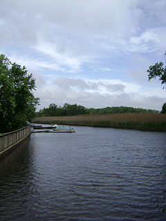
Brandywine Creek is a tributary of the Christina River in southeastern Pennsylvania and northern Delaware in the United States. The Lower Brandywine is 20.4 miles (32.8 km) long and is a designated Pennsylvania Scenic River with several tributary streams. The East Branch and West Branch of the creek originate within 2 miles (3 km) of each other on the slopes of Welsh Mountain in Honey Brook Township, Pennsylvania, about 20 miles (32 km) northwest of their confluence.
The Otselic River(aht-SEEL-ik), formerly known as Otselic Creek is a 55.4-mile-long (89.2 km) tributary of the Tioughnioga River in central New York in the United States. It drains a hilly area, mostly forested and agricultural, east of the Finger Lakes at the northern edge of the Susquehanna River watershed.

The Unadilla River is a 71-mile-long (114 km) river in the Central New York Region of New York State. The river begins northeast of the hamlet of Millers Mills and flows generally south to the village of Sidney, where it converges with the Susquehanna River, which drains into the Chesapeake Bay, a bay of the Atlantic Ocean.

Oriskany Creek is a 33-mile-long (53 km) river in New York, United States. It rises in Madison County and flows northeastward, primarily through Oneida County. Oriskany Creek is a tributary of the Mohawk River and therefore part of the Hudson River watershed.

The West Canada Creek is a 76-mile-long (122 km) river in upstate New York, United States. West Canada Creek is an important water way in Hamilton, Oneida, and Herkimer counties, draining the south part of the Adirondack Mountains before emptying into the Mohawk River near the Village of Herkimer. The name "Canada" is derived from a Native American word for "village" (Kanata).

Mill Creek is a neighborhood in the West Philadelphia section of Philadelphia, Pennsylvania. It sits between 44th and 52nd Streets north of Market Street and south of Girard Avenue. It is named for the eponymous creek which was buried in a pipe in the 19th century.

Table Mountain is located in Ulster County, New York. The mountain is part of the Catskill Mountains. Table Mountain is flanked to the south by Peekamoose Mountain, and to the northeast by Lone Mountain.

The Kayaderosseras Creek, usually shortened to Kaydeross, is the largest river that lies completely within Saratoga County, New York State. It originates in the Kayaderosseras Range in the northern part of the county, passes through the towns of Corinth, Greenfield, and Milton, and serves as the boundary between the City of Saratoga Springs and the Town of Malta before emptying into Saratoga Lake.

Sprout Creek is a 24.8-mile-long (39.9 km) creek located entirely within Dutchess County, New York, United States. It is the largest tributary of Fishkill Creek, entering that creek some 11 miles (18 km) upstream from the Hudson River. The creek is annually stocked with 6,000 brown trout, and maintains its own natural population of trout.
Tenmile Creek is a 15.0-mile-long (24.1 km) tributary of Catskill Creek in Albany County, New York. Via Catskill Creek, it is part of the Hudson River watershed.
Potic Creek is a 10.1-mile-long (16.3 km) tributary to Catskill Creek in the Catskill Mountains of New York. The name comes from the Mahican for a waterfall, originally referring to the falls in the Catskill near Wolcott Mills. Potic also originally referred to the name of the American Indian village below the falls and also of the commanding hill north of the falls.
Mill Creek, also previously known as Tierken Kill, is a tributary to the Hudson River. Poetanock was the Native American name for the stream. From its source just west of Snyders Lake in East Greenbush the stream travels southwest, then north and west to the Hudson River. The stream has two waterfalls, the Upper Falls on the Mill Brook, and the Lower Falls on the Mill Brook. Its mouth on the Hudson River is directly opposite Albany New York at what was Van Rensselaer Island, in the City of Rensselaer.
Sparkill Creek, is a tributary of the Hudson River in Rockland County, New York and Bergen County, New Jersey in the United States. It flows through the Sparkill Gap in the Hudson Palisades, which was created by a fault line which provided the only sea-level break in the Palisades.

Sauquoit Creek is a 17.0-mile-long (27.4 km) river in New York, United States. It lies within the southern part of Oneida County. The creek flows eastward, then turns sharply and flows generally northward through the Sauquoit Valley to the Mohawk River, entering the river on the east side of Whitesboro. It is therefore part of the Hudson River watershed.

Mill Pond Park is a public park in the Bronx, New York City. It was built to compensate for the loss of parkland resulting from the construction of new Yankee Stadium between 2006 and 2009. The park’s name was inspired by a dam near the site of a creek that emptied into the Harlem River.

The Canajoharie Creek is a river that flows into the Mohawk River in the Village of Canajoharie in the U.S. State of New York. The name "Canajoharie" is a Mohawk language term meaning "the pot that washes itself", referring to the "Canajoharie Boiling Pot", a 20-foot (6.1 m) wide and 10-foot (3.0 m) deep pothole in the Canajoharie Creek, just south of the village of Canajoharie. Bowmans Creek is one main tributary that enters the creek east of the Hamlet of Sprout Brook. The other main tributary is Brimstone Creek which enters the creek north-northwest of the Village of Ames.
Steele Creek begins in an unnamed swamp south of Cedarville and flows northeast before emptying into the Mohawk River in the Village of Ilion, New York. Steele Creek travels through the Ilion Gorge and alongside NY-51 for most of its length. Steele Creek derives its name from Rudolph Stahl, who built the first grist mill in Ilion along the creek.
References
- ↑ "Mill Creek". Geographic Names Information System . United States Geological Survey . Retrieved 2017-10-31.
| This article related to a river in New York is a stub. You can help Wikipedia by expanding it. |