New South Wales is a state on the east coast of Australia. It borders Queensland to the north, Victoria to the south, and South Australia to the west. Its coast borders the Coral and Tasman Seas to the east. The Australian Capital Territory and Jervis Bay Territory are enclaves within the state. New South Wales' state capital is Sydney, which is also Australia's most populous city. In December 2021, the population of New South Wales was over 8 million, making it Australia's most populous state. Just under two-thirds of the state's population, 5.3 million, live in the Greater Sydney area.

The New England National Park is a protected national park located on the Northern Tablelands in the New England region of New South Wales, Australia. The 67,303-hectare (166,310-acre) park was created in May 1935 and is situated approximately 560 kilometres (350 mi) north of Sydney, and 10 kilometres (6.2 mi) south of Waterfall Way, just 85 kilometres (53 mi) east of Armidale and 65 kilometres (40 mi) west of Coffs Harbour. The closest village to New England National Park is Ebor, located 20 kilometres (12 mi) away.

Tapin Tops National Park is a 110 km2 (42 sq mi) national park that is located in the Mid North Coast region of New South Wales, Australia.
The Limpinwood Nature Reserve is a protected nature reserve that is located on the Northern Rivers region of New South Wales, in eastern Australia. The reserve was gazetted in April 1963 with additions made in 1967, over former fauna and crown reserves, and further additions were made in 1988 to make the reserve to its current area of 2,646 hectares. The reserve is situated north-west of the rural locality of Limpinwood, and north of Tyalgum and defines part of the state border between New South Wales and Queensland.
Berry is a small Australian village in the Shoalhaven region of the New South Wales South Coast, located 143 km (89 mi) south of the state capital, Sydney. It has many historical buildings which are listed on the New South Wales Heritage Register. Berry attracts many tourists who come to enjoy the diversity of landscapes, including coastal beaches, rich dairy farming, and forested mountains. The village hosts a local Produce Market which is held twice each month on the second Saturday and fourth Sunday. Together with Kiama 23 km (14 mi) to the north, Berry acts as a gateway through to other towns and villages along the South Coast of NSW via the Princes Highway and the South Coast railway line. Major highway building projects in and around Berry have now bypassed the village, creating uninterrupted motorway conditions for coastal travel south to Nowra and the South Coast and north to Wollongong and Sydney. This has resulted in the removal of all but local and visitor traffic within the village. Planning is underway to create a pedestrian-friendly precinct in and around Queens Street.

Nowra is a city in the South Coast region of New South Wales, Australia. It is located 160 kilometres (99 mi) south-southwest of the state capital of Sydney. As of the 2021 census, Nowra has an estimated population of 22,584. Situated in the southern reaches of the Sydney basin, Nowra is the seat and commercial centre of the City of Shoalhaven.

Northern Rivers is the most north-easterly region of the Australian state of New South Wales, located between 590 and 820 kilometres north of the state capital, Sydney, and encompasses the catchments and fertile valleys of the Clarence, Richmond, and Tweed rivers. It extends from Tweed Heads in the north to the southern extent of the Clarence river catchment which lies between Grafton and Coffs Harbour, and includes the main towns of Tweed Heads, Byron Bay, Ballina, Kyogle, Lismore, Casino and Grafton. At its most northern point, the region is 102 kilometres (63 mi) south-southeast of the Queensland capital, Brisbane.

The American Discovery Trail is a system of recreational trails and roads that collectively form a coast-to-coast hiking and biking trail across the mid-tier of the United States. Horses can also be ridden on most of this trail. The coastal trailheads are the Delmarva Peninsula on the Atlantic Ocean and the northern California coast on the Pacific Ocean. The trail has northern and southern alternates for part of its distance, passing through Chicago and St. Louis respectively. The total length of the trail, including both the north and south routes, is 6,800 miles (10,900 km). The northern route covers 4,834 miles (7,780 km) with the southern route covering 5,057 miles (8,138 km). It is the only non-motorized coast-to-coast trail.
Taylors Arm is a village in the Nambucca Valley in New South Wales, Australia.

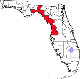
The Nature Coast is an informal, unofficial region of the U.S. state of Florida. The broadest definition of the Nature Coast includes the eight counties that abut the Gulf of Mexico along the Big Bend Coast defined by geologists: from west to east, Wakulla, Jefferson, Taylor, Dixie, Levy, Citrus, Hernando, and Pasco counties. The name "Nature Coast" was originally devised as part of a marketing campaign to promote tourism in Levy, Citrus, Hernando, and parts of Marion and Pasco counties.

The Nambucca River is a river located in the Mid North Coast region of New South Wales, Australia.

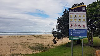
Valla is a suburb in the Nambucca Valley, on the Mid North Coast of New South Wales, Australia. The name was chosen to match that of the British residence of nineteenth century diplomat Andrew Buchanan.

Tweed Shire is a local government area located in the Northern Rivers region of New South Wales, Australia. It is adjacent to the border with Queensland, where that meets the Coral Sea. Administered from the town of Murwillumbah, Tweed Shire covers an area of 1,321 square kilometres (510 sq mi), and has existed as a local government entity since 1947. It was named for the Tweed River.

Numinbah Valley is a rural locality in the City of Gold Coast, Queensland, Australia. In the 2016 census, Numinbah Valley had a population of 218 people.

The Gold Coast hinterland is an area of South East Queensland, Australia that comprises the Tweed Range, Nimmel Range, Tamborine Mountain, Numinbah Valley, eastern parts of the McPherson Range and western parts of suburban Gold Coast, such as Mudgeeraba. This undefined unit of area is known for its tourist attractions including resorts, rainforest, lookouts, national parks, its diversity of fauna and flora and as a green backdrop to the coastal strip. It overlaps part of the Scenic Rim and is part of both the City of Gold Coast and Scenic Rim Region and includes Springbrook, Binna Burra and O'Reilly.
Taylors Arm is a perennial river of the Nambucca River catchment, located in the Mid North Coast region of New South Wales, Australia.

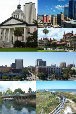
North Florida is a region of the U.S. state of Florida comprising the northernmost part of the state. Along with South Florida and Central Florida, it is one of Florida's three most common "directional" regions. It includes Jacksonville and nearby localities in Northeast Florida, an interior region known as North Central Florida, and the Florida Panhandle.

The Black Bulga State Conservation Area is a protected conservation area located near the Barrington Tops, in the Hunter Region of New South Wales, Australia. The 1,554-hectare (3,840-acre) conservation area is situated 16 kilometres (9.9 mi) from Dungog, and used to be part of Trevor State Forest and Chichester State Forest.
Tomerong is a village in the South Coast region of New South Wales, Australia. It is located approximately 180 kilometres by road south from the state capital Sydney and 20 kilometres south of the commercial centre of the City of Shoalhaven, Nowra in the County of St Vincent. The village is eight kilometres inland of the western shores of Jervis Bay. Its population at the 2021 census was 1,194.

MidCoast Council is a local government area that is located in the Mid North Coast region of New South Wales, Australia. The council was formed on 12 May 2016 through a merger of the Gloucester Shire, Great Lakes and City of Greater Taree Councils.


