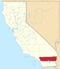
Mountain Center, California

Last updated

Mountain Center
Pines to Palms Scenic Byway, Mountain Center, California.jpg
Riverside County California Incorporated and Unincorporated areas Mountain Center Highlighted 0649544.svg
USA California location map.svg
Red pog.svg
Mountain Center
Location within the state of California
Usa edcp location map.svg
Red pog.svg
Mountain Center
Mountain Center (the United States)
Coordinates: 33°42′15″N116°43′33″W / 33.70417°N 116.72583°W / 33.70417; -116.72583
Country United States
State California
County Riverside
Area
[1]
  Total1.886 sq mi (4.885 km2)
  Land1.884 sq mi (4.881 km2)
  Water0.002 sq mi (0.004 km2)  0.09%
Elevation
[2]
4,518 ft (1,377 m)
Population
 (2020) [3]
  Total66
  Density35/sq mi (14/km2)
Time zone UTC-8 (Pacific (PST))
  Summer (DST) UTC-7 (PDT)
ZIP codes
92561
GNIS feature IDs 1661073; 2629133

Mountain Center is an unincorporated community and census-designated place [4] in the San Jacinto Mountains, within western central Riverside County, California.

Contents

Geography

It lies centered on the junction of State Route 74 and State Route 243 in the southern division of San Bernardino National Forest. Mountain Center lies just north of Lake Hemet, midway between Hemet and Palm Desert, just south of the town of Idyllwild, and it is southeast of the city of Riverside, the county seat of Riverside County. [5] Its elevation is 4,518 feet (1,377 m). [2] Although Mountain Center is unincorporated, it has a post office, with the ZIP code of 92561. [6]

According to the United States Census Bureau, the CDP covers an area of 1.9 square miles (4.9 km2), 99.91% of it land, and 0.09% of it water.

Lake Hemet is the only major body of water in Mountain Center. [7]

The Mountain Fire and the Cranston Fire burn scars remain visible in the community.

Demographics

At the 2010 census Mountain Center had a population of 63. The population density was 33.4 inhabitants per square mile (12.9/km2). The racial makeup of Mountain Center was 60 (95%) White, 0 (0%) African American, 1 (1%) Native American, 1 (1%) Asian, 0 (0%) Pacific Islander, 0 (0%) from other races, and 1 (1%) from two or more races. Hispanic or Latino of any race were 15 people (24%). [8]

The whole population lived in households, no one lived in non-institutionalized group quarters, and no one was institutionalized.

There were 36 households, 5 (14%) had children under the age of 18 living in them, 13 (36%) were opposite-sex married couples living together, 3 (8%) had a female householder with no husband present, 0 (0%) had a male householder with no wife present. There were 0 (0%) unmarried opposite-sex partnerships, and 0 (0%) same-sex married couples or partnerships. 19 households (53%) were one person and 6 (17%) had someone living alone who was 65 or older. The average household size was 1.75. There were 16 families (44% of households); the average family size was 2.56.

The age distribution was 12 people (19%) under the age of 18, 0 people (0%) aged 18 to 24, 8 people (13%) aged 25 to 44, 30 people (48%) aged 45 to 64, and 13 people (21%) who were 65 or older. The median age was 53.5 years. For every 100 females, there were 75.0 males. For every 100 females age 18 and over, there were 70.0 males.

There were 58 housing units at an average density of 30.8 per square mile, of the occupied units, 25 (69%) were owner-occupied and 11 (31%) were rented. The homeowner vacancy rate was 29%; the rental vacancy rate was 27%. 40 people (64% of the population) lived in owner-occupied housing units and 23 people (37%) lived in rental housing units.

Government

Federal:

State:

Local:

Transportation

Forest Folk, using a grant from the Riverside County Transportation Commission, operates the Idyllwild Shuttle, which provides door-to-door service. [13]

Education

It is in the Hemet Unified School District. [14]

See also

Related Research Articles

<span class="mw-page-title-main">Banning, California</span> American city in California, United States

Banning is a city in Riverside County, California, United States. Its population was 29,505 as of the 2020 census, down from 29,603 at the 2010 census. It is situated in the San Gorgonio Pass, also known as Banning Pass. It is named for Phineas Banning, stagecoach line owner and the "Father of the Port of Los Angeles."

<span class="mw-page-title-main">East Hemet, California</span> Census-designated place in California, United States

East Hemet is a census-designated place (CDP) in Riverside County, California, United States, located east of Hemet. East Hemet is in an unincorporated area outside the city limits of Hemet. The population was 17,418 at the 2010 census, up from 14,823 at the 2000 census.

<span class="mw-page-title-main">Hemet, California</span> City in California, United States

Hemet is a city in the San Jacinto Valley in Riverside County, California. It covers a total area of 29.3 square miles (76 km2), about half of the valley, which it shares with the neighboring city of San Jacinto. The population was 89,833 at the 2020 census. It borders San Jacinto to the north, East Hemet to the east, Polly Butte and Diamond Valley Lake to the south, and Green Acres and Juniper Springs to the west.

<span class="mw-page-title-main">Idyllwild–Pine Cove, California</span> Community in Riverside County

Idyllwild, Pine Cove, and Fern Valley are three adjacent unincorporated communities in the San Jacinto Mountains in Riverside County, California, United States. Idyllwild has the largest population of the three. For statistical purposes, the United States Census Bureau has defined Idyllwild–Pine Cove as a census-designated place (CDP). The CDP's population was 3,874 at the 2010 census, up from 3,504 as of the 2000 census.

<span class="mw-page-title-main">Nuevo, California</span> Census-designated place in California, United States

Nuevo is a rural community located east of Lake Perris and the city of Perris in Riverside County, California. The population of the census-designated place (CDP) is 7,033 according to the 2020 census, up from 6,447 at the 2010 census.

<span class="mw-page-title-main">Pedley, California</span> Place in California, United States

Pedley was a census-designated place (CDP) in Riverside County, California, United States. The population was 12,672 at the 2010 census, up from 11,207 at the 2000 census. On July 1, 2011, the CDP became part of the City of Jurupa Valley.

<span class="mw-page-title-main">Perris, California</span> City in Riverside County, California, United States

Perris is an old railway city in Riverside County, California, United States, located 71 miles (114 km) east-southeast of Los Angeles and 81 miles (130 km) north of San Diego. It is known for Lake Perris, an artificial lake, skydiving, Southern California Railway Museum, and its sunny dry climate. Perris is within the Inland Empire metropolitan area of Southern California. Perris had a population of 78,700 as of the 2020 census.

<span class="mw-page-title-main">San Jacinto, California</span> City in Riverside County in southern California, US

San Jacinto is a city in Riverside County, California, United States. It is located at the north end of the San Jacinto Valley, with Hemet to its south and Beaumont to its north. The mountains associated with the valley are the San Jacinto Mountains. The population was 44,199 at the 2010 census. The city was founded in 1870 and incorporated on April 20, 1888, making it one of the oldest cities in Riverside County.

<span class="mw-page-title-main">Valle Vista, California</span> Place in California, United States

Valle Vista is a unincorporated area in Riverside County, California, United States and is located in the San Jacinto Valley. Valle Vista is adjacent to and east of the cities of San Jacinto and Hemet. The population was 11,036 at the 2010 census, up from 8,356 at the 2000 census. For statistical purposes, the United States Census Bureau has defined Valle Vista as a census-designated place (CDP).

<span class="mw-page-title-main">Wildomar, California</span> City in California, United States

Wildomar is a city in southwest Riverside County, California, United States. The city was incorporated on July 1, 2008. As of the 2020 census, the population was 36,875. The community has grown quickly during the early 21st century; the population has more than doubled since the 2000 census, when the community was still an unincorporated census-designated place.

<span class="mw-page-title-main">Winchester, California</span> Census-designated place in California, United States

Winchester is a census-designated place (CDP) in Riverside County, California, USA. As of the 2010 census, the CDP had a total population of 2,534, up from 2,155 at the 2000 census.

<span class="mw-page-title-main">Aguanga, California</span> Census-designated place in California, United States

Aguanga is a census-designated place located within the Inland Empire, Riverside County, California. It is located about 18 miles (29 km) east of Temecula and 22 miles (35 km) south-southeast of Hemet. Aguanga lies at an elevation of 1955 feet. As of the 2010 census, it had a population of 1,028.

<span class="mw-page-title-main">Anza, California</span> Census-designated place in California, United States

Anza is a census-designated place located in southwestern Riverside County, California, in the Anza Valley, a semi-arid region at a mean elevation of 3,921 feet (1,195 m) above sea level. It is located 13 miles (21 km) south of Idyllwild, 32 miles (51 km) east-northeast of Temecula, 40 miles (64 km) southwest of Palm Springs, and 90 miles (140 km) northeast of San Diego, being traversed by State Route 371. Anza is on the Pacific Crest Trail. The population was 3,075 at the 2020 census.

Hemet Unified School District is a school district in Hemet, California which covers; Hemet, East Hemet, Valle Vista, Anza, Winchester, and Idyllwild. Christi Barrett is the district's Superintendent, having succeeded Dr. Barry L. Kayrell, EdD in June 2016. Stacey Bailey is the president of the Board of Education.

<span class="mw-page-title-main">Menifee, California</span> City in California, United States

Menifee is a city in Riverside County, California, United States, and is part of the Inland Empire. Named after a local miner, Luther Menifee Wilson, it was settled in the 19th century, and established as an independent city in 2008. Since then, Menifee has become one of the fastest growing cities in California and the United States.

<span class="mw-page-title-main">Whitewater, California</span> Census-Designated Place in California, United States

Whitewater is a census-designated place in Riverside County, California. It is directly off Interstate 10 halfway between North Palm Springs and Cabazon on the way from Palm Springs to Los Angeles. It is known as the site of the San Gorgonio Pass Wind Farm. The ZIP Code is 92282, and the community is inside area code 760. The population was 859 at the 2010 census. The elevation is 1,575 feet (480 m).

<span class="mw-page-title-main">San Jacinto Valley</span> Valley in Riverside County, California

The San Jacinto Valley is a valley located in Riverside County, in Southern California, in the Inland Empire. The valley is located at the base of the San Jacinto Mountains in the east and Santa Rosa Hills to the south with the San Gorgonio Pass to the north. The average elevation is 1,500 feet (460 m), with the highest points in the foothills south of Hemet and the western slopes of the San Jacinto Mountains. It is home to two cities, Hemet and San Jacinto, and several unincorporated communities. According to the 2020 census, the valley has a combined population of over 190,000 residents, including more than 143,000 residents within the city limits of Hemet and San Jacinto. The valley is also where the story and play "Ramona" was set; the story was written after author Helen Hunt Jackson visited the valley in the 1880s. The valley is also known for being an area of agriculture, which has given way to more urbanized development.

<span class="mw-page-title-main">Riverside County, California</span> County in California, United States

Riverside County is a county located in the southern portion of the U.S. state of California. As of the 2020 census, the population was 2,418,185, making it the fourth-most populous county in California and the 10th-most populous in the United States. The name was derived from the city of Riverside, which is the county seat.

<span class="mw-page-title-main">Lake Riverside, California</span> Census-designated place in California, United States

Lake Riverside is a census-designated place in the south western part of Riverside County, California. Lake Riverside sits at an elevation of 3,379 feet (1,030 m). The 2010 United States census reported Lake Riverside's population was 1,173. The community is named after the man-made Lake that the community surrounds.

<span class="mw-page-title-main">Cranston Fire</span> 2018 wildfire in Southern California

The Cranston Fire was a wildfire that burned in southwest Riverside County, California, in the United States. The fire was started on July 25, 2018, by Brandon M. McGlover, in an act of arson. The fire burned a total of 13,139 acres (53 km2), before it was fully contained on August 10. The Cranston Fire impacted the communities of Idyllwild, Mountain Center, and Anza as well as recreational activities in the Lake Hemet area, San Bernardino National Forest and Mount San Jacinto State Park. Over 7,000 people were evacuated due to the Cranston Fire. These communities also went without power for 11 days in 100° temperatures.

References

  1. "U.S. Census". Archived from the original on January 25, 2012.
  2. 1 2 "Mountain Center". Geographic Names Information System . United States Geological Survey, United States Department of the Interior. January 19, 1981. Retrieved April 29, 2008.
  3. "US Census Bureau". www.census.gov. Retrieved September 10, 2024.
  4. U.S. Geological Survey Geographic Names Information System: Mountain Center, California
  5. Rand McNally. The Road Atlas '08. Chicago: Rand McNally, 2008, p. 15.
  6. "Free ZIP Code Lookup with area code, county, geocode, MSA/PMSA, population". www.zipinfo.com.
  7. "Lake Hemet". Lake Hemet.
  8. "2010 Census Interactive Population Search: CA - Mountain Center CDP". U.S. Census Bureau. Archived from the original on July 15, 2014. Retrieved July 12, 2014.
  9. "California's 41st Congressional District - Representatives & District Map". Civic Impulse, LLC.
  10. "Statewide Database". Regents of the University of California. Archived from the original on February 1, 2015. Retrieved May 1, 2015.
  11. "Our District". Riverside County District 3.
  12. "Riverside County Sheriff, CA | Official Website". www.riversidesheriff.org.
  13. "Forest Folk". forestfolk.org.
  14. "2020 CENSUS - SCHOOL DISTRICT REFERENCE MAP: Riverside County, CA" (PDF). U.S. Census Bureau. p. 3 (PDF p. 4/6). Retrieved October 4, 2024. - Text list