Norridgewock, Maine | |
---|---|
Country | United States |
State | Maine |
County | Somerset |
Area | |
• Total | 51.21 sq mi (132.63 km2) |
• Land | 49.95 sq mi (129.37 km2) |
• Water | 1.26 sq mi (3.26 km2) |
Population (2020) | |
• Total | 3,278 |
• Density | 66/sq mi (25.3/km2) |
Time zone | UTC-5 (Eastern (EST)) |
• Summer (DST) | UTC-4 (EDT) |
Norridgewock is a town in Somerset County, Maine, United States. The population was 3,278 at the 2020 census. [2]
Situated on the New England and Acadia border, which New France defined as the Kennebec River, the area was once territory of the Norridgewock Indians, a band of the Abenaki nation. Their village was located at Old Point, now part of Madison. [3]
English colonists suspected Father Sebastien Rale (or Rasle), the French missionary at the village since 1694, of abetting tribal hostilities against British settlements during the French and Indian Wars. During Father Rale's War, soldiers left Fort Richmond (now Richmond) in whaleboats until they reached Taconic Falls (now Winslow), then marched quietly to Norridgewock Village, arriving on August 23, 1724. Battle of Norridgewock was "sharp, short and decisive," leaving 26 warriors slain, 14 wounded and 150 survivors fleeing to Quebec, Canada. Father Rale was among the dead. [4]
The British settled the area in 1773, then called Norridgewock Plantation. In 1775, Benedict Arnold and his troops marched through on their way to the Battle of Quebec. [3]
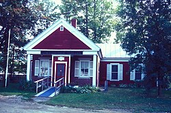
The town was incorporated on June 18, 1788. It became county seat of Somerset County in 1809, [5] with a courthouse built in 1820 and remodeled in 1847, although the county seat would be moved to Skowhegan in 1871. [6] Wooden logs were floated down the Kennebec River. A sawmill was built to manufacture the region's abundant hardwoods, used in local factories to make carriages and furniture. Norridgewock also had a gristmill and granite works. Built in 1849 and replaced in 1929, the 600-foot (180 m) Norridgewock Covered Bridge across the Kennebec River was the second longest covered bridge in Maine after the 792-foot (241 m) Bangor Covered Bridge, which was built in 1846 across the Penobscot River to Brewer. The Eaton School was organized by Hamlin F. Eaton in 1856 and incorporated in 1874 " ... for the promotion of literature, science and morality." Its Second Empire building, designed by architect Charles F. Douglas of Lewiston, later became Somerset Grange #18. In 1988, it was listed on the National Register of Historic Places. [7]
According to the United States Census Bureau, the town has a total area of 51.21 square miles (132.63 km2), of which 49.95 square miles (129.37 km2) is land and 1.26 square miles (3.26 km2) is water. [1] Norridgewock is drained by the Sandy River, Mill Stream and Kennebec River.
The village is located at the junction of U.S. Routes 2 and 201A with Maine State routes 8 and 139. Norridgewock borders the towns of Madison to the north, Skowhegan to the east, Fairfield and Smithfield to the south, and Mercer and Starks to the west.
Census | Pop. | Note | %± |
---|---|---|---|
1790 | 333 | — | |
1800 | 633 | 90.1% | |
1810 | 880 | 39.0% | |
1820 | 1,454 | 65.2% | |
1830 | 1,710 | 17.6% | |
1840 | 1,865 | 9.1% | |
1850 | 1,848 | −0.9% | |
1860 | 714 | −61.4% | |
1870 | 1,756 | 145.9% | |
1880 | 1,491 | −15.1% | |
1890 | 1,656 | 11.1% | |
1900 | 1,495 | −9.7% | |
1910 | 1,608 | 7.6% | |
1920 | 1,532 | −4.7% | |
1930 | 1,481 | −3.3% | |
1940 | 1,511 | 2.0% | |
1950 | 1,784 | 18.1% | |
1960 | 1,634 | −8.4% | |
1970 | 1,964 | 20.2% | |
1980 | 2,552 | 29.9% | |
1990 | 3,105 | 21.7% | |
2000 | 3,294 | 6.1% | |
2010 | 3,367 | 2.2% | |
2020 | 3,278 | −2.6% | |
U.S. Decennial Census [8] |
As of the census [9] of 2010, there were 3,367 people, 1,378 households, and 984 families living in the town. The population density was 67.4 inhabitants per square mile (26.0/km2). There were 1,520 housing units at an average density of 30.4 per square mile (11.7/km2). The racial makeup of the town was 97.2% White, 0.5% African American, 0.3% Native American, 0.2% Asian, 0.2% from other races, and 1.6% from two or more races. Hispanic or Latino of any race were 0.5% of the population.
There were 1,378 households, of which 30.3% had children under the age of 18 living with them, 55.5% were married couples living together, 10.1% had a female householder with no husband present, 5.8% had a male householder with no wife present, and 28.6% were non-families. 21.8% of all households were made up of individuals, and 7.9% had someone living alone who was 65 years of age or older. The average household size was 2.44 and the average family size was 2.78.
The median age in the town was 42.7 years. 22.3% of residents were under the age of 18; 7.2% were between the ages of 18 and 24; 24.4% were from 25 to 44; 31% were from 45 to 64; and 15.1% were 65 years of age or older. The gender makeup of the town was 50.0% male and 50.0% female.
As of the census [10] of 2000, there were 3,294 people, 1,285 households, and 953 families living in the town. The population density was 66.1 inhabitants per square mile (25.5/km2). There were 1,389 housing units at an average density of 27.9 per square mile (10.8/km2). The racial makeup of the town was 98.36% White, 0.30% Black or African American, 0.46% Native American, 0.12% Asian, 0.18% from other races, and 0.58% from two or more races. Hispanic or Latino of any race were 0.36% of the population.
There were 1,285 households, out of which 35.8% had children under the age of 18 living with them, 60.6% were married couples living together, 9.1% had a female householder with no husband present, and 25.8% were non-families. 18.8% of all households were made up of individuals, and 8.2% had someone living alone who was 65 years of age or older. The average household size was 2.56 and the average family size was 2.90.
In the town, the population was spread out, with 26.3% under the age of 18, 6.3% from 18 to 24, 30.1% from 25 to 44, 25.7% from 45 to 64, and 11.5% who were 65 years of age or older. The median age was 38 years. For every 100 females, there were 97.5 males. For every 100 females age 18 and over, there were 94.9 males.
The median income for a household in the town was $35,679, and the median income for a family was $41,536. Males had a median income of $31,800 versus $20,508 for females. The per capita income for the town was $17,325. About 15.1% of families and 16.3% of the population were below the poverty line, including 24.4% of those under age 18 and 12.2% of those age 65 or over.
Somerset County is a county in the U.S. state of Maine, United States. As of the 2020 census, the population was 50,477. Its county seat is Skowhegan.
Belgrade is a town in Kennebec County, Maine, United States. Its population was 3,250 at the 2020 census. However, its population approximately doubles during the summer months as part-year residents return to seasonal camps on the shores of Great Pond, Long Pond and Messalonskee Lake. Belgrade includes the villages of North Belgrade, Belgrade Depot and Belgrade Lakes. It is included in the Augusta, Maine micropolitan New England City and Town Area.
Manchester is a town in Kennebec County, Maine, United States, located at 44.33°N 69.87°W. The population was 2,456 at the 2020 census. The southern part of the town bordering Cobbosseecontee Lake is a popular recreation spot in central Maine, and part of the Winthrop Lakes Region. Manchester is included in the Augusta, Maine micropolitan and included in the Lewiston-Auburn, Maine metropolitan New England City and Town Area.
Monmouth is a town in Kennebec County, Maine, United States. Monmouth is included in the Lewiston-Auburn, Maine metropolitan New England city and town area. The population was 4,066 at the 2022 census.
Vienna is a town in Kennebec County, Maine, United States. The population was 578 at the 2020 census.
Arrowsic is a town in Sagadahoc County, Maine, United States. The population is 477 as of the 2020 United States Census. It is part of the Portland–South Portland–Biddeford, Maine metropolitan statistical area. During the French and Indian Wars, Arrowsic was site of a succession of important and embattled colonial settlements. It is a favorite with artists and birdwatchers.
Georgetown is a town in Sagadahoc County, Maine, United States. The population was 1,058 at the 2020 census. Home to Reid State Park, the town is part of the Portland–South Portland–Biddeford, Maine Metropolitan Statistical Area. Located on an island accessible by car from the mainland, Georgetown includes the villages of Five Islands, Georgetown, Bay Point, Marrtown, West Georgetown and Robinhood. It is a popular tourist destination.
Phippsburg is a town in Sagadahoc County, Maine, United States, on the west side of the mouth of the Kennebec River. The population was 2,155 at the 2020 census. It is within the Portland–South Portland–Biddeford, Maine, metropolitan statistical area. A tourist destination, Phippsburg is home to Bates-Morse Mountain Conservation Area, Fort Popham State Historic Site; it is also home to Fort Baldwin which overlooks Fort Popham, and Popham Beach State Park, as well as Pond Island National Wildlife Refuge. The town includes part of Winnegance.
Woolwich is a town in Sagadahoc County, Maine, United States. The population was 3,068 at the 2020 census. It is part of the Portland–South Portland–Biddeford, Maine metropolitan statistical area. Woolwich is a suburb of the city of Bath located on the opposite shore of Merrymeeting Bay.
Solon is a town in Somerset County, Maine, United States. The population was 978 at the 2020 census.
Richmond is a town in Sagadahoc County, Maine, United States. The population was 3,522 at the 2020 census. It is part of the Portland–South Portland–Biddeford, Maine metropolitan statistical area, situated at the head of Merrymeeting Bay.
Oakland is a town in Kennebec County in the U.S. state of Maine. The population was 6,230 at the 2020 census. Oakland is 4 miles (6 km) west of Waterville and approximately 18 miles (29 km) north of Augusta, the state capital. Waterville and Augusta are service centers for Oakland, and many Oakland residents commute to jobs in those areas.
Clinton is a town in Kennebec County, Maine, United States. The town was named for New York Governor DeWitt Clinton. The population was 3,370 at the 2020 census. The main village in town is the Clinton census-designated place, with a population of 1,386 at the 2020 census.
Anson is a town in Somerset County, Maine, United States. The population was 2,291 at the time of the 2020 census. It includes the villages of Anson and North Anson.
Fairfield is a town in Somerset County, Maine, United States. The population was 6,484 at the 2020 census. The town includes Fairfield Center, Fairfield village and Hinckley, and borders the city of Waterville to the south. It is home to the Good Will-Hinckley School, Lawrence High School and Kennebec Valley Community College.
Madison is a town in Somerset County, Maine, United States. The population was 4,726 at the 2020 census.
Norridgewock is a census-designated place (CDP) in the town of Norridgewock in Somerset County, Maine, United States. The population was 1,351 at the 2020 census.
Pittsfield is a town in Somerset County, Maine, United States. The population was 3,908 at the 2020 census. Pittsfield is home to the Maine Central Institute, a semi-private boarding school, and the annual Central Maine Egg Festival.
Skowhegan is a census-designated place (CDP) in the town of Skowhegan in Somerset County, Maine, United States. The population was 6,404 at the 2020 census.
Skowhegan is the county seat of Somerset County, Maine, United States. As of the 2020 census, the town population was 8,620. Every August, Skowhegan hosts the annual Skowhegan State Fair, the oldest continuously held state fair in the United States. Skowhegan was originally inhabited by the indigenous Abenaki people who named the area Skowhegan, meaning "watching place [for fish]," and were mostly dispersed by the end of the 4th Anglo-Abenaki War.
coolidge mansfield history description new england 1859.