Orange, Vermont | |
---|---|
Coordinates: 44°9′11″N72°23′27″W / 44.15306°N 72.39083°W | |
Country | United States |
State | Vermont |
County | Orange |
Communities | Orange East Orange |
Area | |
• Total | 39.0 sq mi (101.0 km2) |
• Land | 38.8 sq mi (100.4 km2) |
• Water | 0.2 sq mi (0.6 km2) |
Elevation | 1,923 ft (586 m) |
Population (2020) | |
• Total | 1,048 |
• Density | 27/sq mi (10.4/km2) |
Time zone | UTC-5 (Eastern (EST)) |
• Summer (DST) | UTC-4 (EDT) |
ZIP Codes | |
Area code | 802 |
FIPS code | 50-53425 [1] |
GNIS feature ID | 1462167 [2] |
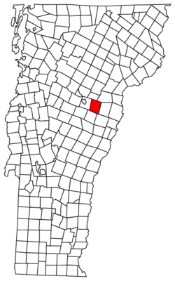
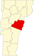
Orange is a town in Orange County, Vermont, United States. The population was 1,048 at the 2020 census. [3]
According to the United States Census Bureau, the town has a total area of 39.0 square miles (101.0 km2), of which 38.8 square miles (100.4 km2) is land and 0.2 square mile (0.6 km2) (0.59%) is water. The Waits River flows through the northeastern part of Orange. [4] Orange is also the site of the Dix Reservoir, the major water supply for adjoining Barre, along with its associated water processing facilities.
Census | Pop. | Note | %± |
---|---|---|---|
1800 | 348 | — | |
1810 | 686 | 97.1% | |
1820 | 751 | 9.5% | |
1830 | 1,016 | 35.3% | |
1840 | 984 | −3.1% | |
1850 | 1,007 | 2.3% | |
1860 | 936 | −7.1% | |
1870 | 733 | −21.7% | |
1880 | 731 | −0.3% | |
1890 | 589 | −19.4% | |
1900 | 598 | 1.5% | |
1910 | 644 | 7.7% | |
1920 | 485 | −24.7% | |
1930 | 508 | 4.7% | |
1940 | 482 | −5.1% | |
1950 | 410 | −14.9% | |
1960 | 430 | 4.9% | |
1970 | 540 | 25.6% | |
1980 | 752 | 39.3% | |
1990 | 915 | 21.7% | |
2000 | 965 | 5.5% | |
2010 | 1,072 | 11.1% | |
2020 | 1,048 | −2.2% | |
U.S. Decennial Census [5] |
As of the census [1] of 2000, there were 965 people, 362 households, and 278 families residing in the town. The population density was 24.9 people per square mile (9.6/km2). There were 422 housing units at an average density of 10.9 per square mile (4.2/km2). The racial makeup of the town was 98.55% White, 0.10% Native American, 0.21% Asian, 0.52% from other races, and 0.62% from two or more races. Hispanic or Latino of any race were 1.55% of the population.
There were 362 households, out of which 37.3% had children under the age of 18 living with them, 64.9% were couples living together and joined in either marriage or civil union, 6.6% had a female householder with no husband present, and 23.2% were non-families. 16.9% of all households were made up of individuals, and 4.4% had someone living alone who was 65 years of age or older. The average household size was 2.67 and the average family size was 3.03.
In the town, the population was spread out, with 27.0% under the age of 18, 6.1% from 18 to 24, 29.2% from 25 to 44, 27.0% from 45 to 64, and 10.6% who were 65 years of age or older. The median age was 38 years. For every 100 females, there were 97.3 males. For every 100 females age 18 and over, there were 97.8 males.
The median income for a household in the town was $40,300, and the median income for a family was $44,375. Males had a median income of $32,500 versus $22,614 for females. The per capita income for the town was $16,356. About 6.7% of families and 7.1% of the population were below the poverty line, including 3.5% of those under age 18 and 8.0% of those age 65 or over.
In 1780, the American Revolution-era government of Vermont granted the town of Orange to Captain Ebenezer Green, Amos Robinson, and 63 other shareholders. [6] At the time, New Hampshire, Vermont, and New York were fighting for control of Vermont, including the right to award town charters—a fight eventually won by Vermont. [7] During the Revolution, New York unsuccessfully attempted to award a charter for the town of Kempton, which would have encompassed the same territory as Orange. [7] The first settlement in Orange took place in 1793, when Joseph Williams and his family built a house in the southern portion of the town. [7] Orange was officially organized in 1796 in a meeting which took place at Williams's home, and its first government consisted of: Joseph Thayer as town meeting moderator; John Sloane, town clerk; Thomas Storrs Paine, Fairbanks Bush, and Gould Camp as selectmen (Camp was also town treasurer); Ezra Paine, constable; listers Fairbanks Bush, Ezra Goodale, and Humphrey Hunt; and grand juror Joseph Williams. In 1798, Orange was represented in the Vermont House of Representatives for the first time, following the election of Ezra Goodale. [7]
Windsor County is a county located in the U.S. state of Vermont. As of the 2020 census, the population was 57,753. The shire town is the town of Woodstock. The county's largest municipality is the town of Hartford.
Stamford is a town in Bennington County, Vermont, United States. The population was 861 at the 2020 census.
Groton is a town in Caledonia County, Vermont, United States. The population was 984 at the 2020 census. It contains the places Groton Pond, Rickers Mills, Rickers and West Groton. The unincorporated village of Groton in the southeast corner of town is recorded as the Groton census-designated place (CDP), with a population of 419 at the 2020 census.
Richford is a town in Franklin County, Vermont, United States, located along the Canada–United States border. The population was 2,346 at the 2020 census.
Corinth is a town in Orange County, Vermont, United States. The population was 1,455 at the 2020 census.
Strafford is a town in Orange County, Vermont, United States. The population was 1,094 at the 2020 census. The town of Strafford was created on August 12, 1761, by way of a royal charter which King George III of Great Britain issued to Governor Benning Wentworth of New Hampshire. The town was named after the Earl of Strafford. Its town house is one of the most famous in Vermont, sitting atop a hill at the end of the historic town common.
Thetford is a town in Orange County, Vermont, United States in the Connecticut River Valley. The population was 2,775 at the 2020 census. Villages within the town include East Thetford, North Thetford, Thetford Hill, Thetford Center, Rices Mills, Union Village, and Post Mills. The town office is in Thetford Center.
Topsham is a town in Orange County, Vermont, United States. The population was 1,199 at the 2020 census. It contains four villages: East Topsham, Topsham Four Corners, Waits River, and West Topsham.
Vershire is a town in Orange County, Vermont, United States, created under Vermont Charter of August 3, 1781. The population was 672 at the 2020 census. The name Vershire is a portmanteau of Vermont and New Hampshire.
Washington is a town in Orange County, Vermont, in the United States. The population was 1,032 at the 2020 census. The town is believed to be named after George Washington, although the town may also be named after Washington, Connecticut, as there are records of individuals moving from that town in Connecticut to Vermont around 1766.
West Fairlee is a town in Orange County, Vermont, United States. The population was 621 at the 2020 census.
Killington is a town in Rutland County, Vermont, United States. The population was 1,407 at the 2020 census. Killington Ski Resort and numerous vacation lodges are located here. The town was previously named Sherburne, but was renamed to its original name, "Killington", in 1999.
Brookline is a town in Windham County, Vermont, United States. The population was 540 at the 2020 census.
Dover is a town in Windham County, Vermont, United States. The population was 1,798 at the 2020 census. It is famed for being the location of the Mount Snow ski area.
Londonderry is a town in Windham County, Vermont, United States. It is bounded on the north by Landgrove and Weston, on the east by Windham, on the south by Jamaica and on the west by Winhall and Landgrove. The population was 1,919 in the 2020 census. The town contains the villages of Londonderry and South Londonderry.
Bridgewater is a town in Windsor County, Vermont, United States. The population was 903 at the 2020 census. Bridgewater contains the hamlets of Bridgewater Village, Bridgewater Corners, West Bridgewater, and Bridgewater Center.
Hartford is a town in Windsor County, Vermont, United States. It is on the New Hampshire border, at the intersection of Interstates 89 and 91. It is the site of the confluence of the White and Connecticut rivers; the Ottauquechee River also flows through the town. The town is composed of five unincorporated villages: Hartford, Quechee, West Hartford, White River Junction and Wilder. As of the 2020 census, the population was 10,686.
Hartland is a town in Windsor County, Vermont, United States. The population was 3,446 at the 2020 census. It includes the villages of Hartland, Hartland Four Corners, and North Hartland.
Pomfret is a town in Windsor County, Vermont, United States. The population was 916 at the 2020 census.
Weston is a town in Windsor County, Vermont, United States. The population was 623 at the 2020 census. Home to the Weston Playhouse Theatre Company, it includes the villages of Weston and The Island.