General information
- Pronunciation: English: /ˈmɛlbərn/ MEL-bərn, locally [ˈmæɫbən] ⓘ , elsewhere also /ˈmɛlbɔːrn/ MEL-born
- Common English name(s): Melbourne
- Official English name(s): Melbourne
- Adjectival(s): Melburnian
- Demonym(s): Melburnian

The following outline is provided as an overview of and topical guide to Melbourne:
Melbourne – Largest city in Victoria, second-largest city in Australia and Oceania. [1] It is located in the South-East of Australia, and is a major economic centre in the Asia-Pacific. The city is home to 4,917,750 people as of the 2021 census. [1]
Melbourne | |
|---|---|
 Melbourne Location within Australia | |
| Coordinates: 37°49′06.5″S144°57′59.8″E / 37.818472°S 144.966611°E |


Local Government Areas in Melbourne


Government and politics of Melbourne


1800s
1900s
2000s


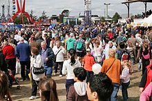

Events and festivals in Melbourne


Basketball in Melbourne
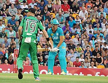
Cricket in Melbourne
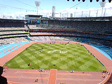
Olympics in Melbourne
Netball
Rugby in Melbourne
St Kilda is an inner seaside suburb in Melbourne, Victoria, Australia, six kilometres southeast of the Melbourne central business district, located within the City of Port Phillip local government area. St Kilda recorded a population of 19,490 at the 2021 census.

Parkville is an inner-city suburb in Melbourne, Victoria, Australia, 3 km (1.9 mi) north of Melbourne's Central Business District, located within the Cities of Melbourne and Merri-bek local government areas. Parkville recorded a population of 7,074 at the 2021 census.

The following is a timeline of the history of the city of Melbourne, Victoria, Australia.

Albert Park is an inner suburb of Melbourne, Victoria, Australia, 4 km (2.5 mi) south of Melbourne's Central Business District. The suburb is named after Albert Park, a large lakeside urban park located within the City of Port Phillip local government area. Albert Park recorded a population of 6,044 at the 2021 census.

Port Melbourne is an inner-city suburb in Melbourne, Victoria, Australia, 3 km (2 mi) south-west of the Melbourne central business district, located within the Cities of Melbourne and Port Phillip local government areas. Port Melbourne recorded a population of 17,633 at the 2021 census.
South Melbourne is an inner suburb in Melbourne, Victoria, Australia, 3 kilometres (1.9 mi) south of Melbourne's Central Business District, located within the City of Port Phillip local government area. South Melbourne recorded a population of 11,548 at the 2021 census.

Southbank is an inner-city suburb in Melbourne, Victoria, Australia, 1 km (0.62 mi) south of the Melbourne central business district, located within the Cities of Melbourne and Port Phillip local government areas. Southbank recorded a population of 22,631 at the 2021 census.
Abbotsford is an inner-city suburb in Melbourne, Victoria, Australia, 2 km (1.2 mi) north-east of Melbourne's Central Business District, located within the City of Yarra local government area. Abbotsford recorded a population of 9,088 at the 2021 census.

Moonee Ponds is an inner-city suburb in Melbourne, Victoria, Australia, 7 km (4.3 mi) north-west of Melbourne's Central Business District, located within the City of Moonee Valley local government area. Moonee Ponds recorded a population of 16,224 at the 2021 census.

Glen Waverley is an eastern suburb of Melbourne, Victoria, Australia, located 19 km (12 mi) southeast of the Melbourne central business district. It is the council seat of the City of Monash local government area and a prominent suburban commercial district, as well as a local transport hub as the interchange between the Glen Waverley line terminus and the upcoming SRL East ring line. Glen Waverley recorded a population of 42,642 at the 2021 census.
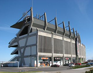
Waverley Park is an Australian rules football stadium in Mulgrave, Victoria, Australia. The first venue to be designed and built specifically for Australian Rules football, for most of its history, its purpose was as a neutral venue and used by all Victorian-based Victorian Football League/Australian Football League clubs. During the 1990s it became the home ground of both the Hawthorn and St Kilda football clubs.

Williamstown is a suburb in Melbourne, Victoria, Australia, 11 km (6.8 mi) south-west of Melbourne's Central Business District, located within the City of Hobsons Bay local government area. Williamstown recorded a population of 14,407 at the 2021 census.

St Kilda Road is a street in Melbourne, Victoria, Australia. It is part of the locality of Melbourne which has the postcode of 3004, and along with Swanston Street forms a major spine of the city.

Melbourne tram route 109 is a tram route on the Melbourne tramway network serving the city of Melbourne in Victoria, Australia. Operated by Yarra Trams, the route is coloured orange and extends from Box Hill to Port Melbourne over 19.3 kilometre of double track via Whitehorse Road, Victoria Street and Collins Street. It is serviced out of Kew depot utilising A and C class trams.

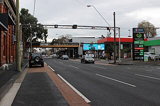
St Kilda Junction is a major intersection in Melbourne, Australia. It is in the suburb of St Kilda, bordering Windsor and St Kilda East, and is the meeting point of the major roads Punt Road, St Kilda Road, Dandenong Road/Queens Way/Princes Highway and Fitzroy Street.
Australian non-residential architectural styles are a set of Australian architectural styles that apply to buildings used for purposes other than residence and have been around only since the first colonial government buildings of early European settlement of Australia in 1788.

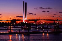
Melbourne is the capital and most populous city of the Australian state of Victoria, and the second-most populous city in Australia, after Sydney. The city's name generally refers to a 9,993 km2 (3,858 sq mi) metropolitan area also known as Greater Melbourne, comprising an urban agglomeration of 31 local government areas. The name is also used to specifically refer to the local government area named City of Melbourne, whose area is centred on the Melbourne central business district and some immediate surrounds.

Fitzroy Street is the major thoroughfare of the beachside Melbourne suburb of St Kilda. Its fortunes have risen and fallen along with that of St Kilda itself, from wealthy residential district to a popular working and middle class beachside entertainment district, to cheap and seedy, and popular again in the late 20th century. In recent years Fitzroy Street itself has gone from a popular restaurant strip to the situation in 2017 where only a few restaurants remain amongst kebab shops and convenience stores catering the backpackers and many empty shopfronts. It is named after Charles Augustus FitzRoy, Governor of New South Wales in 1842 when St Kilda was first subdivided.
Numerous proposals have been made for improvements to the Melbourne tram network, the largest such network in the world. Nearly all of these have been for track extensions of existing lines to connect with nearby railway station or to service new areas and suburbs.