Pecatonica Township, Illinois

Last updated

Pecatonica Township
Township
Pecatonica, IL Pecatonica Township 02.JPG
Town hall
Map highlighting Pecatonica Township, Winnebago County, Illinois.svg
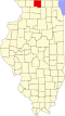
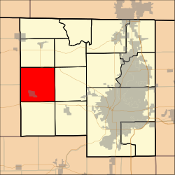
Location in Winnebago County
Coordinates: 42°19′57″N89°20′22″W / 42.33250°N 89.33944°W / 42.33250; -89.33944
Country United States
State Illinois
County Winnebago
EstablishedNovember 6, 1849 (1849-11-06)
Government
  Supervisor Greg Deppe
Area
  Total
35.49 sq mi (91.9 km2)
  Land35.13 sq mi (91.0 km2)
  Water0.36 sq mi (0.9 km2)  1.01%
Elevation
728 ft (222 m)
Population
 (2010)
  Estimate 
(2016) [1]
4,198
  Density124/sq mi (48/km2)
Time zone UTC-6 (CST)
  Summer (DST) UTC-5 (CDT)
FIPS code 17-201-58421
[2] [3]

Pecatonica Township is located in Winnebago County, Illinois. As of the 2010 census, its population was 4,355 and it contained 1,750 housing units. [4] It contains part of the census-designated place of Westlake Village.

Contents

Geography

According to the 2010 census, the township has a total area of 35.49 square miles (91.9 km2), of which 35.13 square miles (91.0 km2) (or 98.99%) is land and 0.36 square miles (0.93 km2) (or 1.01%) is water. [4]

Demographics

Historical population
CensusPop.Note
2016 (est.)4,198 [1]
U.S. Decennial Census [5]

Points of Interest

Pecatonica Township contains the Pecatonica Wetlands Forest Preserve, a county park.

References

  1. 1 2 "Population and Housing Unit Estimates" . Retrieved June 9, 2017.
  2. U.S. Geological Survey Geographic Names Information System: Township of Pecatonica
  3. Illinois Regional Archives Depository System. "Name Index to Illinois Local Governments". Illinois State Archives. Illinois Secretary of State . Retrieved September 19, 2014.
  4. 1 2 "Population, Housing Units, Area, and Density: 2010 - County -- County Subdivision and Place -- 2010 Census Summary File 1". United States Census. Archived from the original on February 12, 2020. Retrieved May 28, 2013.
  5. "Census of Population and Housing". Census.gov. Retrieved June 4, 2016.