Gallery
 Tikhonravov Crater floor in Arabia quadrangle, as seen by Mars Global Surveyor
 Layers under cap rock of a pedestal crater, as seen by HiRISE under HiWish program. Pedestal crater is within the much larger Tikhonravov Crater. Location is Arabia quadrangle.
 Pedestal crater, as seen by HiRISE under HiWish program The ejecta is not symmetrical around crater because the asteroid came at a low angle out of the northeast. The ejecta protected the underlying material from erosion; hence the crater looks elevated. The location is Casius quadrangle.
 Close-up of East side (right side) of previous image of pedestal crater showing polygons on lobe. Since the margin of the crater has lobes and polygons, it is believed there is ice under the protective top. Picture taken with HiRISE under HiWish program. Note: this is an enlargement of the previous image.
 Pedestal crater, as seen by HiRISE under HiWish program. Top layer has protected the lower material from being eroded. The location is Casius quadrangle.
 Pedestal crater, as seen by HiRISE under HiWish program Scallops are forming at the bottom edge of the pedestal. Location is Casius quadrangle.
 Pedestal crater, as seen by HiRISE under HiWish program Dark lines are dust devil tracks. Location is Casius quadrangle.
 Pedestal crater, as seen by HiRISE under HiWish program Location is Cebrenia quadrangle.
 Pedestal crater, as seen by HiRISE under HiWish program Location is Hellas quadrangle.
 Pedestal craters form when the ejecta from impacts protect the underlying material from erosion. As a result of this process, craters appear perched above their surroundings.
 Pedestal crater with layers, as seen by HiRISE under HiWish program Location is Amazonis quadrangle.
 Drawing shows a later idea of how some pedestal craters form. In this way of thinking, an impacting projectile goes into an ice-rich layer—but no further. Heat and wind from the impact hardens the surface against erosion. This hardening can be accomplished by the melting of ice which produces a salt/mineral solution thereby cementing the surface.
 Dark slope streaks near the top of a pedestal crater, as seen by HiRISE under the HiWish program.
 Dark slope streaks and layers near a pedestal crater, as seen by HiRISE under the HiWish program.
 Pedestal Crater and ridge in Oxia Palus quadrangle, as seen by HiRISE. Click on image to see detail of the edge of the pedestal crater. The flat-topped ridge near the top of the image was once a river that became inverted. The pedestal crater superposes the ridge, so it is younger.
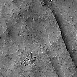 Biblis Patera Pedestal crater, as seen by HiRISE.


 Wide CTX image of layers under the ejecta surface of a pedestal crater.
 Layers under top layer of pedestal crater, as seen by HiRISE under HiWish program
 Close view of layers under ejecta surface of pedestal crater, as seen by HiRISE under HiWish program


