
Chaves is a city and a municipality in the north of Portugal. It is 10 km south of the Spanish border and 22 km south of Verín (Spain). The population of the entire municipality in 2011 was 41,243, in an area of 591.23 km2. The municipality is the second most populous of the district of Vila Real. With origins in the Roman civitas Aquæ Flaviæ, Chaves has developed into a regional center. The urban area or city proper has 17,535 residents (2001).

Ouro Preto, formerly Vila Rica, is a Brazilian municipality located in the state of Minas Gerais. The city, a former colonial mining town located in the Serra do Espinhaço mountains, was designated a World Heritage Site by UNESCO due to its Baroque colonial architecture. Ouro Preto used to be the capital of Minas Gerais from 1720 until the foundation of Belo Horizonte in 1897.
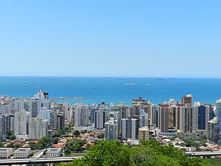
Vitória is the capital of the state of Espírito Santo, Brazil. It is located on a small island within a bay where a number of rivers meet the sea. It was founded in 1551. The city proper is 93 square kilometres and has a population of 322,869 (2022), whilst the Greater Vitória metropolitan area has a population of more than 1,880,828, the 14th largest in Brazil.

In Brazil, public holidays may be legislated at the federal, statewide and municipal levels. Most holidays are observed nationwide.
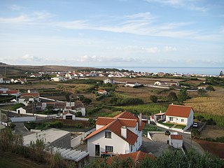
Vila do Porto is the single municipality, the name of the main town and one of the civil parishes on the island of Santa Maria, in the Portuguese archipelago of Azores. Its nearest neighbor, administratively, is the municipality of Povoação on the southern coast of São Miguel, and it is physically southwest of the islets of the Formigas. The population in 2021 was 5,408, in an area of 96.89 km2 (37.41 sq mi).

Novo Hamburgo is a municipality in the southernmost Brazilian state of Rio Grande do Sul, located in the metropolitan area of Porto Alegre, the state capital. As of 2020, its population was 247,032. The city covers an area of 217 km2 (84 sq mi), and the average temperature is 19 °C (66 °F), which is mild for the region. The Sinos River runs through the urban area.

Ribeira Grande is a municipality in the northern part of the island of São Miguel in the Portuguese Azores. The population in 2011 was 32,112, in an area of 180.15 km2. The municipal seat is located in the civil parish of Matriz, with a population of about 4000 inhabitants, part of the urbanized core of what is commonly referred to as the city of Ribeira Grande.

Lages is a Brazilian municipality located in the central part of the state of Santa Catarina, in the region known in Portuguese as "Planalto Serrano".

Penafiel (Portuguese pronunciation:[pɨnɐfiˈɛl]or is a municipality and former bishopric in the northern Portuguese district of Porto. Capital of the Tâmega Subregion, the population was 72,265 in 2011, in an area of 212.24 square kilometres.
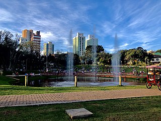
Passo Fundo is a municipality in the north of the southern Brazilian state of Rio Grande do Sul. It is named after its river. It's the tenth largest city in the state with an estimated population of 204,722 inhabitants living in a total municipal area of 780 km2.

Cachoeira is an inland municipality of Bahia, Brazil, on the Paraguaçu River. The town exports sugar, cotton, and tobacco and is a thriving commercial and industrial centre.

Viamão is a city in Rio Grande do Sul, Brazil. In size it is the largest municipality in the metropolitan region of Porto Alegre and the seventh most populous in the state.
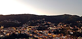
Sabará is a Brazilian municipality located in the state of Minas Gerais. The city belongs to the Belo Horizonte metropolitan region and to the associated microregion.

Arroio Grande is a Brazilian municipality in the southern part of the state of Rio Grande do Sul. The population is 18,238 in an area of 2513.60 km². Its second industry is agriculture which was primary until the 1970s, it currently has more urban population (80%) than rural (20%). Much of the area is made up of plains.

Vacaria is a municipality in the northeast of the southern Brazilian state of Rio Grande do Sul.
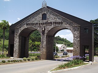
Antônio Prado is a municipality located in the Serra Gaúcha regionin The city is in the state of Rio Grande do Sul, Brazil. It boasts the largest collection of architectural heritage designated by IPHAN related to Italian colonization in Brazil. Its population is estimated at 13,045 people.
Nova Bassano is a municipality and a city in the state of Rio Grande do Sul, south Brazil.
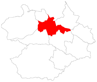
Sede ("Seat") is a district of the municipality of Santa Maria, in the Brazilian state of Rio Grande do Sul. It is situated in the north portion of Santa Maria. Downtown Santa Maria is one of its bairros (neighbourhoods).

The Igreja Matriz de Nossa Senhora da Conceição is a Brazilian Catholic temple located in the city of Viamão, state of Rio Grande do Sul. It is the second-oldest church in the state and the seat of the oldest parish of the Archdiocese of Porto Alegre. It is also the main architectural landmark of Viamão.


