
Tundzha Glacier is a glacier on Livingston Island in the South Shetland Islands, Antarctica situated east-southeast of Berkovitsa Glacier, west of Saedinenie Snowfield, northwest of Pimpirev Glacier, north of Kamchiya Glacier and east-northeast of Verila Glacier. It is bounded by Snow Peak to the west, Teres Ridge to the east and the glacial divide between the Drake Passage and Bransfield Strait to the south. The glacier extends 7.5 nautical miles in east-west direction and 2.4 nautical miles in the north-south direction, and drains northwards into Hero Bay between Avitohol Point and Siddins Point.

Barnard Point is a headland which marks the south-east side of the entrance to False Bay on the south side of Livingston Island in the South Shetland Islands, Antarctica. It is situated on Rozhen Peninsula, 1.5 km (1 mi) north-north-west of Botev Point and 6.6 km (4 mi) south-east of Miers Bluff.

Rish Point is an ice-free point projecting 300 m from the south coast of Livingston Island in the South Shetland Islands, Antarctica. It is situated at the east extremity of South Beaches, Byers Peninsula, 2.3 km northwest of Amadok Point, 1.3 km southwest of Clark Nunatak, and 1 km northeast of Stackpole Rocks. Juturna Lake is centred 320 m northeast of the point.
Vardim Rocks are a group of rocks situated on the south side of Hell Gates, facing Devils Point in the southwest extremity of Byers Peninsula on Livingston Island in the South Shetland Islands, Antarctica. Extending 1.3 km (0.81 mi) in east-west direction. The two principal islets in the group, Demon and Sprite, are extending 420 by 400 m and 270 by 150 m respectively, with surface area of the former 9 hectares. The area was visited by early 19th century sealers.

Okol Rocks is a group of rocks in the north of Aitcho Islands group on the west side of English Strait in the South Shetland Islands, Antarctica. The principal feature in the group is Lambert Island (62°22′16″S59°45′49″W).

The Meade Islands are a group of two large islands, Zverino Island and Cave Island, the minor Pisanitsa Island, and several rocks lying in the north entrance to McFarlane Strait, off Archar Peninsula, Greenwich Island in the South Shetland Islands, Antarctica. The surface areas of the first two islands are 48 hectares and 18 hectares. respectively. The area was visited by early 19th century sealers.
Craggy Island is a narrow island marked by crags, lying in Hero Bay, Livingston Island in the South Shetland Islands, Antarctica and forming the northeast side of Blythe Bay. Its surface area is 9 hectares .) The area was frequented by early nineteenth century English and American sealers operating from Blythe Bay.
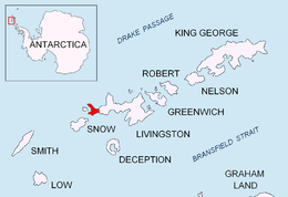
Lynx Rocks is a group of rocks in southwestern Hero Bay on the north side of Livingston Island in the South Shetland Islands, Antarctica. The area was visited by early 19th century sealers operating from nearby Blythe Bay.
Chapman Rocks is a group of rocks in central Hero Bay on the north side of Livingston Island in the South Shetland Islands, Antarctica. The area was visited by early 19th century sealers operating from nearby Blythe Bay.
Eliza Rocks is a chain of rocks lying between Desolation Island and Zed Islands off the north coast of Livingston Island in the South Shetland Islands, Antarctica and extending 1 km in west-northwest direction. The area was visited by early 19th century sealers operating from Blythe Bay, Desolation Island.
Frederick Rocks is a group of rocks lying in Barclay Bay on the north side of Livingston Island in the South Shetland Islands, Antarctica. The area was visited by early 19th century sealers operating on nearby Byers Peninsula.

Hetty Rock is the largest of several rocks in Walker Bay off John Beach in western Livingston Island in the South Shetland Islands, Antarctica. The area was visited by early 19th century sealers.

Eddystone Rocks is a group of two rocks lying to the northwest of Rugged Island off western Livingston Island in the South Shetland Islands, Antarctica.

Lientur Rocks is a group of prominent adjacent rocks lying off the north coast of Robert Island in the South Shetland Islands, Antarctica and extending 660 m (722 yd) in east–west direction and 320 m (350 yd) in north–south direction. The area was visited by early 19th-century sealers operating from nearby Clothier Harbour.

Mellona Rocks is a group of scattered rocks lying at the north entrance to Nelson Strait in the South Shetland Islands, Antarctica and extending 1.7 by 0.9 km. The area was known to the early 19th-century sealers and sometimes included under the names 'Heywood Islands' or 'Powels Islands'.
Liberty Rocks is a group of four prominent adjacent rocks lying at the north entrance to Nelson Strait in the South Shetland Islands, Antarctica and extending 430 by 120 m. The area was visited by early 19th-century sealers.
Graovo Rocks is the group of rocks off the north coast of Robert Island in the South Shetland Islands, Antarctica. They are situated east of Lientur Rocks and southwest of Liberty Rocks, and extend 1.75 km (1.09 mi) in north-south direction and 750 m (820 yd) in east-west direction.
Skrino Rocks is the chain of rocks off the east coast of Robert Island in the South Shetland Islands, Antarctica, extending 570 m (623 yd) in east–west direction.
Priboy Rocks is the group of rocks off the east coast of Robert Island in the South Shetland Islands, Antarctica, extending 1.65 km (1.03 mi) in east–west direction and 1.2 km (0.75 mi) in north–south direction.

Vodoley Rock is the rock extending 220 m (720 ft) in northwest–southeast direction and 110 m (360 ft) wide in Barclay Bay on the west side of Ioannes Paulus II Peninsula on Livingston Island in the South Shetland Islands, Antarctica. The area was visited by early 19th century sealers operating on nearby Byers Peninsula and Cape Shirreff.

