
Rongel Reef, is a moraine reef in the Emona Anchorage in the eastern parts of Livingston Island in the South Shetland Islands, Antarctica. The reef emerged during a glacier retreat in the late 20th and early 21st centuries.
Tundzha Glacier is a glacier on Livingston Island in the South Shetland Islands, Antarctica situated east-southeast of Berkovitsa Glacier, west of Saedinenie Snowfield, northwest of Pimpirev Glacier, north of Kamchiya Glacier, and east-northeast of Verila Glacier. It is bounded by Snow Peak to the west, Teres Ridge to the east and the glacial divide between the Drake Passage and Bransfield Strait to the south. The glacier extends 7.5 nautical miles in east-west direction and 2.4 nautical miles in the north-south direction, and drains northwards into Hero Bay between Avitohol Point and Siddins Point.

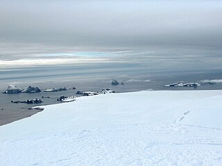
Desolation Island is one of the minor islands in the South Shetlands archipelago, Antarctica situated at the entrance to Hero Bay, Livingston Island. The island is V-shaped with its northern coast indented by Kozma Cove. Surface area is 3.12 square kilometres (1.20 sq mi).

Ficheto Point is an ice-free point on the northeast coast of Varna Peninsula, Livingston Island, Antarctica forming the southeast side of the entrance to Dragon Cove. Channel Rock is lying in the adjacent northwestern part of McFarlane Strait, 1.3 km (0.81 mi) northeast of Ficheto Point and 920 m (1,010 yd) south-southwest of Meade Islands. The area was visited by 19th century sealers.

Blythe Bay is an anchorage at the southeast side of Desolation Island, lying north of Livingston Island in the South Shetland Islands, Antarctica. The bay is bounded by Craggy Island to the northeast, Desolation Island to the northwest, the Miladinovi Islets to the west and Wood Island to the south.

Spark Point, also Canto Point, is a rocky point forming the northwest side of the entrance to both Discovery Bay and Galápagos Cove, and the east side of the entrance to Jambelí Cove in the northeast of Greenwich Island in the South Shetland Islands, Antarctica. The point ends up in a conspicuous monolithic formation and has an adjacent ice-free area of 164 hectares. The area was visited by early 19th century sealers.
Ash Point is a rounded low ice-free point forming the southeast side of the entrance to Discovery Bay in the northeast of Greenwich Island in the South Shetland Islands, Antarctica with an adjacent ice-free area of 201 hectares. Letelier Bank is lying off Ash Point, while Bascopé Point is situated 460 m (503 yd)to the southwest, with the 1 km (0.62 mi) wide Rojas Cove indenting for 310 m (339 yd) the coast between that point and Guesalaga Peninsula. The area was visited by early 19th century sealers.

Window Island is a small ice-free island off the north coast of Ray Promontory in the northwest of Byers Peninsula, Livingston Island in the South Shetland Islands, Antarctica. The island has a surface area of 23 hectares and rises to 72 m (236 ft). It was known to the early 19th century sealers operating on Byers Peninsula.

Morris Rock is a rock outcropping that rises to 55 m (180 ft) in the northwest extremity of the Aitcho group, English Strait in the South Shetland Islands, Antarctica. The area was visited by early 19th century sealers.

Ongley Island is a rugged rocky island lying off the north coast of Greenwich Island in the South Shetland Islands, Antarctica. Extending 1.35 km (0.84 mi) in west-northwest direction and 470 m (510 yd) wide, with a surface area of 44 hectares. The area was visited by early 19th century sealers.
Pyramid Island is a conspicuous, pillar-shaped rocky island rising to 205 m (673 ft) off the north entrance to McFarlane Strait in the South Shetland Islands, Antarctica. Its surface area is 9 hectares. Cone Rock
(62°25′56.9″S60°06′08.3″W) is rising to 6 m (19.7 ft) 1.33 km (0.83 mi) south of the island,
2.03 km (1.26 mi) north-northwest of Meade Islands, 2.8 km (1.7 mi) northeast of Williams Point and
1.65 km (1.03 mi) east of Koshava Island, Zed Islands. The vicinity of Pyramid Island was visited on 19 February 1819 during the discovery of the South Shetlands by Captain William Smith in the British brig Williams, and later by early 19th century sealers.

Wood Island is a conspicuous rocky island in Hero Bay, Livingston Island in the South Shetland Islands, Antarctica lying southeast of Desolation Island and Miladinovi Islets and forming the south side of Blythe Bay. Surface area 14 hectares .) The area was frequented by early nineteenth century English and American sealers operating from Blythe Bay.

Aspis Island is a small, low-lying, ice-free island rising to 15 metres (49 ft), easternmost in the Dunbar group off the northwest coast of Varna Peninsula, Livingston Island in the South Shetland Islands, Antarctica.
Cora Cove is the 750 m wide cove in the northwest part of Blythe Bay indenting for 590 m the southeast coast of Desolation Island off Livingston Island in the South Shetland Islands, Antarctica. The cove was used by early 19th century sealers operating from Blythe Bay.
Cape Danger is the rocky point forming the northwest extremity of the ice-free Desolation Island situated in the entrance to Hero Bay, Livingston Island in the South Shetland Islands, Antarctica. The cape forms the west side of the entrance to Kozma Cove. The area was visited by early 19th century sealers operating from nearby Blythe Bay.
Chapman Rocks is a group of rocks in central Hero Bay on the north side of Livingston Island in the South Shetland Islands, Antarctica. The area was visited by early 19th century sealers operating from nearby Blythe Bay.
Eliza Rocks is a chain of rocks lying between Desolation Island and Zed Islands off the north coast of Livingston Island in the South Shetland Islands, Antarctica and extending 1 km in west-northwest direction. The area was visited by early 19th century sealers operating from Blythe Bay, Desolation Island.

Hetty Rock is the largest of several rocks in Walker Bay off John Beach in western Livingston Island in the South Shetland Islands, Antarctica. The area was visited by early 19th century sealers.

Vodoley Rock is the rock extending 220 m (720 ft) in northwest–southeast direction and 110 m (360 ft) wide in Barclay Bay on the west side of Ioannes Paulus II Peninsula on Livingston Island in the South Shetland Islands, Antarctica. The area was visited by early 19th century sealers operating on nearby Byers Peninsula and Cape Shirreff.
Mihaylovski Cove is the 5 km wide cove indenting for 1.3 km the northwest coast of South Bay in Livingston Island, Antarctica that is entered west of Ereby Point and east of Lukovo Point, and has its head fed by Kamchiya Glacier. The area was known to early 19th century sealers who operated from nearby Johnsons Dock. The feature is named after the brothers Petar Mihaylovski, physician at St. Kliment Ohridski base during the 2007/08 and subsequent seasons, and Hristo Mihaylovski, engineer in the national Antarctic campaign during 2015/16 and subsequent seasons.


