
Avren Rocks are three adjacent rocks situated in the interior of Micalvi Cove in the south extremity of Robert Island, South Shetland Islands. The group extends 260 m (280 yd) in north–south direction and is 150 m (160 yd) wide. The rocks were first mapped in 2008 by a Bulgarian team. They are named after two settlements in Varna and Kardzhali provinces situated in northeastern and southeastern Bulgaria respectively.

Maglizh Rocks are a group of rocks off the northwest coast of Smith Island, South Shetland Islands. The two adjacent principal rocks, extending 460 m (503 yd) in east-west direction and 140 m (153 yd) wide are situated 300 m (328 yd) north of Lista Point, with the third major one, 300 by 100 m, situated 320 m (350 yd) northwest of them. The rocks have a combined surface area of 10.6 hectares. The rocks are named after the town of Maglizh in southern Bulgaria.
Onogur Islands is the group of nine islands and some islets and rocks adjacent to the northwest coast of Robert Island in the South Shetland Islands, Antarctica. The group is situated between Carlota Cove to the southwest and Clothier Harbour to the northeast, and 700 m (770 yd) southeast of Cornwall Island. Kovach Island and Grod Island, the largest two in the group, have a surface area of 11 hectares and 10 hectares respectively. The area was visited by early 19th century sealers based in Clothier Harbour.

Vardim Rocks are a group of rocks situated on the south side of Hell Gates, facing Devils Point in the southwest extremity of Byers Peninsula on Livingston Island in the South Shetland Islands, Antarctica. Extending 1.3 km (0.81 mi) in east-west direction. The two principal islets in the group, Demon and Sprite, are extending 420 by 400 m and 270 by 150 m respectively, with surface area of the former 9 hectares. The area was visited by early 19th century sealers.

Koynare Rocks are a small group of rocks in Hero Bay off the north coast Livingston Island in the South Shetland Islands, Antarctica situated 7.5 km (4.66 mi) northeast of Siddins Point, 5.3 km (3.29 mi) northwest of Bezmer Point, and 1.4 km (0.87 mi) south of Miladinovi Islets. The area was visited by early 19th century sealers.

Voluyak Rocks is a chain of rocks off the north coast of Greenwich Island in the South Shetland Islands, Antarctica situated 400 m (440 yd) north of Pavlikeni Point. Extending 1.9 km (1.2 mi) in southeast–northwest direction.
Rabisha Rocks is a group of rocks off the north coast of Greenwich Island in the South Shetland Islands, Antarctica situated 1.5 km (0.93 mi) northeast of Voluyak Rocks, 1.3 km (0.81 mi) north of Kabile Island and 1.8 km (1.12 mi) west of Ongley Island.
Tvarditsa Rocks is a group of rocks off the north coast of Greenwich Island in the South Shetland Islands, Antarctica situated 1.9 km (1.2 mi) northeast of Ongley Island, 1.3 km (0.81 mi) southwest of Stoker Island and 2.6 km (1.6 mi) west of Sierra Island.
Buchino Rocks is a group of rocks off the north coast of Greenwich Island in the South Shetland Islands, Antarctica situated 1.5 km (0.93 mi) northwest of Stoker Island, 1.6 km (0.99 mi) southeast of Romeo Island and 1.9 km (1.2 mi) north-northwest of Tvarditsa Rocks.

Eddystone Rocks is a group of two rocks lying to the northwest of Rugged Island off western Livingston Island in the South Shetland Islands, Antarctica.
Milev Rocks is the group of rocks off the north coast of Robert Island in the South Shetland Islands, Antarctica, situated east of Henfield Rock, south-southwest of Orsoya Rocks and southwest of Mellona Rocks, and extending 1.5 km (0.93 mi) in east-west direction and 600 m (656 yd) in north-south direction.
Skrino Rocks is the chain of rocks off the east coast of Robert Island in the South Shetland Islands, Antarctica, extending 570 m (623 yd) in east–west direction.
Alepu Rocks is the group of rocks off the east coast of Robert Island in the South Shetland Islands, Antarctica, situated in an area with a diameter of 380 m (416 yd).

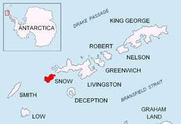
Bizone Rock is the rock off Snow Island in the South Shetland Islands, Antarctica extending 120 m in southeast-northwest direction and 100 m wide. It is the largest and southeasternmost in a group of several rocks extending 1.84 km in southeast-northwest direction and 1 km in a southwest-northeast direction.

Dlagnya Rocks are the several contiguous rocks in Zed Islands off Varna Peninsula, Livingston Island in the South Shetland Islands extending 540 m in north-south direction and 60 m wide. The area was visited by early 19th century sealers.
Goritsa Rocks are the two contiguous rocks in Zed Islands off Varna Peninsula, Livingston Island in the South Shetland Islands extending 330 m in northwest-southeast direction and 70 m wide. The area was visited by early 19th century sealers.
Habermehl Rock is the rock off the north coast of Livingston Island in the South Shetland Islands, Antarctica 37 m long in southeast–northwest direction and 18 m wide, with a surface area of 0.02 ha. The vicinity was visited by early 19th century sealers.
Brahe Rock is the rock off the north coast of Livingston Island in the South Shetland Islands, Antarctica 85 m long in west–east direction and 50 m wide, and split in three. Its surface area is 0.14 ha. The vicinity was visited by early 19th century sealers.
Ballestilla Reef is the 160 m long in southeast–northwest direction and 40 m wide flat and rocky low-tide elevation off the northwest coast of Snow Island in the South Shetland Islands, Antarctica. Its surface area is 0.38 ha. The vicinity was visited by early 19th century sealers.
Borda Rock is the rock off the NW coast of Smith Island in the South Shetland Islands, Antarctica 270 m long in southwest-northeast direction and 90 m wide. Its surface area is 1.46 ha. The vicinity was visited by early 19th century sealers.


